


Arabia
L'Afrique, divisée selon l'etendue de ses principales parties.
159 x 108 cm (conjoined sheets), in hand colour. Scale ca. 1:12,000,000.
€ 20.000,00
A magnificent coloured wall map, enclosed within historiated borders showing topographical vignettes, printed on four conjoined sheets with additional running title above and engraved text providing geographical and political information to the sides, all on additional sheets. While it is a map of Africa, it also shows the Arabian Peninsula in its entirety.
The cartographer Nicolas de Fer (1646-1720), son of a Parisian engraver specialising in the colouring and selling of maps, maintained a good relationship with the Academy of Sciences and was Geographer Royal to the Dauphin and the King of Spain. Nevertheless, his productions were not aimed at a university-educated audience, and his work is distinguished by easy accessibility and popularisation of geographical information rather than by scholarly precision. The present rendering of Arabia, apparently based in part on the work of Delisle, shows this posthumous publication (by de Fer's son-in-law Danet) to be a later release of a much early conception of the Middle East, outdated even in the 1740s. In particular, it omits the Sinai Peninsula included in several of de Fer's earlier efforts. "Like Delisle, De Fer had considerable prestige and influence in France and all over Europe" (Historical Atlas of the Gulf, p. 278). Among the toponyms along the coast of the Arabian Gulf are Abadan, Sur, Ahsa, Janama, Bahr, El Catif, Bischa, Borou, Godo, Vodana, Calba, Dadana, and Pinder.
Professionally repaired; some wrinkling, but preserving its impressive wall appearance.
Cf. OCLC 71549733. Historical Atlas of the Persian Gulf (16th to 18th c.) 70 (1717 map). Khaled Al Ankary, The Arabian Peninsula in Old European Maps, 112 & 140.
Ähnlich
-
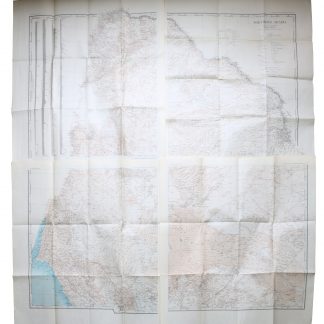
Northern Arabia according to the original investigations of Alois Musil …New York, 1926.
€ 3.500,00 -
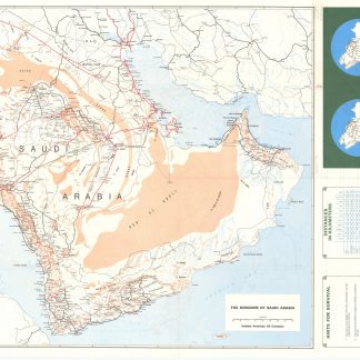
Saudi Arabian Road map.Dammam, early 1980s.
€ 1.000,00 -
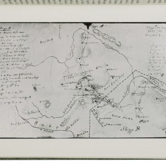
A contribution to the geography and cartography of north-west Yemen (based …Cairo, 1939.
€ 2.800,00 -
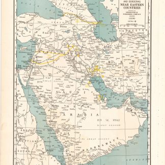
Arabia and near bordering countries. Includes: Palestine, Iran (Persia) …Chicago, ca. 1936-1941.
€ 1.500,00
