[VERKAUFT]
Dieses Stück ist bereits verkauft. Am Ankauf eines gleichwertigen Exemplars bzw. von Stücken ähnlicher Bedeutung sind wir immer interessiert.
The First Edition of Blaeu’s Atlas Maior: Exceptional Unrestored Condition. With Unusually-Fine Contemporary Hand Colour
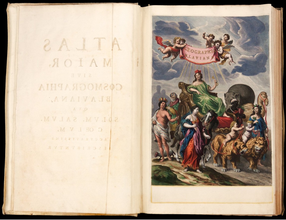
Atlas Major, sive Cosmographia Blaviana, qua solum, salum, coelum accuratissime describuntur.
11 vols.
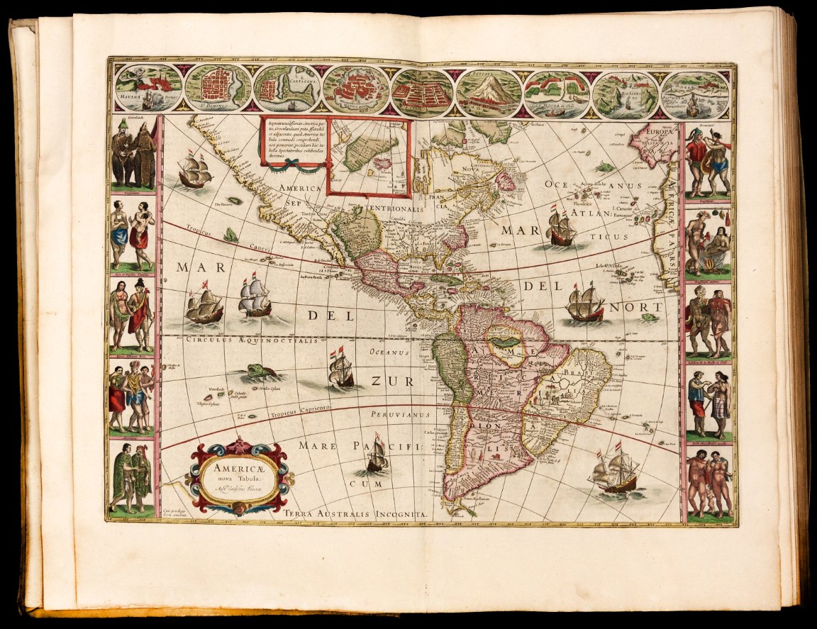
An exceptionally fine copy, with contemporary hand-color, of the first edition of the Atlas Maior, the crowning achievement of one of the most famous Dutch cartographers. This is the most lavish atlas ever produced, and certainly one of the most beautiful.
Willem Janszoon Blaeu, the head of the Blaeu publishing family and the official cartographer of the Dutch East India Company (VOC), first published a world atlas in 1630, titled Atlas Appendix, with 60 maps. He steadily expanded the atlas in the following years, until in 1635 the book became so large that it would not fit in a single volume. The new atlas was to be known as the Theatrum Orbis Terrarum (or Theatre du Monde in French). The history of this book, and its eventual development into the greatest atlas ever published - Blaeu's Atlas Maior - requires an appraisal of the rivalry between the firms Jansson and Blaeu.
In the middle of the 17th century, the firms Jansson and Blaeu were engaged in ongoing one-upmanship in the atlas market. If Blaeu published a two-volume atlas with 210 maps, Jansson would closely follow with a three-volume 300-map atlas. After the death of Willem Jansz. Blaeu in 1638, the competition sped up; both firms issued larger versions of their multi-volume atlas: the Atlas novus. By the end of 1658, Bleau had published an Atlas novus with six-volumes and 400 maps, while Jansson had published a six-volume Atlas novus with 450 maps.
Jansson attempted to solidify his primacy when he issued his 11-volume German-language Novus Atlas absolutissimus. The set had a huge compliment of maps, between 500 and 550, and when combined with Cellarius's celestial atlas, and Jansson's eight-volume town book, his firm was the first to realize a complete description of the countries, towns, oceans, and heavens.
Johannes Blaeu was not to be outdone, however. In 1662, Blaeu issued his Atlas maior (Major Atlas) in eleven volumes, with approximately 600 maps. He would follow it with French and Dutch editions and attempted to complete a Spanish edition. The Americas volume was the last volume included in the Atlas maior. The set was the largest, most impressive, and most expensive publication of the 17th century, and it stands as the pinnacle of printed atlases.
In 1672, a fire broke out in the Blaeu firm workshop, decimating the stock and the business, and bringing an end to the in-progress publication of the Spanish language edition of the Atlas Maior at 10 volumes - it was originally supposed to run to 12. Johannes Blaeu died the following year, and the family business declined thereafter.
Volumes: Volume I: World, Northern Europe, Scandinavia. 1662.
Half-titles, engraved allegorical title, printed title with hand-colored vignette, 61 engraved maps and plates, including 5 plans and 9 plates of Tycho Brahe’s astronomical observatory on the island of Haven in the Danish Sound. Includes the important world map, of which Shirley observes: “As with all productions of the firm of Blaeu, the engraving and layout are all of the highest standard.” The world map which begins the atlas is a double hemisphere map. Shirley, 428.
Volume II: Eastern Europe, Russia, Sweden, Greece. Printed title with hand-colored vignette, half-titles, hand-colored woodcut illustrations, 39 engraved maps (38 double-page).
Volume III: Germany. Printed title with hand-colored vignette, 96 engraved maps (3 folding and 92 double-page).
Volume IV: Netherlands and Belgium. Printed title with hand-colored vignette, 2 engraved pictorial titles hand-colored and heightened with gold, with letterpress title over slip and 63 hand-colored maps (60 double-page).
Volume V: England. Printed title with hand-colored vignette, engraved architectural title dated 1662, hand-colored and heightened in gold, with letterpress title over slip, 58 engraved maps (57 double-page), 3 hand-colored engraved plates, woodcut and engraved illustrations.
Volume VI: Scotland and Ireland. Printed title with hand-colored vignette, engraved hand-colored architectural title dated 1654, with letterpress title over slip, half-title, 55 engraved maps (54 double-page).
Volume VII: France and Switzerland. Printed title with hand-colored vignette, engraved hand-colored architectural title, with letterpress title over slip, half-title, 70 engraved maps (67 double-page).
Volume VIII: Italy. Printed title with hand-colored vignette, engraved hand-colored architectural title, with letterpress title over slip, 59 engraved maps (58 double-page), and one half-page engraved map in text.
Volume IX: Spain, Portugal, and Africa. 2 printed titles with hand-colored vignette, engraved hand-colored architectural title, with letterpress title over slip, 41 double-page maps and views (3 folding) including 7 plates of the Escorial.
Volume X: Asia, China, and Japan. Printed title with hand-colored vignette, 2 engraved hand-colored architectural titles, first with letterpress title over slip, half-title, 28 double page maps.
Volume XI: America. Printed title with hand-colored vignette, 23 engraved double-page maps.
Provenance: F.C. Koch, Rotterdam; Jean R. Perrette, Brittany.


