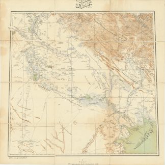
Interwar British map from Mosul to Tabriz
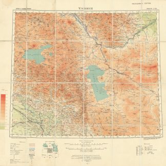
Tabriz. North J-38. Provisional edition. G.S.G.S. No. 2555.
Heliozincographed color map (610 x 650 mm). Scale 1:1,000,000. Dissected into 24 sheets and mounted on cloth. Folding into contemporary marbled card covers, with the label of map sellers Sifton, Praed & Co. to front cover.
€ 1.500,00
A scarce official British military map of northern Iraq and north-western Iran, from Mosul up to Tabriz. It was originally issued during WWI before being updated and corrected in the interwar period. The manuscript annotations suggest the map was used in the field with either archaeological or military aims, with several inked lines tracing routes out of Mosul, a place name added, and a "Rock Fort" indicated above Sudi Bulak just South of Lake Urmia.
Quite a scarce copy, with just two listings of the 1924 version in OCLC, at Lake Forest College (Illinois) and the American University of Beirut. Several institutions have sets of the GSGS series 25555, therefore it is likely they hold copies of the present map despite not listing them individually.
Professionally backed in linen, annotations, otherwise quite well preserved.
OCLC 41122667.