Landkarten, Pläne
Zeige Artikel 337–384 von 539 (Landkarten, Pläne)
-
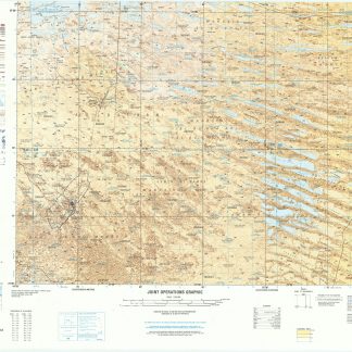
Joint Operations Graphic. Series 1501.London, ca. 1984-1991.
€ 3.500,00 -
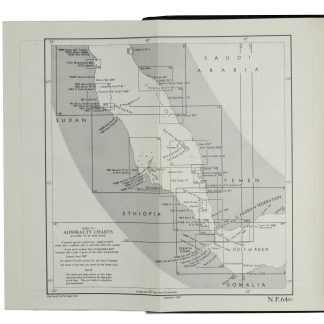
Red Sea and Gulf of Aden Pilot Comprising the Suez Canal, the Gulfs of …London, 1967.
€ 1.250,00 -
Bombardamento della citta di Tolone fatto da gl' Imperiali ed Aleati l'Anno …No place, ca. 1707.
€ 4.500,00 -
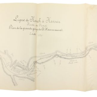
Ligne de Keneh à Kosseir. Rapport.Kairo, 1891.
€ 3.500,00 -
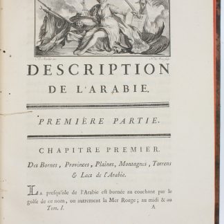
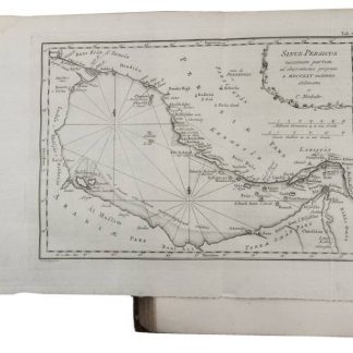
Description de l'Arabie, d'après les observations et recherches faites …Paris, 1779.
€ 6.500,00 -
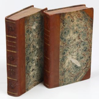
Reize naar Arabië en andere omliggende landen.Amsterdam and Utrecht, 1776-1780.
€ 18.000,00 -
Description de l'Arabie, d'après les observations et recherches faites …Paris, 1779.
€ 6.500,00 -
Beschryving van Arabie, uit eigene waarnemingen en in 't land zelf verzamelde …Amsterdam and Utrecht, 1774.
€ 2.800,00 -
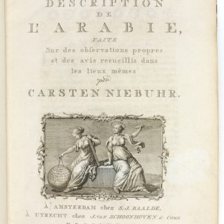
Description de l'Arabie, faite sur des observations propres et des avis …Amsterdam & Utrecht, 1774.
€ 3.500,00 -

Reize naar Arabië en andere omliggende landen.Amsterdam & Utrecht, 1776-1780.
€ 6.000,00 -

Voyage en Arabie & en d'autres Pays circonvoisins. Tome premier (-second). …Amsterdam & Utrecht, 1775-1780.
€ 6.000,00 -
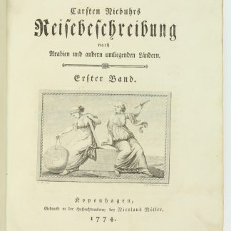
Reisebeschreibung nach Arabien und anderen umliegenden Ländern.Copenhagen, 1774-1778.
€ 5.800,00 -
Travels through Arabia and other countries in the East [...].Perth, 1799.
€ 7.500,00 -
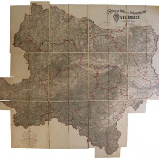
Strassen-Karte des Erzherzogthumes Österreich unter der Enns. Verfaßt …Wien, Juli 1881.
€ 2.500,00 -
[The Ottoman Empire and the Balkan Wars].Istanbul, 1924 and 1928.
€ 8.500,00 -

Carte de l’Empire Ottoman comprenant les possessions de la Porte en Europe, …Paris, 1825.
€ 3.000,00 -
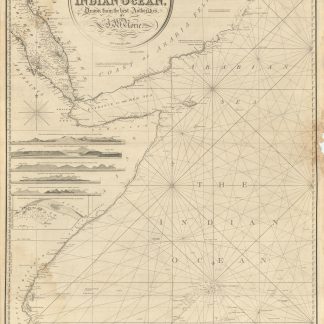
A Chart of the Indian Ocean, Drawn from the Best Authorities, by J. W. …London, 1852.
€ 2.800,00 -
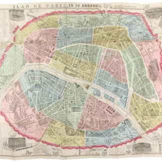
Nouveau plan de Paris divisé en 20 arrondissements méthode Zugenbuhler.Paris, 1865.
€ 350,00 -
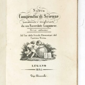
Nuovo compendio di scienze, accresciuto e migliorato da un sacerdote Luganese. …Lugano, 1845.
€ 350,00 -
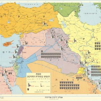
Mapah ha-neft ba-mizrah ha-tikhon (Map of the Oil Industry in the Middle …Jerusalem, 1963.
€ 2.500,00 -
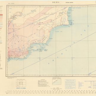
Salala. GSGS 2555. Asia. North E-40.London, 1950.
€ 600,00 -
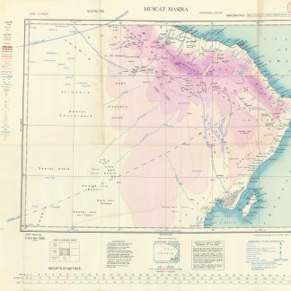
Asia 1:1,000,000. Muscat-Masira. NF-40.London, 1944.
€ 1.000,00 -
Arabia and the Persian Gulf. S.E. Section. [Map of Arabia and the Persian …Dehra Dun, 1916.
€ 2.500,00 -
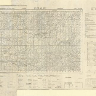
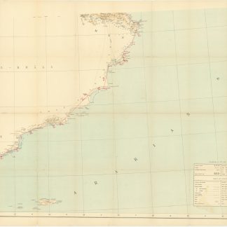
Trucial States, Muscat and Oman. Wadi Al Jizi. Series K668. Edition I-GSGS. …United Kingdom, 1967.
€ 2.000,00 -
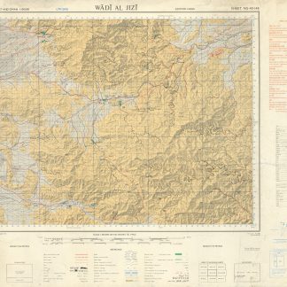
Trucial States, Muscat and Oman. Wadi Al Jizi. Series K668. Edition I-GSGS. …United Kingdom, 1967.
€ 2.800,00 -
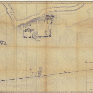
Tell-Halâf-Stadt 1913.Tell Halaf, 1913.
€ 4.500,00 -
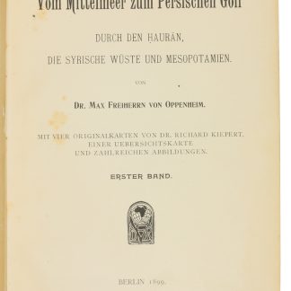
Vom Mittelmeer zum Persischen Golf durch den Hauran, die Syrische Wüste …Berlin, 1899-1900.
€ 8.500,00 -
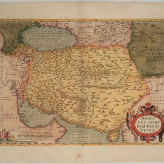
Persici sive Sophorum Regni Typus.Antwerp, 1574.
€ 2.500,00 -
[Atlas of the world].Ottoman Empire, 1909/10 CE = 1325 Rumi.
€ 4.500,00 -
Manuscript map album of the Ottoman Empire.Ottoman Empire, ca. 1910.
€ 8.500,00 -
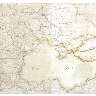
Collection of 2 maps from an Ottoman atlas: Arabian Peninsula and Hejaz …No place, ca. 1912.
€ 1.800,00 -
Mamalik Muhrsaa wa-Shahanaa bik haa wa'ldygha bilad.Istanbul, 1309 Rumi Calendar 1893.
€ 3.500,00 -
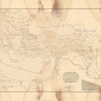
Memalik-i Osmaniyye'nin Aktâr-i Simaliyesi Haritasi.Üsküdar Istanbul, ca 1803.
€ 48.000,00 -
Collection of maps from Ottoman Turkey.Turkey, 1915-1919 CE = 1331, 1335 Rumi.
€ 250,00 -
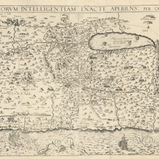
Situs Terrae Promissionis SS Bibliorum Intelligentiam Exacte Aperiens: …Köln, 1682.
€ 2.000,00 -
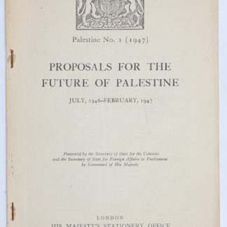
Palestine No. 1 1947. Proposals for the Future of Palestine. July, 1946 …London, 1947.
€ 1.500,00 -
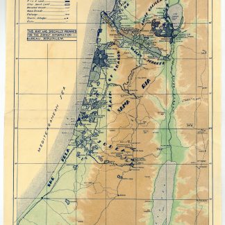
Eretz-Israel - Palestine.Jerusalem, ca. 1930s.
€ 300,00 -
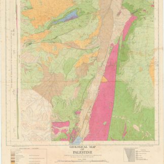
Geological map of Palestine.Jaffa, 1947.
€ 1.200,00 -
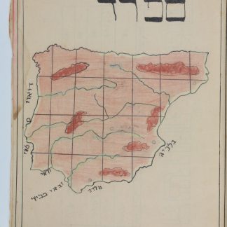
Machberet kitâ a'. [School notebook with hand-coloured maps].No place, ca. 1920s.
€ 250,00 -
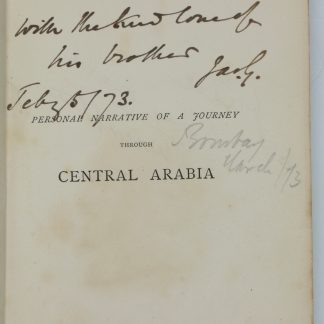
Personal Narrative of a Year's Journey Through Central and Eastern Arabia …London & New York, 1871.
€ 2.500,00 -
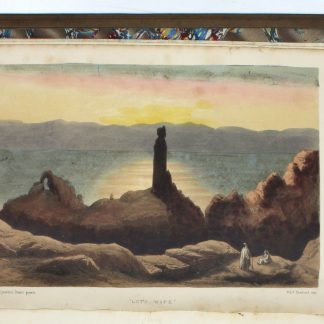
The Desert of the Exodus. Journeys on Foot in the Wilderness of the Forty …Cambridge, 1871.
€ 450,00 -
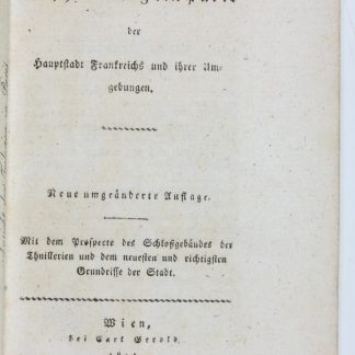
Neueste Beschreibung von Paris der Hauptstadt Frankreichs und ihrer Umgebungen. …Wien, 1814.
€ 100,00 -
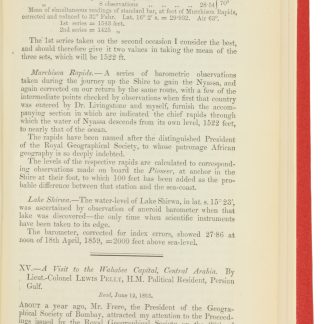
A Visit to the Wahabee Capital, Central Arabia. In: The Journal of the …London, 1865.
€ 3.500,00 -
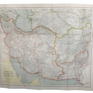
Persia, Afghanistan and Baluchistan. (Philips' Authentic Imperial Maps …Liverpool, 1920s.
€ 850,00 -
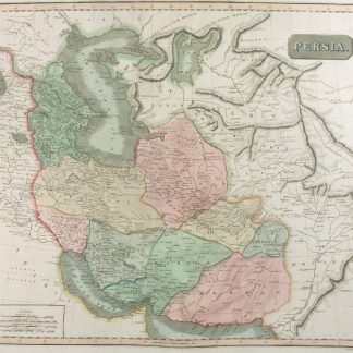
Persia.N. p., ca. 1820.
€ 750,00 -

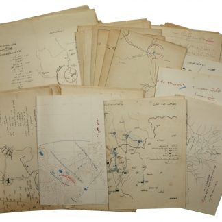
Road strip maps Iran. Dizful-Kazvin (1-10), Hamadan-Khosrovi (11-16)."83 Rep Group. I.E.", July 1944.
€ 3.500,00 -
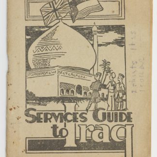
Services Guide to Iraq.No place or date but Iraq, likely Baghdad , ca. 1942.
€ 1.500,00 -
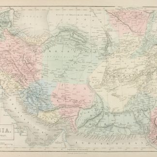
Persia and Afghanistan.Edinburgh, 1854.
€ 250,00
Zeige Artikel 337–384 von 539 (Landkarten, Pläne)
Nichts Passendes gefunden? Durchsuchen Sie unsere 30.000 Bücher und Autographen nach Sachgebieten oder benutzen Sie die erweiterte Suche.