Landkarten, Pläne
Zeige Artikel 1–48 von 540 (Landkarten, Pläne)
-
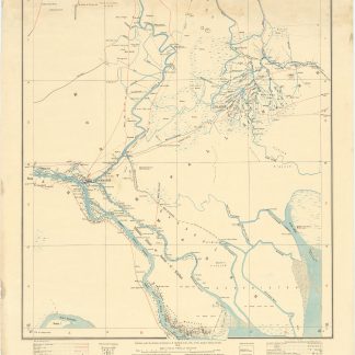
Turkey in Asia and Persia. Iraq & Arabistan Provinces. No. 10.B [Muhammareh].Calcutta, 1912-1915.
€ 3.500,00 -
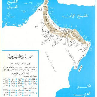
Imarat al-Sahil wa-Uman wa-al-Dawlah al-Saudiyah al-Ula 1818-1973 [The …Cairo, 1978.
€ 4.500,00 -
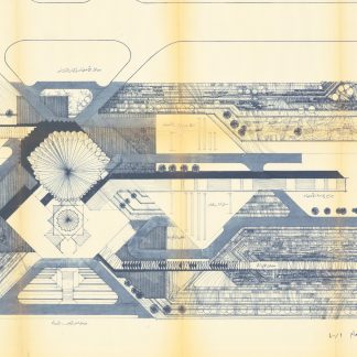
[Architectural plans of the Federal National Council assembly building].United Arab Emirates, ca. 1971.
€ 18.000,00 -
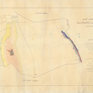
Geomorphological Map of Northern Part of Gabal Hafeet (U.A.E.).Abu Dhabi, 1970s.
€ 12.500,00 -
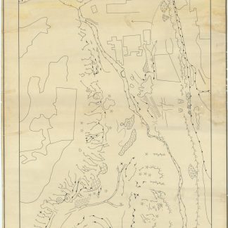
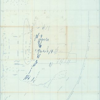
Manuscript map - [Town Planning Department Al Ain. Geological Survey of …Al Ain, 1970s.
€ 7.500,00 -
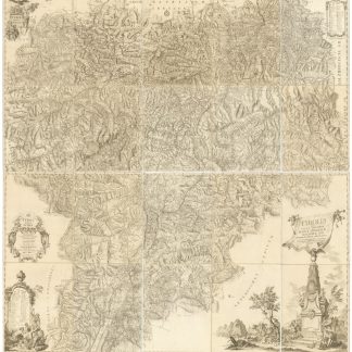
Atlas Tyrolensis. Tyrolis sub felici regimine Mariae Theresiae [...] chorographice …Wien, 1774.
€ 5.000,00 -
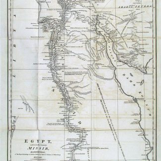
Observations on the Manners and Customs of the Egyptians, the Overflowing …London, 1800.
€ 850,00 -
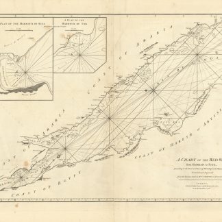
A Chart of the Red Sea from Geddah to Suez, According to the General Chart …London, 1781.
€ 8.500,00 -
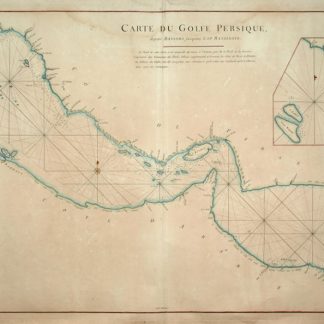
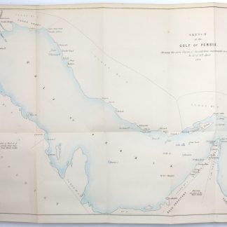
Carte du Golfe Persique, depuis Bassora jusqu'au Cap Rasalgate.Paris & Brest, 1775.
€ 7.500,00 -
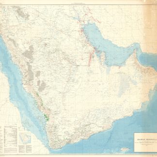
Arabian Peninsula.New York, 1969.
€ 100,00 -
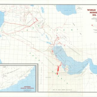
World Oil's 1958 Middle East oil map.Houston, Texas, 1958.
€ 4.500,00 -
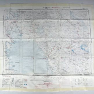
Bushire (N.H-39, fourth edition). Tehran (N.I-39, third edition).London, 1951.
€ 850,00 -
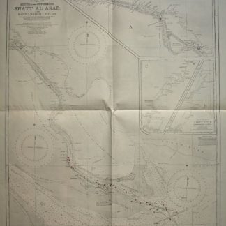
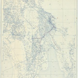
Persian Gulf. Mouth of the Euphrates. Shatt Al Arab and Bahmanshir River. …London, 1944.
€ 1.500,00 -
The Transactions of the Bombay Geographical Society. From January 1863 …Bombay, 1865.
€ 95.000,00 -
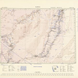
Laila. North F-38. Second edition. Army/Air Style. Sales copy.London, 1944.
€ 700,00 -
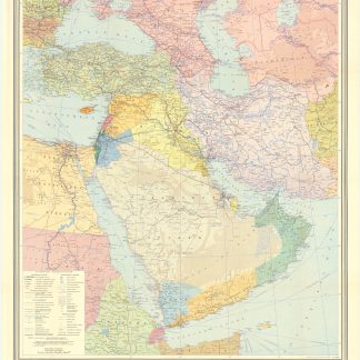
Jazirat al-'Arab wa-al-manatiq al-mutakhimah la-ha: kharitah tamhidiyah …Dharan, 1950-52 CE = 1369-71 H.
€ 4.500,00 -
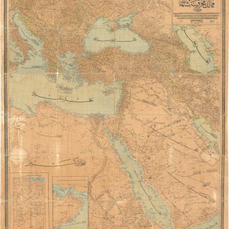
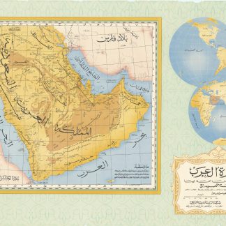
Omoumi Mamalik Mahrousi Shahani [General map of the protected countries. …Istanbul, 1896 CE = 1312 H.
€ 45.000,00 -
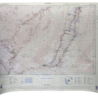
Laila. North F-38. Second edition. Army/Air Style.London, 1944.
€ 850,00 -
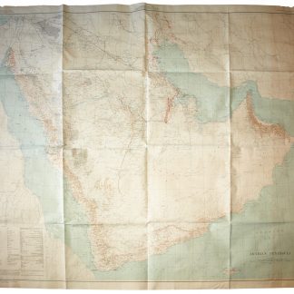
[United States Geological Survey of the Kingdom of Saudi Arabia]. Arabian …Washington, D.C., 1958.
€ 15.000,00 -
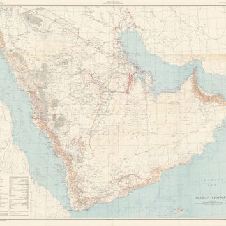
[United States Geological Survey of the Kingdom of Saudi Arabia]. Arabian …Washington, D.C., 1958.
€ 15.000,00 -
[United States Geological Survey of the Kingdom of Saudi Arabia]. Arabian …Washington, D.C., 1967.
€ 4.500,00 -
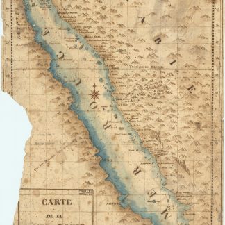
Carte de la mer Rouge, relevée sur celle de James Bruce.Egypt, probably Cairo, 1827.
€ 15.000,00 -
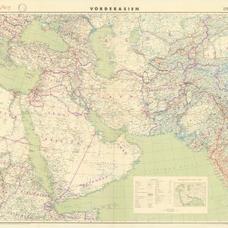
Vorderasien. 1:5,000,000.Berlin, 1941.
€ 500,00 -
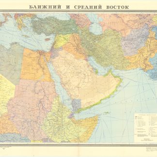
Blizhnij i srednij vostok.Moscow, 1972.
€ 400,00 -
Jugo-zapadnaja Azija.Moscow, 1972.
€ 300,00 -
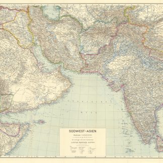
Südwest-Asien. 1:5,000,000. Grundlage: Stielers Handatlas.Gotha, 1942.
€ 150,00 -
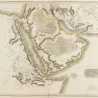
Arabia, Egypt, Abyssinia, Red Sea &c.Edinburgh, ca. 1823.
€ 2.500,00 -
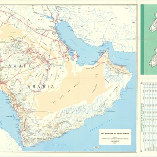
Saudi Arabian road map.Dammam, 1978.
€ 1.000,00 -
Dhahran. Scale 1:500,000.Dhahran, 1954.
€ 5.000,00 -
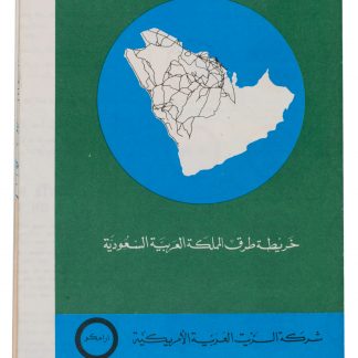
Saudi Arabian road map.Dammam, 1973.
€ 1.800,00 -
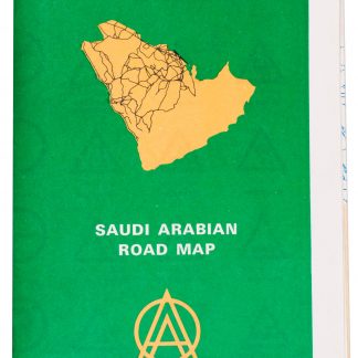
Saudi Arabian road map.Dammam, 1975.
€ 1.350,00 -
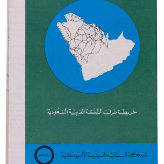
Saudi Arabian Road Map.Dammam, 1973.
€ 1.500,00 -
North East Rub Al Khali. B-1583-X.Saudi Arabia, 1953.
€ 2.800,00 -
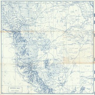
Western Area. Scale 1:1,000,000.Dhahran, 1953.
€ 8.500,00 -
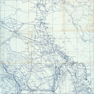
Central Area. Scale 1:1,000,000.Dhahran, 1953 or shortly after.
€ 6.500,00 -
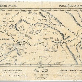
Arménie Russe. Rossijskaja Armenija.Venice, 1828.
€ 1.500,00 -
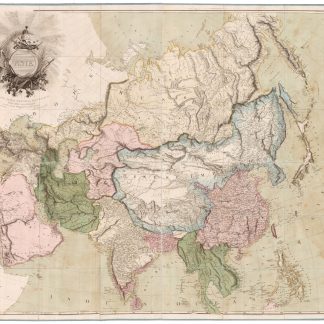
Asia. To Major James Rennell, Esqr. F.R.S. &c. &c. This Map is …London, 1801.
€ 12.500,00 -
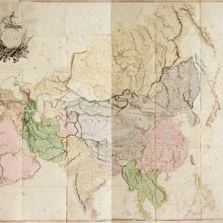
"Asia". Altkolorierte Kupferstichkarte mit ornamentaler Titelkartusche …London, 1801.
€ 12.500,00 -
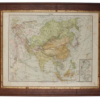
Asien.Leipzig, 1892.
€ 60,00 -
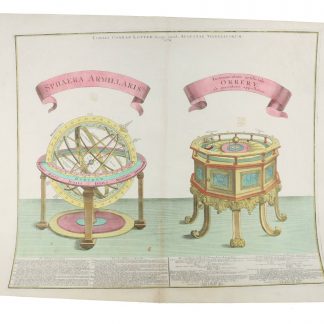
Sphaera armillaris. Instrumentum artificiale Orrery ab inventore appellatum.Augsburg, 1774.
€ 850,00 -
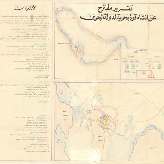
Taqrir muqtarah an insha’ Quwwa Bahariyya li-Dawlat al-Bahrayn [Sketch …Bahrain, mid-1970s.
€ 28.000,00 -
Memoir on Bahreyn. (And:) Pengelly, W. M. Remarks on a Portion of the Eastern …Bombay, 1863.
€ 15.000,00 -
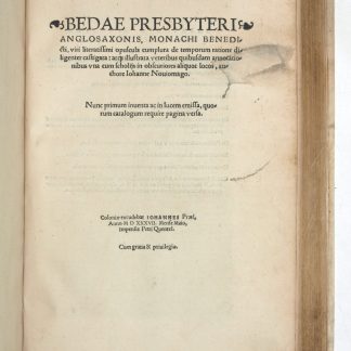
Opuscula complura de temporum ratione diligenter castigata.Cologne, May 1537.
€ 8.500,00 -
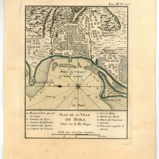
Plan de la ville de Moka située sur la Mer Rouge.Paris, 1764.
€ 450,00 -
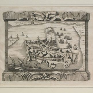
Das Eyland Ormus oder Jerun.No place or date, mid-18th c.
€ 400,00 -
Guerre d'Orient. Campagnes d'Egypte et de Syrie 1798-1799. Mémoires pour …Paris, 1847.
€ 7.500,00 -
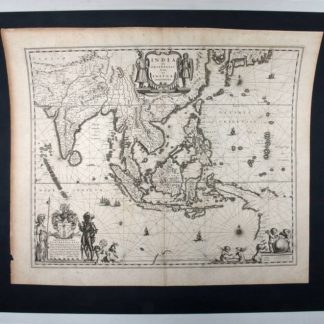
India quae orientalis dicitur, et insulae adiacentes.Amsterdam, 1640.
€ 1.500,00 -
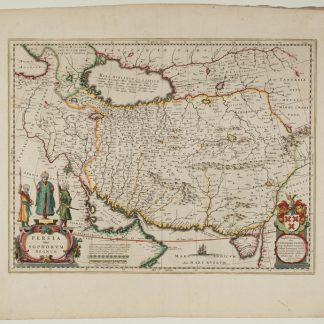
Persia Sive Sophorum Regnum.Amsterdam, 1642.
€ 1.500,00
Zeige Artikel 1–48 von 540 (Landkarten, Pläne)
Nichts Passendes gefunden? Durchsuchen Sie unsere 30.000 Bücher und Autographen nach Sachgebieten oder benutzen Sie die erweiterte Suche.