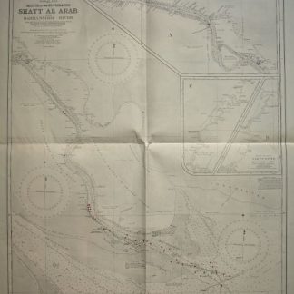
Persian Gulf. Mouth of the Euphrates. Shatt Al Arab and Bahmanshir River. From surveys by the Port Directorate, Basra, 1926-38. Khor Abdullah surveyed by Commr. H. E. F. Paine RIN, 1941-1942.
London, 1944.
Map (67 x 98 cm). Lights and beacons highlighted in purple.
€ 1,500.00
Wartime reprint, “reproduced by the U.S. Hydrographic Office from British Admiralty Chart”. First issued in 1921, with changes in 1923, 1928, 1931, 1936, 1940, and 1943.
References
Not in Al Ankary; Al-Qasimi.
Related
-
Vom Mittelmeer zum Persischen Golf durch den Hauran, die Syrische Wüste …Berlin, 1899-1900.
€ 8,500.00 -

Carte de l’Empire Ottoman comprenant les possessions de la Porte en Europe, …Paris, 1825.
€ 3,000.00 -

La seconda [terza, quarta] parte delle relationi universali.Brescia, 1599.
€ 3,000.00 -
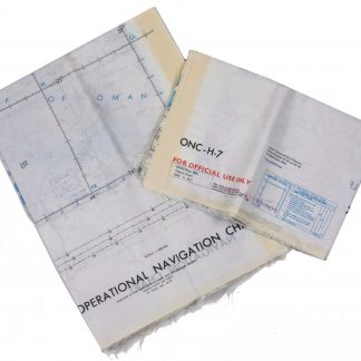
Persian Gulf. ONC-H-6/7. Operational navigation chart.St. Louis, 1969.
€ 2,800.00