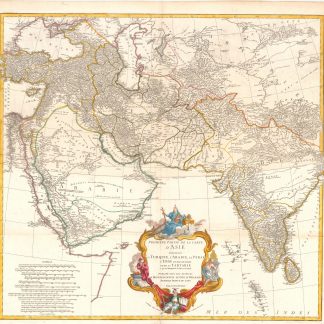
A large 2-sheet map of the Middle East
Premier Partie de la Carte d' Asie, contenant La Turquie, L'Arabie, La Perse, L'Inde en deça du Gange et de la Tartarie ce qui est limitrophe de la Pers et du Gange.
Paris, 1751.
Engraved map on two sheets (75 x 79 cm), with hand-coloured cartouche and coloured in outline.
€ 950.00
“The first really modern map of Arabia” (Tibbetts). An extremely detailed two-sheet map showing the Middle East, Arabia and India. The map extends from Turkey and Arabia to India, Tibet and the Gobi Desert in the east.
References
Alai, General maps E.126; Al-Qasimi 169; Tibbetts 281.
Related
-
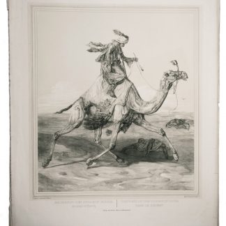
Skizzen aus dem Orient, gesammelt in den Jahren 1840 und 1841. Nach der …Darmstadt, 1843.
€ 18,000.00 -
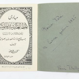
Egyptian ABC book.Cairo, ca. 1925.
€ 950.00 -
[Wrapper-title:] East India views islands headlands &c.London, ca. 1790?-ca. 1805.
€ 28,000.00 -
Annual report 1382-1383.Jeddah, 1964 CE = 1383 H.
€ 1,250.00