The most detailed and accurate geography of its day
Géographie historique, ecclésiastique et civile, ou description de toutes parties du globe terrestre.
8vo. 12 vols. With 72 engr. maps. Contemp. French full calf with giltstamped labels and gilt spines. All edges red; marbled endpapers.
€ 7,500.00
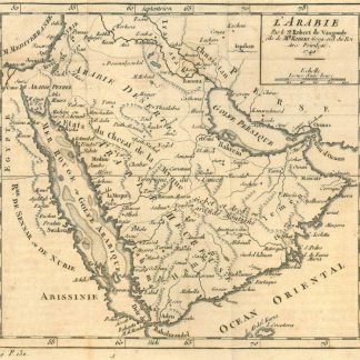
A fine copy of the twelve-volume octavo edition of the most detailed and accurate geography of its day (published simultaneously in four quarto volumes). All the maps are taken from the "Atlas Portatif" (1748-49) of Robert de Vaugondy. The fine map of the Arabian Peninsula is derived, via Vaugondy, from Delisle; "it includes the three classic divisions of the Arabian Peninsula and the following regional subdivisions: Tahama in the south west, Bahrain, which extends along the east coast and includes the town of Cathema, Yemen in the south which includes Oman, the States of the Cherif of Mecca which includes Hagiaz and parts of the centre of the Arabian Peninsula. Although the width of the Red Sea is exaggerated, the Sinai peninsula's shape is very close to reality. The topographical features and watercourses are not very different to how they are shown on other maps of the same period. A town named Naged is shown to the north west of the town of Janama" (Al Ankary).
Some bindings slightly bumped at extremeties. Contemporary ms. ownership "Leon. van Berg" to pastedowns; titles bear stamp of the La Valsainte Charterhouse, Switzerland (dissolved in 1825). Slightly browned. Formerly in the collection of the Swiss industrialist Herry W. Schaefer.
Streit 17, p. 252, n. 6198. Brunet VI, 19613. OCLC 34221488. For the map of Arabia cf. Tibbetts 278. Sultan Bin Muhammad Al-Qasimi, The Gulf in Historic Maps, S. 162. Al Ankary Collection 338 (all referencing Vaugondy's map).
Related
-
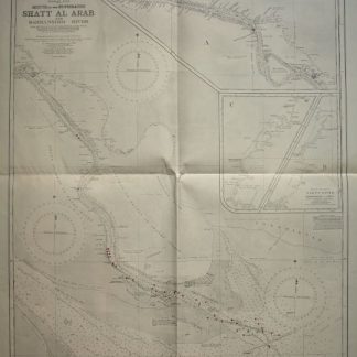
Persian Gulf. Mouth of the Euphrates. Shatt Al Arab and Bahmanshir River. …London, 1944.
€ 1,500.00 -

Persian Gulf. ONC-H-6/7. Operational navigation chart.St. Louis, 1967.
€ 1,500.00 -
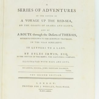
A Series of Adventures in the Course of a Voyage up the Red-Sea, on the …London, 1780.
€ 12,500.00 -
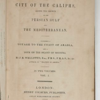
Travels to the City of the Caliphs, along the Shores of the Persian Gulf …London, 1840.
€ 6,000.00