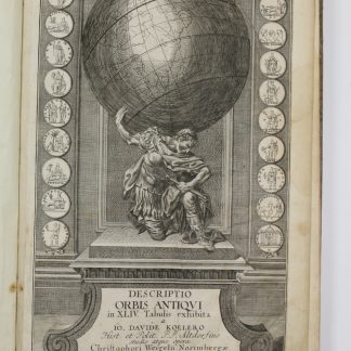
Descriptio orbis antiqui in XLIV tabulis exhibita.
Folio. With engraved title-page and engraved table of contents, 40 numbered engraved double-page maps, including one world map, and 4 numbered engraved double-page plans, all in original hand colour. Contemporary half calf over marbled boards with gilt stamped spine title.
€ 3,800.00
A well-preserved copy of this 18th century atlas of the classical world, containing maps of remarkable quality, skilfully coloured. Beginning with a map of the entire ancient world and one of Europe, it includes several European countries as well as Asia and Africa, with maps of Arabia, Persia, Syria, Palestine, and Egypt. The plans show the cities of Rome, Athens, and Jerusalem as well as the camp of the Israelites in Sinai. Maps no. 43 and 44 provide an overview of the political situation in Europe, Northern Africa and parts of Asia in the 5th century. The cartouches surrounding the maps mostly consist of numismatic elements, some also containing figural depictions. An illustration of the Titan Atlas constitutes the centre of the engraved title.
Contemporary ownership of M. Elias to flyleaf. Latterly in the library of the Viennese collector Werner Habel, with his signed and stamped ownership, dated 1979, to the pastedown.
Without the engraved dedication and portrait, which were included with only a very few copies. Binding slightly rubbed, hinges starting. Paper slightly browned; margins of the flyleaf, the title-page, the index and of maps 19-27 more noticeably waterstained. One large crease to the table of contents.
Shirley, T.WEIG-2a/b. Phillips 31. Bauer, Weigel 7, 1.46. For the map of Arabia: Al Ankary 138. Historical Atlas of the Persian Gulf (2006) 98. Al-Qasimi (Maps 1493-1931) 129. Not in Tibbetts.
Related
-

Carte de l’Empire Ottoman comprenant les possessions de la Porte en Europe, …Paris, 1825.
€ 3,000.00 -

Reize naar Arabië en andere omliggende landen.Amsterdam & Utrecht, 1776-1780.
€ 6,000.00 -
Hodaeporicon Indiae Orientalis; Das ist: Warhafftige Beschreibung der ansehnlich …Leipzig, 1608.
€ 28,000.00 -
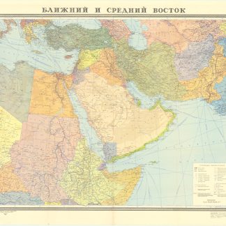
Blizhnij i srednij vostok.Moscow, 1972.
€ 400.00