The first manual for the use of chronometers at sea
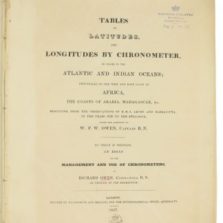
Tables of Latitudes, and Longitudes by Chronometer, of Places in the Atlantic and Indian Oceans; principally of the West and East Coast of Africa, the Coasts of Arabia, Madagascar. &c. resulting from the Observations of H.M.S. Leven and Barracouta, in the Years 1820 to 1826 inclusive [...]. To which is prefixed an Essay on the Management and Use of Chronometers by Richard Owen.
4to. (2), 33, (3), 16, (36), 8 pp. Contemporary blue boards for the Danish Navy Library, later backed with cloth.
€ 2,500.00
First edition of this important work in the history of navigation: probably the first manual for the use of chronometers at sea. Based on observations conducted under the direction of Vice-Admiral William Fitzwilliam Owen (1774-1857). The referenced places along the Eastern coast of Arabia include Ras Morebat, the Khuriya Muriya Islands, Ras al-Hadd, and Muscat.
Several contemporary handwritten corrections in ink. Stamp of the Royal Danish Navy Library on title-page. Binding a little loosened, corners or boards bumped, but internally fine; final 8 pp. of errata printed on paper of lesser quality and thus slightly browned.
OCLC 4878142.
Related
-
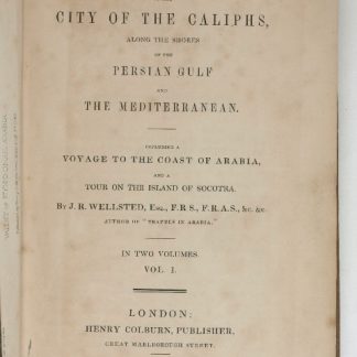
Travels to the City of the Caliphs, along the Shores of the Persian Gulf …London, 1840.
€ 6,000.00 -
A contribution to the geography and cartography of north-west Yemen (based …Cairo, 1939.
€ 2,800.00 -
A Voyage from England to India, in the Year MDCCLIV, and an Historical …London, 1773.
€ 4,500.00 -

Die Ritterlich und lobwürdig reiß [...] Sagend von den landen, Egypto, …Strasbourg, 1516.
€ 450,000.00