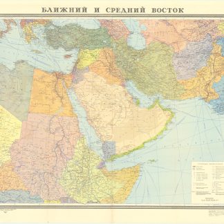
Blizhnij i srednij vostok.
Moscow, [Main Directorate of Geodesy and Cartography under the Council of Ministers of the USSR], 1972.
88 x 100 cm. Original colour-printed map. Scale 1:6,000,000.
€ 400.00
Rare political map of the Middle East from the Cold War era, centred on the Arabian Peninsula and the Gulf region, but also comprising Egypt, Sudan, Ethiopia and Somalia, as well as Greece, Turkey and the Levant, Iraq, Iran, Pakistan, and Afghanistan. With Cyrillic titles and captions.
Small marginal flaws.
Related
-
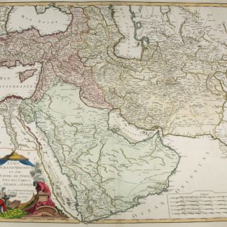
Etats du Grand-Seigneur en Asie, Empire de Perse, Pays des Usbecs, Arabie …Paris, 1753.
€ 1,950.00 -

The complete series of the first 200 works issued by the Hakluyt Society.London, 1847-1958.
€ 85,000.00 -

Reize naar Arabië en andere omliggende landen.Amsterdam & Utrecht, 1776-1780.
€ 6,000.00 -
Der Nahe Osten. Tornisterschrift des NS.-Führungsstabes der Wehrmacht. …Berlin, 1944.
€ 350.00