
Blueprint map of the Nejd
Western Area. Scale 1:1,000,000.
760 x 750 mm. Scale 1:1,000,000. Relief shown by hachures, spot heights, submarine contours, airports and airstrips, mining activity, and land routes. Key in English. Printed on cloth.
€ 8,500.00
Blueprint map of Saudi Arabia covering 20-26° N and 38-45° E, extending from the Nejd to the Red Sea coast including Jeddah and Yanbu al-Nakhal. It pays particular attention to geological features, showing the lava fields of Harrat Rahat, Harrat Kishb, Harrat Khaybar, Harrat Nawasif, Harrat Buqum and Harrat Hadan, as well as the Uruq Subay dunes and the tribal areas of Bilad Zahran and Bilad Ghamid. Among the most prominent labelled cities are Mecca with its environs (Muna, Shumaysi), Medina, Jeddah and Taif; the Darb al-Hijaz (Riyad-Jeddah Road) is named.
The sheet was prepared as a working document by Aramco and the US Geological Survey to help them in the early stages of comprehensive nationwide mapping and exploration work for the Saudi Government.
Slightly toned along folding lines and right margin.
Related
-
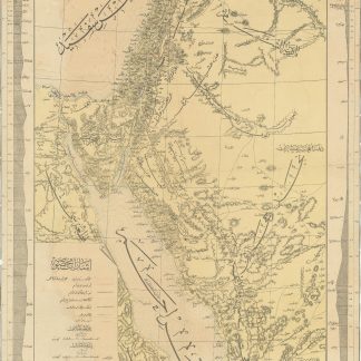
[Map and Profile of the Hijaz Railway Route].Constantinople, 1904 CE = 1320 Rumi.
€ 22,000.00 -
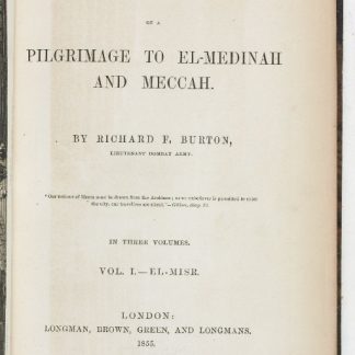
Personal Narrative of a Pilgrimage to El-Medinah and Meccah.London, 1855-1856.
€ 15,000.00 -
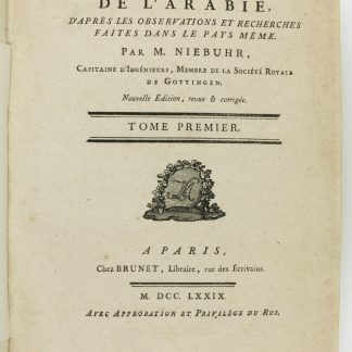
Description de l'Arabie, d'après les observations et recherches faites …Paris, 1779.
€ 6,500.00 -
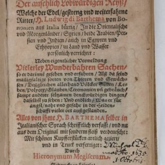
Hodaeporicon Indiae Orientalis; Das ist: Warhafftige Beschreibung der ansehnlich …Leipzig, 1608.
€ 28,000.00