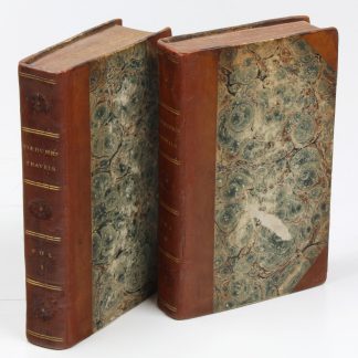
Travels Through Arabia and Description of Arabia - second English edition
Travels through Arabia and other countries in the East [...].
12mo. 2 vols. XX, 339, (1) pp. XII, 359, (1) pp. With 8 engraved plates and one engraved folding map of the Arabian Gulf. Contemporary half calf over marbled boards with giltstamped spine and spine-title. All edges sprinkled red.
€ 7,500.00
Second edition in English of Niebuhr's excellent account of his travels in the Middle East, Egypt, Persia, India and Arabia, the first scientific expedition to this area, subsidised by the Danish king. Of the five scientists, Carsten Niebuhr (1733-1815) was the sole survivor, and his work represents an important contribution to the study of the Middle East. The maps Niebuhr drew in the course of the expedition were remarkably detailed and accurate. Indeed, his map of Yemen was the first exact map of the area ever, remaining the standard for the next 200 years. The volumes include authentic descriptions of life and customs in Yemen, Oman and elsewhere, with detailed descriptions of Mecca and Medina, Sana'a and Mocha as well as several references to coffee and coffeehouses. The first volume was adapted from Niebuhr's "Reisebeschreibung nach Arabien" (1774) and the second from his "Beschreibung von Arabien" (1772). Previously published in Edinburgh in 1792.
Corners and hinges professionally repaired. With near-contemporary manuscript presentation note to flyleaves: "presented to the Glenbervie Sunday School Library by G. M". Later pencil ownership of the Scottish dentist and naturalist E. G. H. Lightfoot, dated Aberdeen 1953. Some additional pencil notes to pastedown and flyleaf of volume I, including brief biographical notes on Niebuhr in Lightfoot's handwriting.
ESTC T176314. Howgego, to 1800, N24. Hünersdorff, p. 1081. OCLC 5416838. Cf. Weber II, 550. Macro 1700. Atabey 873-874 (other eds).
Related
-
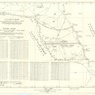
Final map of dividing line of the Kuwait - Saudi Arabia Neutral Zone.N. p., August 1968.
€ 3,500.00 -
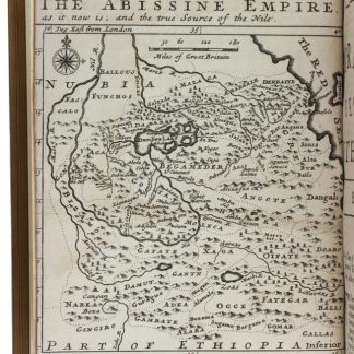
The travels of the Jesuits in Ethiopia: containing [...] travels in Arabia …London, 1710.
€ 25,000.00 -

Carte de l’Empire Ottoman comprenant les possessions de la Porte en Europe, …Paris, 1825.
€ 3,000.00 -
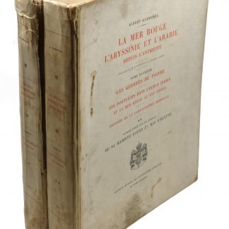
La Mer Rouge, l'Abyssinie et l'Arabie. Tome 2: Les guerres du poivre. Les …Cairo, 1935.
€ 850.00