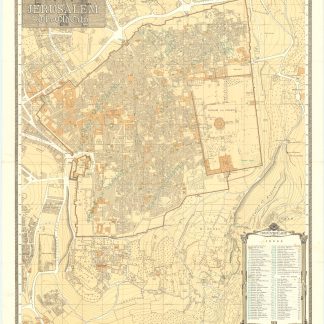
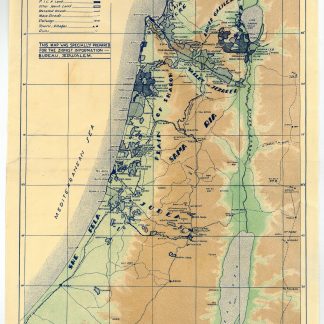
Zionist Information Bureau map of Mandate Palestine
Eretz-Israel - Palestine.
Chromozincographic folding map, 400 x 240 mm. Drawn by M. Pikovsky.
€ 300.00
A rare Zionist map of Palestine titled in Hebrew and English and specially prepared for the Zionist Information Bureau in Jerusalem. Established in 1925, the Zionist Information Bureau of Tourism was the main force behind the promotion of a new type of tourism - Zionist tourism - of British Mandate Palestine. The contributing engraver, Michael Pikovsky (1866-1943), produced many of the maps used by the Zionist Information Bureau and similar bodies. This map presents a good example of the work Pikovsky and his fellow illustrators and cartographers were producing in Palestine in the 1930s. The map shows Zionist land ownership in Mandate Palestine (that owned by the Jewish National Fund, P.I.C.A., and "other Jewish land"), as well as ruins and ancient sites which were becoming increasingly important to tourism, such as Masada.
A few marginal small closed tears with tape repairs on verso, otherwise bright and clean.