Maps and Plans
Showing items 433–480 of 540 (Maps and Plans)
-
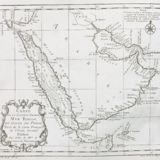
Carte de la Coste d'Arabie, Mer Rouge, et Golfe du Perse. Tirée de la …Amsterdam, ca. 1745.
€ 250.00 -
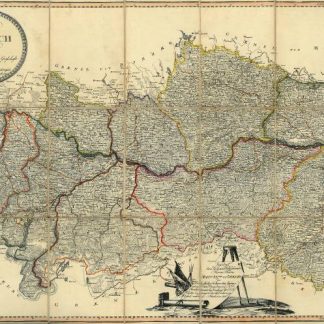
Neueste Karte des Erzherzogthums Oesterreich. Ob und unter der Enns. Eingetheilt …Wien, 1800.
€ 450.00 -
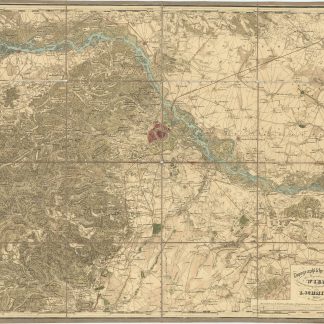
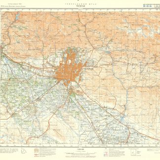
Topographische Karte der Gegenden von Wien. Astronomisch trigonometrisch …Wien, um 1850.
€ 250.00 -
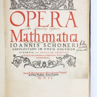
Opera mathematica.Nuremberg, 1551.
€ 35,000.00 -

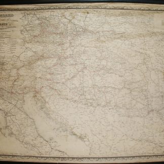
General-Post und Strassenkarte des Lombardisch-Venezianischen Königreichs.Wien, 1848.
€ 750.00 -
Eisenbahn- Post- Dampfschiffahrts- und Telegrafen-Karte des Oesterreichischen …Wien, ca. 1865.
€ 350.00 -
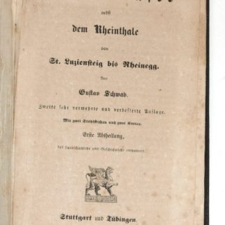
Der Bodensee nebst dem Rheinthale von St. Luziensteig bis Rheinegg. Zweite …Stuttgart u. Tübingen, 1840.
€ 600.00 -
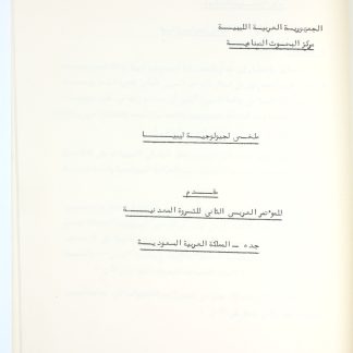
[The Geology of Libya].Jeddah, 1974.
€ 850.00 -
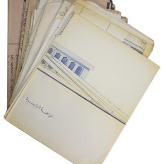
[Architectural plans of Al Seef Palace].Sharjah, 1976.
€ 7,500.00 -
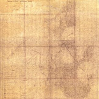
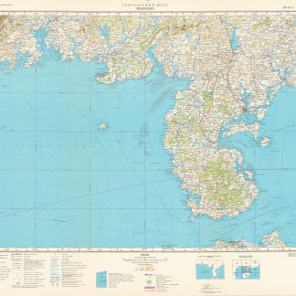
Al Sharjah and Ras Al Khaimah Emirates. Oman Coast. Arabian Gulf. Synthetic …Paris, 1968.
€ 5,000.00 -
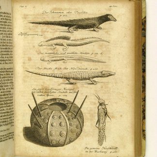
Reisen oder Anmerkungen verschiedene Theile der Barbarey und der Levante …Leipzig, 1765.
€ 2,000.00 -
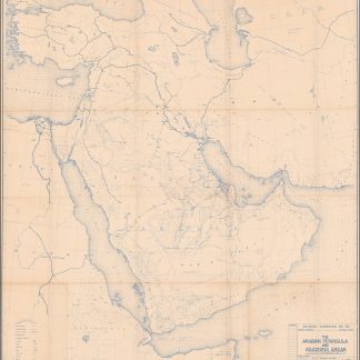
The Arabian Peninsula and Adjoining Areas. B-1237.Dhahran / Jeddah / San Francisco, March 1942.
€ 85,000.00 -
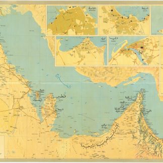
Road Map of the Gulf.Middle East, 1970s.
€ 1,500.00 -
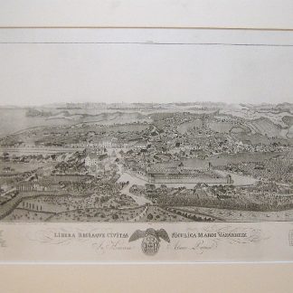
Libera regiaque civitas siculica Maros Vasarhely.Targu Mures, 1822-1827.
€ 3,500.00 -
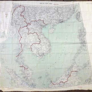
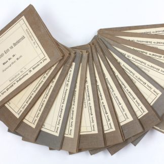
Fabric Map - South East Asia and Hong Kong. Restricted. G.S.G.S. (Misc) …London, 1954.
€ 650.00 -
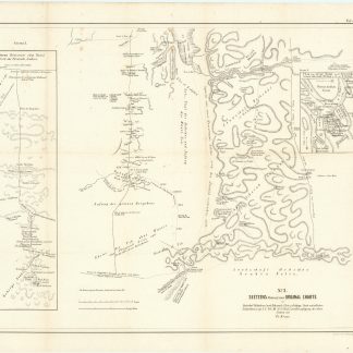
Seetzens Entwurf einer Original Charte von Dschebal (Gebalene) und Scharah- …Berlin, 1859.
€ 750.00 -
Administrativ-Karte des Erzherzogthums Oesterreich ob der Enns nach den …Linz, 1872.
€ 350.00 -

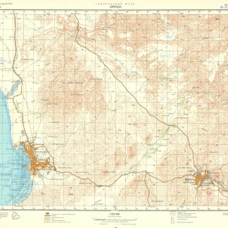
General'nyí shtab. Medina. G-37. (And:) Al-Wajh. G-37-A. (And:) Madain-Salih. …Moscow, 1982, 1972, 1978-1979.
€ 4,500.00 -
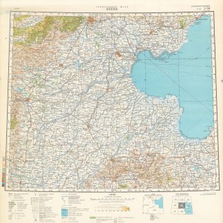
General'nyí shtab. Abadan, Jel'-Kuvejt, Manama. 14-01-43. (And:) Bender-Abbas, …Moscow, 1974-1985.
€ 6,000.00 -
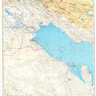
General'nyí shtab. (Arabian Peninsula 1:200,000).Moscow, 1975-1991.
€ 95,000.00 -
General'nyí shtab. (China 1:1,000,000).Moscow, 1971-1989.
€ 7,500.00 -
General'nyí shtab. (China 1:200,000).Moscow, mainly 1970s and 1980s.
€ 150,000.00 -
General'nyí shtab. (China 1:500,000).Moscow, 1970-1989.
€ 20,000.00 -
General'nyí shtab. (Iran, Iraq, Levant 1:200,000).Moscow, 1963-1991.
€ 45,000.00 -
General'nyí shtab. (Iran, Iraq, Levant 1:500,000).Moscow, 1964-1989.
€ 9,500.00 -
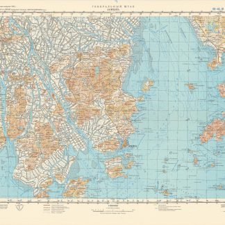
General'nyí shtab. (Japan 1:200,000).Moscow, 1968-2002.
€ 20,000.00 -
General'nyí shtab. (Red Sea 1:200,000).Moscow, 1975-1991.
€ 35,000.00 -
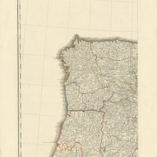
Neueste Generalkarte von Portugal und Spanien. Nach den astronomischen …Wien, 1790.
€ 200.00 -

Countries between Constantinople & Calcutta including Turkey in Asia, …London, 1885.
€ 2,000.00 -
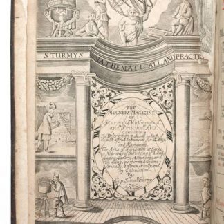
The Mariners Magazine. [...] Revised, corrected and enlarged by John Colson.London, 1700.
€ 8,500.00 -
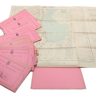
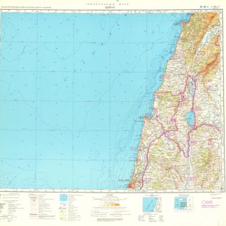
Palestine Survey Maps.Jerusalem?, 1942-1945.
€ 6,500.00 -
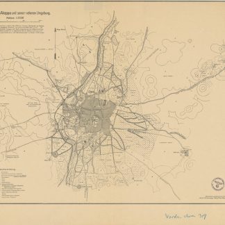
Kartenbild von Aleppo und seiner näheren Umgebung.Probably Syria, June 1918.
€ 450.00 -
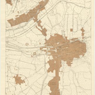
Damascus.Probably Damascus, 1918.
€ 8,500.00 -

Homs N.-O. Amplification de la Carte de l'État-Major Ottoman au 200.000e.Paris, 1924.
€ 300.00 -
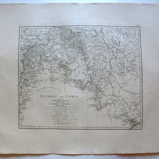
Euphrat und Tigris. Verfasst von Herrn d'Anville.Vienna, 1786.
€ 250.00 -
[Levant. 1:200,000].Paris, 1920-1937.
€ 1,800.00 -

[Levant. 1:50,000].Paris, 1926-1939.
€ 2,800.00 -
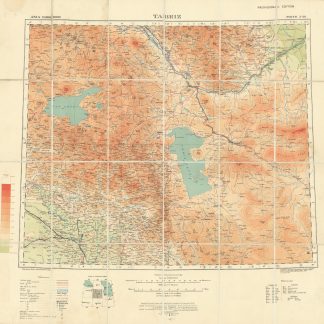
Tabriz. North J-38. Provisional edition. G.S.G.S. No. 2555.London, 1924.
€ 1,500.00 -
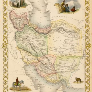
Persia.London, 1851.
€ 500.00 -
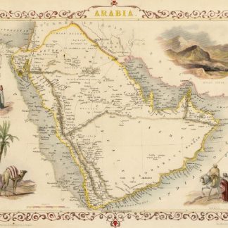
Arabia.London, 1851.
€ 500.00 -
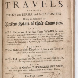
Collections of travels through Turky into Persia, and the East-Indies. …London, 1684.
€ 8,500.00 -
Vierzig-Jährige Reise-Beschreibung. Worinnen dessen durch Türkey, Persien, …Nuremberg, 1681.
€ 8,500.00 -
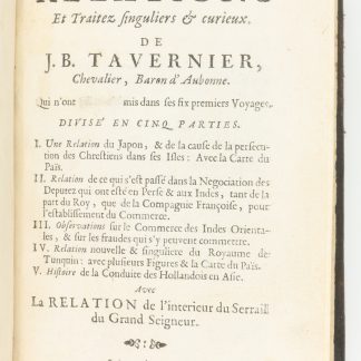
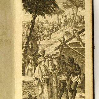
(Nouvelle relation de l'interieur du Serail du Grand Seigneur). Recueil …Amsterdam, 1679.
€ 2,500.00 -
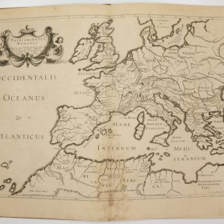
Antiquorum Patriarchatuum Descriptio.Paris, 1640.
€ 3,500.00 -
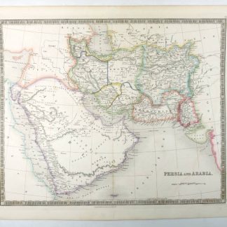
Persia and Arabia.London, 1847.
€ 750.00 -
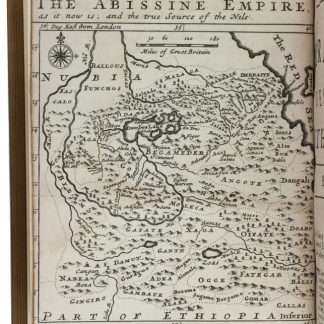
The travels of the Jesuits in Ethiopia: containing [...] travels in Arabia …London, 1710.
€ 25,000.00 -
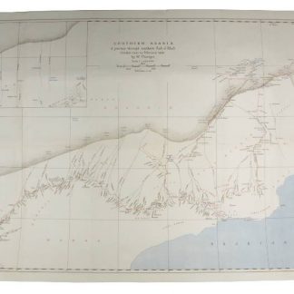
Southern Arabia. A Journey Through Southern Rub el Khali. October 1945 …London, 1946.
€ 1,800.00 -
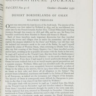
Desert Borderlands of Oman. (In: The Geographical Journal. Vol. CXVI Nos. …London, 1950.
€ 1,800.00
Showing items 433–480 of 540 (Maps and Plans)
Not what you were looking for? Browse 30,000 books and autographs by subject or try our advanced search.