[VERKAUFT]
Dieses Stück ist bereits verkauft. Am Ankauf eines gleichwertigen Exemplars bzw. von Stücken ähnlicher Bedeutung sind wir immer interessiert.
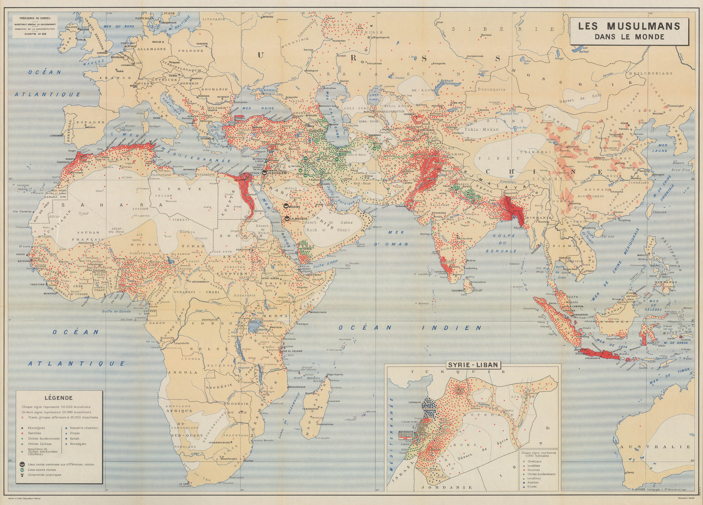
The spread of Islam across the globe
Les Musulmans dans le monde.
996 x 741 mm. Colour-printed map, scale ca. 1:18,000,000.
Early 1950s world map showing the spread of Islam. Prepared by the "Centre des hautes études d'administration musulmane" (CHEAM), a French government agency formed in 1936 to provide intelligence, resources, and training to French colonial officers, including the military. Renamed "Centre des hautes études sur l'Afrique et l'Asie modernes" after decolonisation, it was ultimately dissolved in 2000 and its remit transferred to the "Institut des hautes études en relations internationales".
Published shortly before the Algerian War and the wave of recruitment of Turkish and Northern African migrant workers to continental northern Europe, the map reveals no relevant numbers of Muslims at all in Europe north of Sarajevo. Indeed, by 1956 there would be 300,000 Algerians in France, and that number would more than double within a decade. A recent Pew Research report documents Muslim population in France at 5,720,000 or 8.8% of the total population.
Issued as map 55, an annex to the special "Orient-Occident" series of the "Articles et Documents" of the centre's Direction de la Documentation. Traces of old folds, with the title panel on the reverse a little darkened, but altogether in perfect condition.
OCLC 166101833.

