
Carte de l’Empire Ottoman comprenant les possessions de la Porte en Europe, en Asie, et en Afrique; avec les parties limitrophes de l’Arabie, de la Perse, de la Russie et de l’Empire Austriche. Dressée par Nöel et Vivien, geographes; et gravée par Giraldon-Bovinet.
12 sheets joined and mounted on cloth; total dimensions 1190 x 1300 mm. Engraved map in original outline colour. In the original marbled paper box with manuscript title on cartouche and a 19th century bookseller’s label.
€ 3.000,00
A large map coving from the Balkans to the Ukraine, the Caspian Sea, Western Persia, Arabia and the Nile. Unusually, the map uses stipple engraving to give texture to the open areas, especially in Arabia. It is also an uncommonly international publication, published in France by the engraver, with the assistance of publishers in other countries: James Wyld and John Cary in London; Artaria & Fontaine in Mannheim; Villardi in Milan; Bouffa & Fils in Amsterdam; and Brunin in Glasgow (a publisher not listed in Tooley’s Dictionary).
Minor defects to the box, slight browning, otherwise in fine condition.
OCLC 1061136095.
Ähnlich
-
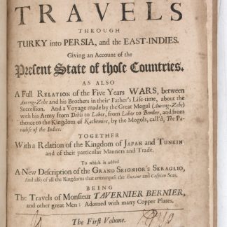
Collections of travels through Turky into Persia, and the East-Indies. …London, 1684.
€ 8.500,00 -
![Sammandrag af Justitiae-Radets Herr Casten [!] Niebuhrs Resa i Levanten och Beskrifning om Arabien.](https://inlibris.com/wp-content/uploads/2020/05/img-bn45052-324x324.jpg)
Sammandrag af Justitiae-Radets Herr Casten [!] Niebuhrs Resa i Levanten …Stockholm, 1787.
€ 3.500,00 -

Persian Gulf. ONC-H-6/7. Operational navigation chart.St. Louis, 1967.
€ 1.500,00 -
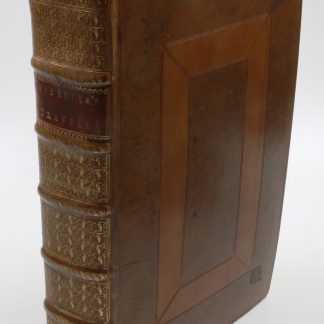
Collections of travels through Turky into Persia, and the East-Indies. …London, 1684.
€ 16.500,00
