![Approaches to Mina Sulman including [Khor Kaliya &] Sitra Anchorage (3792).](https://inlibris.com/wp-content/uploads/2022/03/img-bn57382.jpg)
Admiralty Hydrographic Chart of Manama
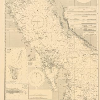
Approaches to Mina Sulman including [Khor Kaliya &] Sitra Anchorage (3792).
Standard issue, 700 x 1024 mm. Scale 1:50,000.
€ 1.800,00
Detailed nautical chart of the approaches to Mina Salman, the primary cargo port and customs point of Bahrain, prepared by the British Admiralty. Undoubtedly one of the better antiquarian maps of northern Bahrain.
The chart details the approaches to Mina Salman as well as the Sitra anchorage. Approach channels to Mina Salman were built in 1954, and a pier was constructed in 1956, mainly used by dhows. In 1958 it became a free port, and in 1962 a deep water wharf composed of six berths was constructed. The wharf allowed cargo to be directly loaded onto the port for the first time. In the 1960s, the port had refrigeration, storage facilities and equipment for handling large ships.
The map includes the cities of Muharraq and Manama, showing numerous minarets. Bahrain Fort, the Portuguese Fort, Abu Mahur Fort, and the Sheikh's palace are labelled. Another prominent site is Muharraq Airfield, a military base established by the Royal Air Force in April 1943 as RAF Bahrain (later RAF Muharraq) that remained in use until 1971, when Bahrain declared independence.
The British Admiralty has produced nautical charts since 1795 under the auspices of the United Kingdom Hydrographic Office (HO). Its main task was to provide the Royal Navy with navigational products and service, but since 1821 it has also sold charts to the public. The present chart was composed after Admiralty surveys from 1932 to 1960. The 1951 first edition saw revisions and corrections in 1962-65.
Very well preserved with a single fold. Provenance: stamps of Maria K. Iatrou, seller of nautical charts, books and instruments in Piraeus, Greece.
Ähnlich
-

Persian Gulf. ONC-H-6/7. Operational navigation chart.St. Louis, 1967.
€ 1.500,00 -

United Arab Emirates Abu Dhabi. Mina Zayed Tariff Rules.Abu Dhabi, 1970s.
€ 650,00 -
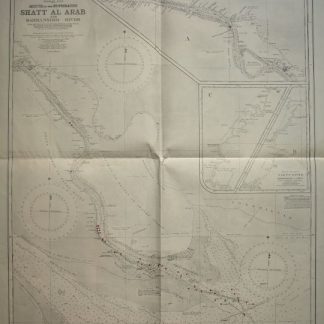
Persian Gulf. Mouth of the Euphrates. Shatt Al Arab and Bahmanshir River. …London, 1944.
€ 1.500,00 -
Persian Gulf. Western Sheet. No. 2837b.London, 1948.
€ 1.500,00
![Approaches to Mina Sulman including [Khor Kaliya &] Sitra Anchorage (3792).](https://inlibris.com/wp-content/uploads/2022/03/img-bn57382-324x324.jpg)