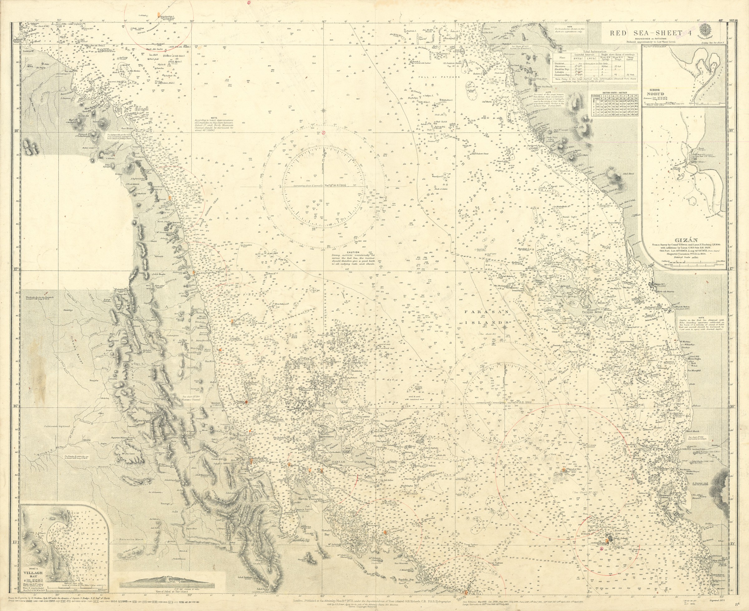
Red Sea - Sheet 4. No. 8d.
Standard issue, 710 x 860 mm. No scale information.
€ 1.250,00
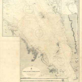
Nautical chart of the Red Sea between Trinkitat in Sudan and Hodeida in Saudi Arabia, prepared by the British Admiralty. With three inset maps of Khor Nohud, Gizán, and the Disei Village Bay, as well as a view of Jabal at Tair Island.
The chart shows the Farasan Islands as well as the Dahlak Archipelago and the Zubair Group. Among the most prominent labelled cities are Loheiya, Hodeida, Gizán, and Massawa. Other interesting details include an Egyptian military station at Mount Keren, an Italian post near the Arafale craters, the Husna-l Majis Hill Fort, and the Sheikh's Tomb near Hali Point in Saudi Arabia.
The British Admiralty has produced nautical charts since 1795 under the auspices of the United Kingdom Hydrographic Office (HO). Its main task was to provide the Royal Navy with navigational products and service, but since 1821 it has also sold charts to the public. The present chart was composed after Admiralty surveys of the 19th century; it was first published in 1873 and saw several corrections up to 1936.
With a single fold. A few manuscript notes. Captioned in print and in a former collector's hand on verso. Brown smudge near left margin; faint marginal flaws.
![Gulf of Aden [...] Eastern Portion Including Socotra Island. No. 6a.](https://inlibris.com/wp-content/uploads/2022/04/img-bn58797-324x324.jpg)