Less than 100 ever produced
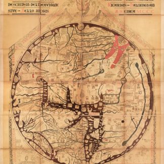
The Mappa Mundi. Hanc quam videtis terrarum orbis tabulam descripsit.
1840 x 1500 mm. Colour lithograph on paper, sectionalized and laid on linen.
€ 25.000,00
The most important feat of cartography to come out of the British Middle Ages, and perhaps second only to the Fra Mauro map among all of medieval cartography, the Hereford Mappa Mundi contains over 500 drawings, depicting 420 cities and towns, 15 Biblical events, 33 plants, animals, birds and strange creatures, 32 images of the peoples of the world, and eight pictures from classical mythology. It lay undisturbed - occasionally secreted away below floors, when war or other upheavals put it at risk - and largely ignored for centuries before its sudden rise to fame in the 1850s, when the British Museum undertook its restoration. It has since been a touchstone of medieval geography and the development of a global sense of the world, one of the last and most beautiful mappae mundi created when the art had reached its height.
Based on the ancient tradition of the T-O map (so-called because the seas between the continents of Africa, Europe, and Asia form a T-shape within the circular O of the world), the mappae mundi became ever more complex as Europeans began to understand the scale of the globe - which, though drawn as if projected on a flat circle, they were quite aware was spherical, which the O shape was intended to reflect. Eventually, the rhumb lines and carefully realistic coastlines of Portolan charts would usurp the ancient tradition of the the mappa mundi, but the Hereford example is among the finest, and certainly the largest and most detailed extant mappa mundi from the British Isles.
Following its blooming popularity, Hereford elected to issue this facsimile edition published with a monograph by the Rev. W. L. Bevan, available to a mere 116 subscribers. Of these, only about half took up the opportunity to purchase the map, making this example particularly scarce. The map itself is a slightly larger-than-life-sized colour lithographic copy, stretching nearly two meters in height and a meter and a half in width. It borrows from the original, painted on a single sheet of vellum by hand and surviving more than 700 years, its true sense of scope, one which had an unprecedented impact on both to the medieval eye and the medieval mind.
Slight toning, gentle wear along old folds; altogether in very good condition.
Ähnlich
-
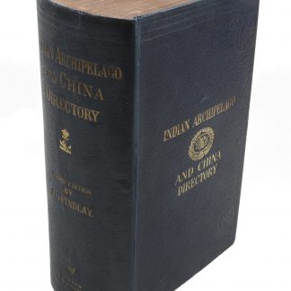
A Directory for the Navigation of the Indian Archipelago and the Coast …London, 1889.
€ 2.500,00 -
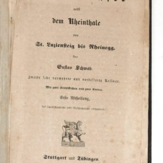
Der Bodensee nebst dem Rheinthale von St. Luziensteig bis Rheinegg. Zweite …Stuttgart u. Tübingen, 1840.
€ 600,00 -
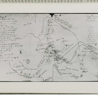
A contribution to the geography and cartography of north-west Yemen (based …Cairo, 1939.
€ 2.800,00 -
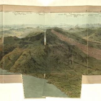
Panorama prise au Sommet du Mont Rigi.Zürich, 1816.
€ 2.500,00