DE NYUAD21

-
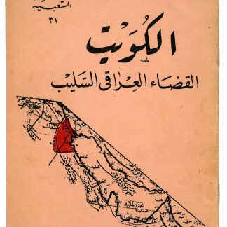 7The Iraqi claim to Kuwait
Al-Kuwayt al-qatha al-iraqi al-salib [Kuwait, The Stolen Iraqi Province].Baghdad, no date but ca. 1961.
€ 2.500,00First edition of a rare pamphlet outlining the Iraqi claim to Kuwait and opposing its independence.
Kuwait emerged as an independent state in June 1961, after 62 years as a British protectorate. With a new constitution, it held its first parliamentary elections in 1963, thereby becoming the first Arab state in the Gulf to establish a parliament. …
-
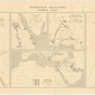 11Petroleum facilities in Iraq and Iran
Petroleum Facilities Middle East.Washington, DC, August 1945.
Auf AnfrageFive maps on a single sheet, issued by the U.S. Government immediately after the end of World War II. The maps show all relevant petroleum facilities in Iraq and Western Iran, in Egypt, in Southwestern Iran, and in the Kuwait, Saudi Arabia, Bahrain, and Qatar areas, identifying not only international boundaries, capital cities and major towns, principal …
-
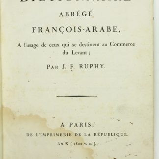 13The first dictionary of Arabic published in France
Dictionnaire abrégé François-Arabe, a l'usage de ceux qui se destinent …Paris, an X 1802 v. st..
€ 4.500,00Only edition. The first dictionary of Arabic published in France: a unidirectional wordbook of more than 6,000 French terms translated into Arabic (in Arabic typeface), printed in large type and generously spaced, for the use of French merchants in the orient.
In the preface, the author anticipates the concept of linguistic relativity when …