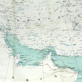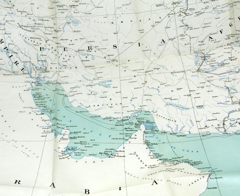
Persian Gulf and adjacent countries.
London, War Office, Topographical Section, 1908.
Coloured map (72 x 57 cm). Scale 1:4,055,040.
€ 1.500,00
Map of the Arabian Gulf. “It must have been drawn to show the zones of influence of Russia and Great Britain in Persia, as defined by the Anglo-Russian convention on 31st of august 1907” (Alai).
Literatur
Alai, General maps E.354. OCLC 221059917. Not in Al Ankary; Al-Qasimi.
Ähnlich
-

Carta do grande Afonso de Albuquerque escrita a el-Rey D. Manoel.Portugal, 1780.
€ 6.500,00 -
Trade of India. Report on the Conditions and Prospects of British Trade …London, 1919.
€ 2.500,00 -
Frontier and Overseas Expeditions from India. Compiled in the Intelligence …Simla, 1907-1911.
€ 75.000,00 -
2 original photographs.No place or date.
€ 450,00