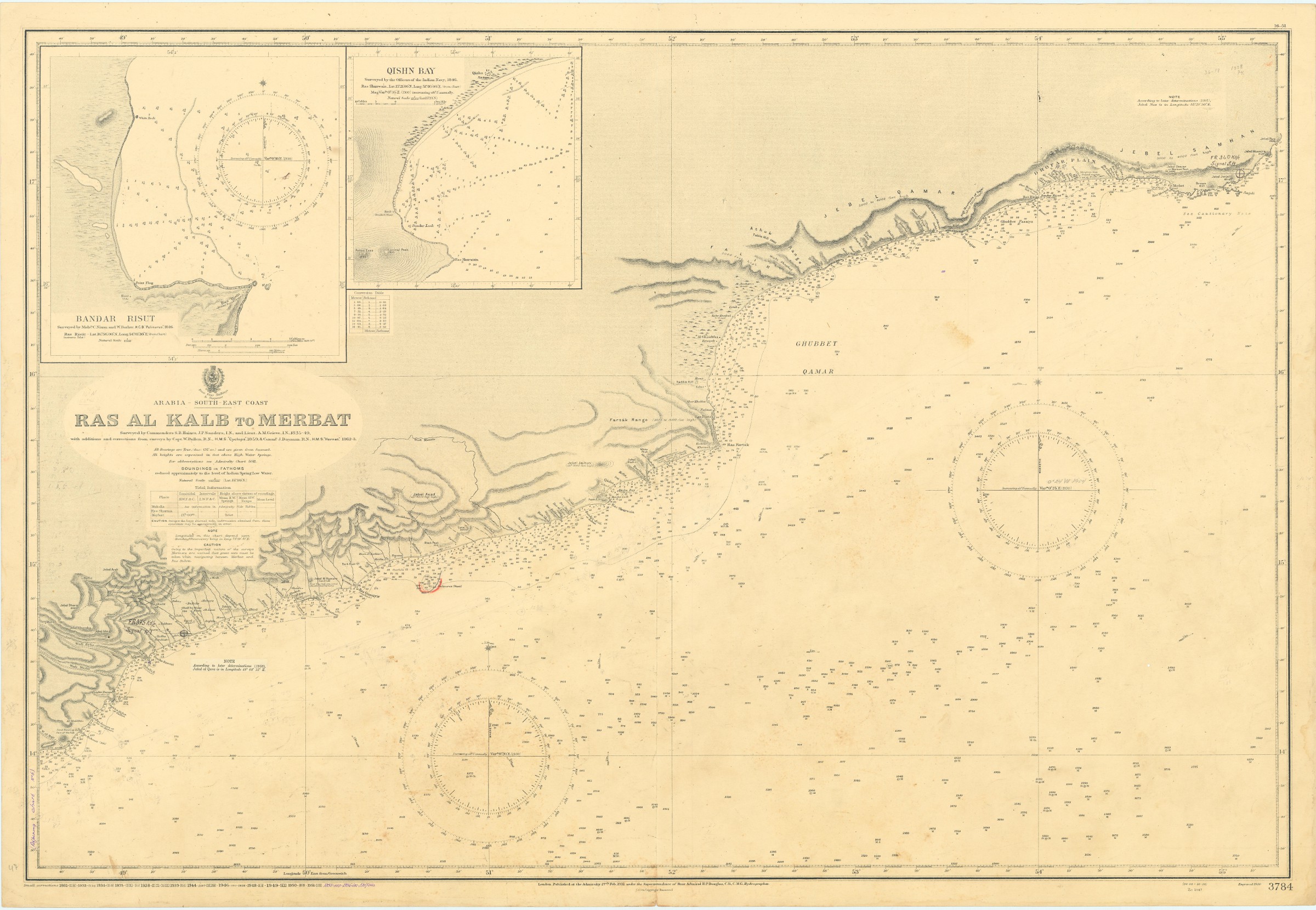
Arabia, South-East Coast. Ras al Kalb to Merbat, surveyed by Commanders S. B. Haines, J. P. Sanders and A. M. Grieve. 3784.
London, at the Admiralty, 1930.
Ca. 102 x 70 cms. Engraved map.
€ 1.500,00
Naval map of the south eastern coast of Oman. Includes vignette views of Bandar Risut and Qishn Bay, giving a detailed view of the mountain landscape and listing the most important mountains such as Jebel Qamar, Jebel Asad, Jebel Jaihun, Jebel Arsh, Jebel Dhora, and Jebel Samhan. With additions and corrections from surveys by Capt. W. Pullen. R.N., H.M.S. "Cyclops", 1859 and Commander J. Dayman. R.N., H.M.S. "Hornet", 1862-63.
Some pencil notes, stamp of the "N.V. Observator Rotterdam". Well preserved.
Ähnlich
-
![Taqrir muqtarah an insha’ Quwwa Bahariyya li-Dawlat al-Bahrayn [Sketch proposal to build a Naval Force for the country of Bahrain].](https://inlibris.com/wp-content/uploads/2020/06/img-bn52212-324x324.jpg)
Taqrir muqtarah an insha’ Quwwa Bahariyya li-Dawlat al-Bahrayn [Sketch …Bahrain, mid-1970s.
€ 28.000,00 -

Islands in the Southern Portion of the Red Sea. No. 453.London, 1928.
€ 1.500,00 -
![Indian Ocean - Northern Portion [Admiralty Chart No 748b].](https://inlibris.com/wp-content/uploads/2023/10/img-bn33603-324x324.jpg)
Indian Ocean - Northern Portion [Admiralty Chart No 748b].London, ca. 1881.
€ 1.000,00 -
![Gulf of Aden [...] Eastern Portion Including Socotra Island. No. 6a.](https://inlibris.com/wp-content/uploads/2022/04/img-bn58797-324x324.jpg)
Gulf of Aden [...] Eastern Portion Including Socotra Island. No. 6a.London, 1934.
€ 400,00