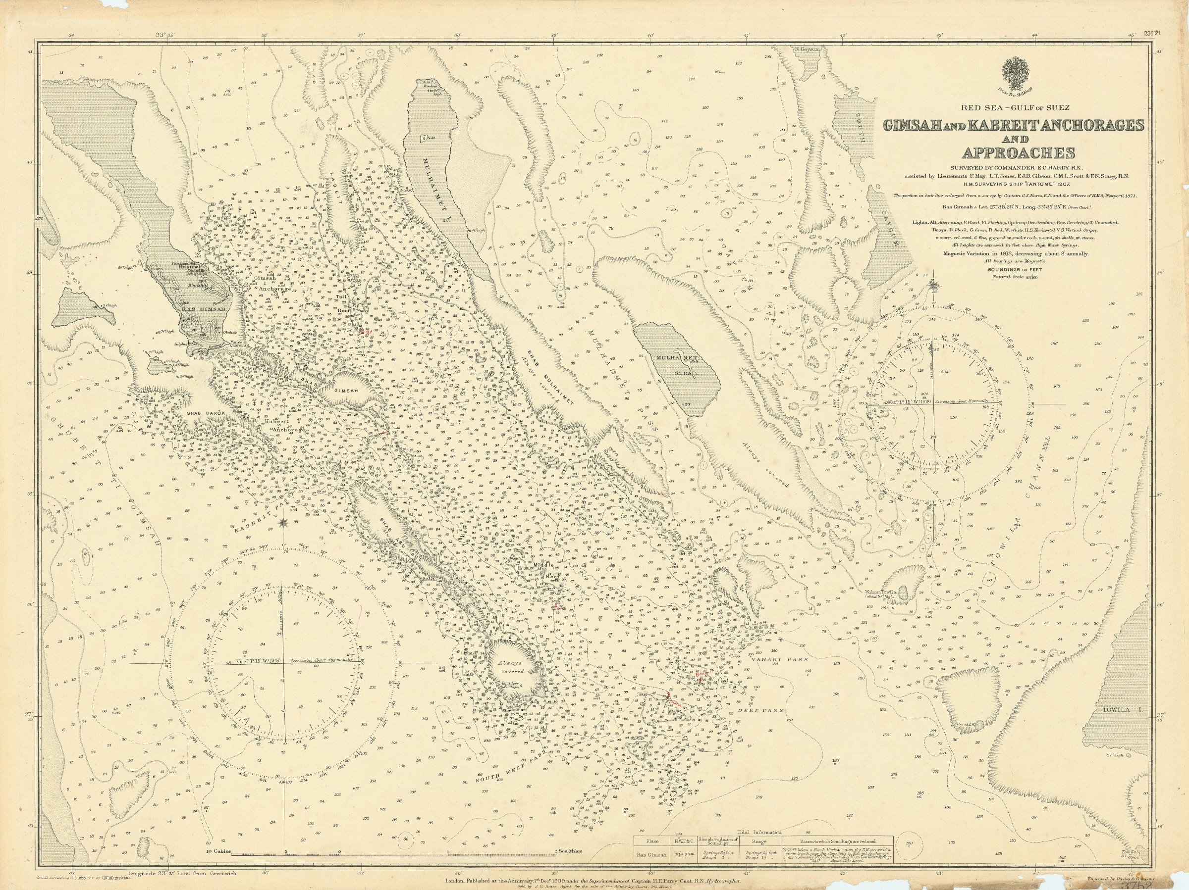
Red Sea - Gulf of Suez. Gimsah and Kabreit Anchorages and Approaches surveyed by Commander E. C. Hardy, R. N.
London, published at the Admiralty, 1920.
685 x 510 mm. Scale 1:29,100.
€ 800,00
Nautical chart (3752) of the Gulf of Suez. Engraved chart, including tidal information, compass roses, soundings, seabed notations, currents, sandbanks, shoals, inland elevations. This edition first published in 1909, revised in 1920, with stamp "examined & corrected 1926". Signs of contemporary use with markings in red ink. A few edge flaws.
Ähnlich
-
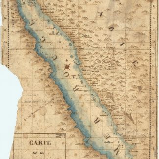
Carte de la mer Rouge, relevée sur celle de James Bruce.Egypt, probably Cairo, 1827.
€ 15.000,00 -

The complete series of the first 200 works issued by the Hakluyt Society.London, 1847-1958.
€ 165.000,00 -

Voyage en Arabie & en d'autres Pays circonvoisins. Tome premier (-second). …Amsterdam & Utrecht, 1775-1780.
€ 6.000,00 -

Descriptio orbis antiqui in XLIV tabulis exhibita.Nuremberg, ca. 1720.
€ 3.800,00