![[Wrapper-title:] East India views islands headlands &c.](https://inlibris.com/wp-content/uploads/2020/05/img-bn50141.jpg)
![[Wrapper-title:] East India views islands headlands &c. – Bild 2](https://inlibris.com/wp-content/uploads/2020/05/img-bn50141-a.jpg)
![[Wrapper-title:] East India views islands headlands &c. – Bild 3](https://inlibris.com/wp-content/uploads/2020/05/img-bn50141-b.jpg)
![[Wrapper-title:] East India views islands headlands &c. – Bild 4](https://inlibris.com/wp-content/uploads/2020/05/img-bn50141-c.jpg)
![[Wrapper-title:] East India views islands headlands &c. – Bild 5](https://inlibris.com/wp-content/uploads/2020/05/img-bn50141-d.jpg)
![[Wrapper-title:] East India views islands headlands &c. – Bild 6](https://inlibris.com/wp-content/uploads/2020/05/img-bn50141-e.jpg)
![[Wrapper-title:] East India views islands headlands &c. – Bild 7](https://inlibris.com/wp-content/uploads/2020/05/img-bn50141-f.jpg)
![[Wrapper-title:] East India views islands headlands &c. – Bild 8](https://inlibris.com/wp-content/uploads/2020/05/img-bn50141-g.jpg)
Watercolour coastal profiles in the East Indies and elsewhere, by the maritime painter to King George III
[Wrapper-title:] East India views islands headlands &c.
Ten watercolour coastal profiles in grey and blue, of widely varying sizes (30 to 119 cm long), with contemporary captions and other notes in pencil or black ink. 20th-century brown cloth with the artist's original laid-paper wrappers bound at the end, spine title: "East Indian views by N. Pocock taken on the ship Worcester 1798".
€ 28.000,00
A series of ten lovely coastal profiles drawn in watercolour by the English artist Nicholas Pocock (1740-1821), showing coasts and mountains in the East Indies, both coasts of the Indian Ocean, China and the South Atlantic. In the first drawing Mount Agung, an active volcano and the highest mountain on Bali, appears prominently, with its pointed peak reaching above the clouds.
Pocock, son of a Bristol merchant mariner, pursued a career in the merchant marine but had been an amateur painter since childhood. As master mariner of the ship Lloyd, owned by the Quaker merchant Richard Champion, he illustrated his logbooks with fine ink and wash coastal profiles and other drawings (some now in the National Maritime Museum in Greenwich). When Champion went bankrupt in 1778 in the wake of the American Revolution, Pocock devoted himself to painting. His first professional efforts drew praise from Joshua Reynolds, and he exhibited at the Royal Academy beginning in 1782. Pocock soon became a celebrated maritime artist and painter to King George III, moving to London in 1789, where the rate books record him at Great George Street from that year to 1816. He sometimes accompanied naval ships to make sketches and notes that he developed into paintings when back in London. When he painted maritime scenes he had not witnessed live, he interviewed sailors and others to ensure the accuracy of details such as weather conditions, his practical experience as a master mariner aiding him considerably.
The present drawings are not signed individually, but the wrappers (bound at the end) are signed "... Pocock Esqr / Gt George Street". The captions identify the views, some with additional notes about directions, distances, latitudes or soundings. A few topographical names are difficult to read or show irregular spellings (the coordinates help identify some), but they appear to show coasts in Bali, Karimata, Serutu and Lombok (all in the East Indies), Coromandel (the southeast coast of India), Joanna Island (off Madagascar), Macao (across the bay from Hong Kong), Martin Vaz Islands (near Trinidad off the coast of Brazil), Srikakulam (on the east coast of India: 'Frycacoel' may be a misreading of the alternative spelling Ticacoel. The caption gives a latitude of 18° 4' and the ship Worcester stopped in Bengal ten days later: The Asiatic annual register ... for the year 1799, London, 1800, p. 53) and perhaps Burma (Myanmar) and Pondicherry (on the Coromandel coast). The captions identify them as follows (we add numbers giving the order as bound, the probable bibliographical formats and the dimensions): 1. Island of Bally. Oblong agenda 8vo (12 × 30 cm). 2. Caremata & Souroutou nearly in one. 20 fathoms soft ground, oblong agenda. 8vo (12 × 30 cm). 3. Extremes of Lombek ... southward. 3 oblong agenda 8vo leaves pasted together to make a panorama (12 × 87 cm). 4. Caremata & Sourontou. Oblong agenda 8vo (12 × 30 cm). 5. On the coast of Coromandel. 4 oblong 6mo leaves pasted together to make a panorama (16 × 119 cm). 6. Islands Joanna from N to NE. Oblong agenda 8vo (12 × 30 cm). 7. N Macoa. Oblong 4to (19 × 33 cm). 8. View of Martin Vos Rocks distant 7 leagues, Oblong 4to (20.5 × 28.5 cm). 9. The highland on both sides of Chicacul & Frycacoel ... taken on board the ship Worcester August 17th. 1798. Copy N[icholas] P[ocock]. Oblong agenda folio (24 × 59.5 cm). 10. The land of Barma ... The land on both sides - Pondy ... Oblong folio, with the profile rendered in three bands above one another (31.5 × 46 cm).
Only drawing 9 includes a date in the caption, indicating that it is Pocock's copy of a drawing of a scene from 17 August 1798. All the profiles are drawn on wove paper, probably all on pieces from sheets of Royal format made by James Whatman and his successors, who continued to use his name. Only two drawings show watermarks. Drawing 4 is watermarked: "J WHATMAN | 1804" centred along the right half of one long edge of the sheet, the caps and small caps about 19 and 12 mm tall. The other 4 drawings on one or more oblong agenda 8vo leaves are similar in style and may have been made at the same time. Drawing 10 is watermarked: "J WHATMAN", centred along the left half of one short edge of the sheet, the caps and small caps about 20 and 13 mm tall. Nearly all high quality English paper included a year in the watermark for several decades beginning in 1794, and Whatman's successors generally centred the date below the name, but no date appears under the name here. Moreover, the style of the lettering is older than that of the 1804 watermark, resembling Heawood 3458 (London 1784), 3459 (London post-1791), 3461 (n.p. 1781?), including the distinctive M of these marks (the diagonal joining the right vertical well below its top) but with clearer serifs than any of Heawood's (perhaps not very accurate) drawings. This paper seems likely to have been made before 1794. The paper of the ten drawings together contain about the equivalent of three whole sheets, but they would have to have been taken from at least four sheets. The wrappers are made of coarse laid paper and show no watermark.
With a small tear at the head of drawing 9, not approaching the image, drawing 7 spotted and slightly dirty, but further in very good condition. Coastal profiles, mostly in the East Indies and the Indian Ocean, by the maritime painter to King George III.
For Pocock: ODNB 22425.
Ähnlich
-
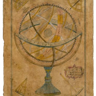
Zâtü'l-Kürsü. Autograph drawing signed.Probably Istanbul, ca. 1732.
€ 9.500,00 -
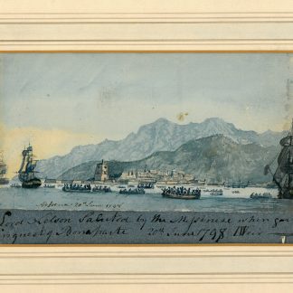
Collection of 28 topographical and naval views.N. p., 1790s-1810s.
€ 48.000,00 -
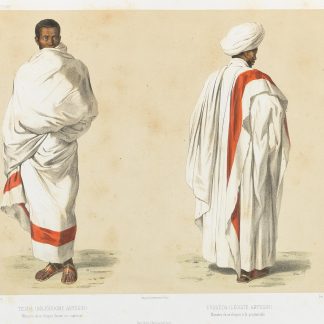
Voyage en Abyssinie execute pendant les annees 1839, 1840, 1841, 1842, …Paris, 1845-1851.
€ 26.500,00 -

A midshipman journal, including "General Account of the Persian Gulf Cable …Various places, on the SS International, 1878-1888.
€ 19.500,00
![[Wrapper-title:] East India views islands headlands &c.](https://inlibris.com/wp-content/uploads/2020/05/img-bn50141-324x324.jpg)