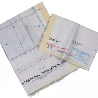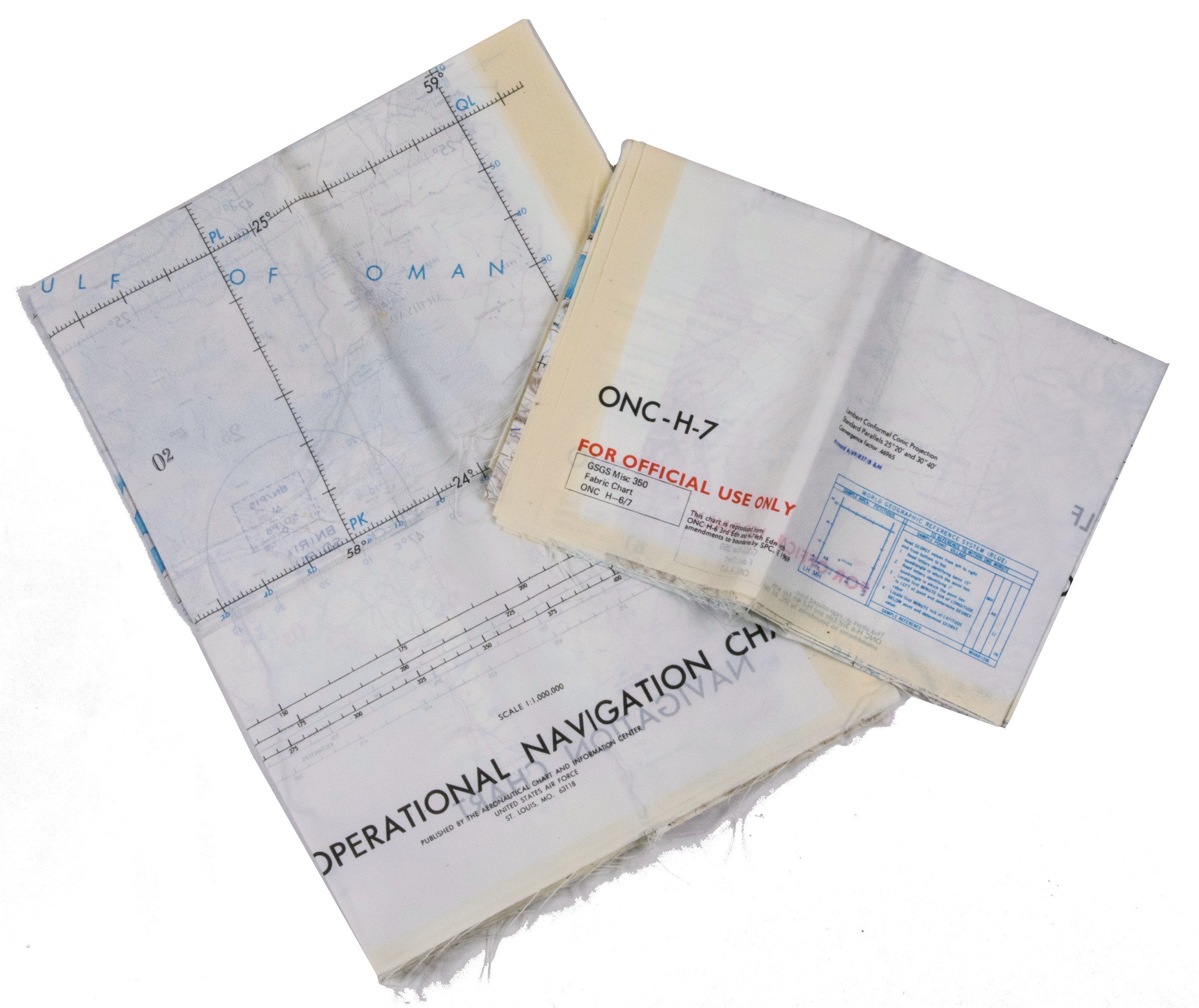
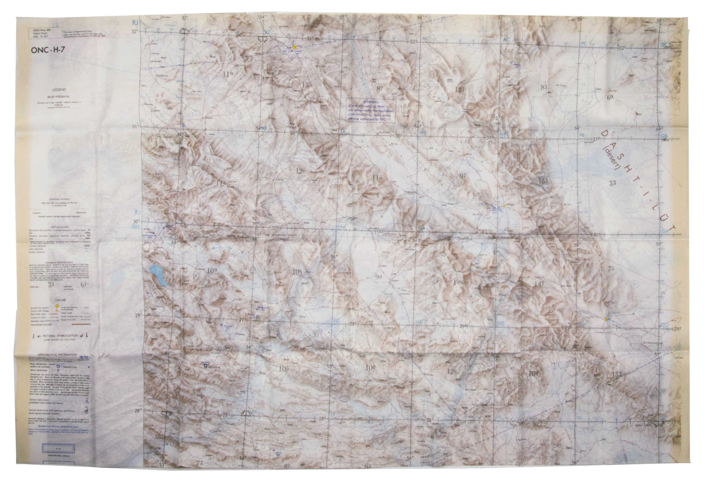
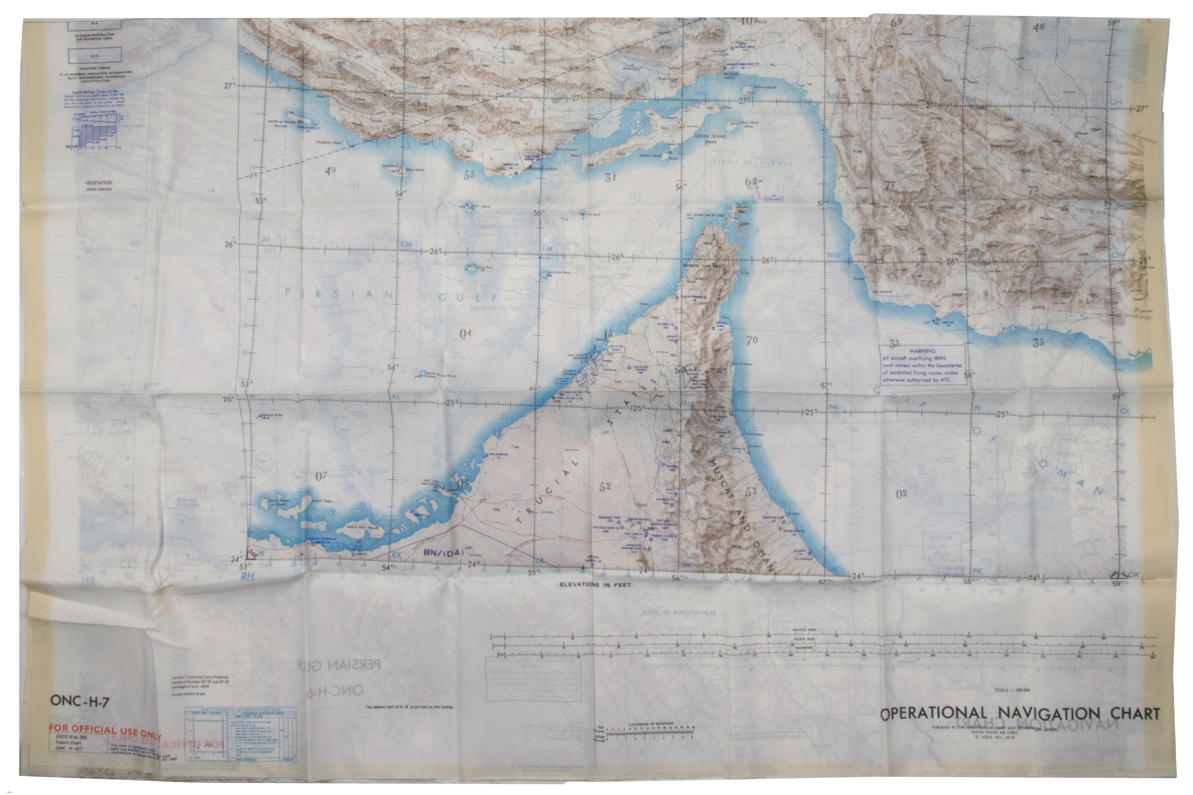
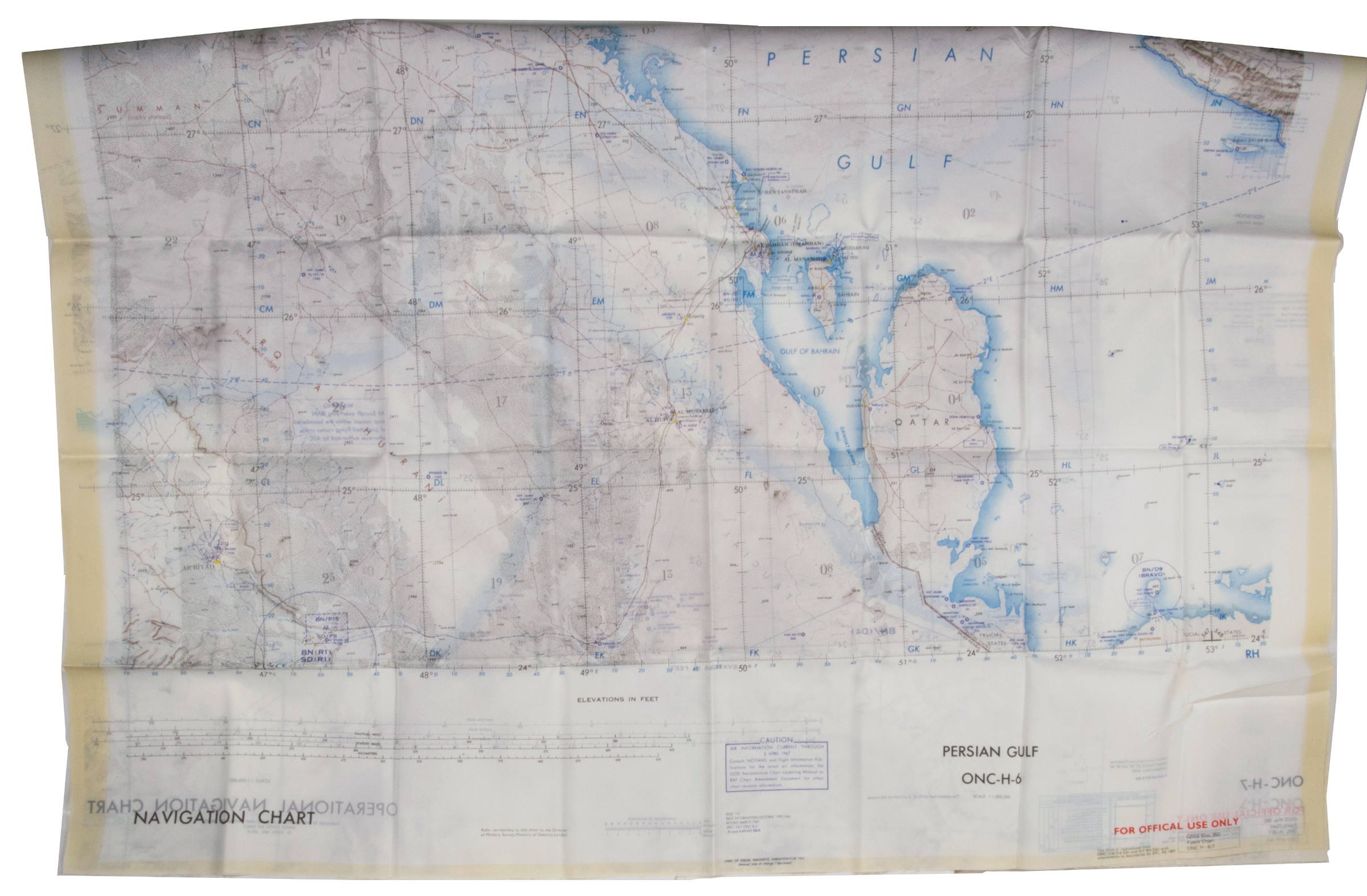
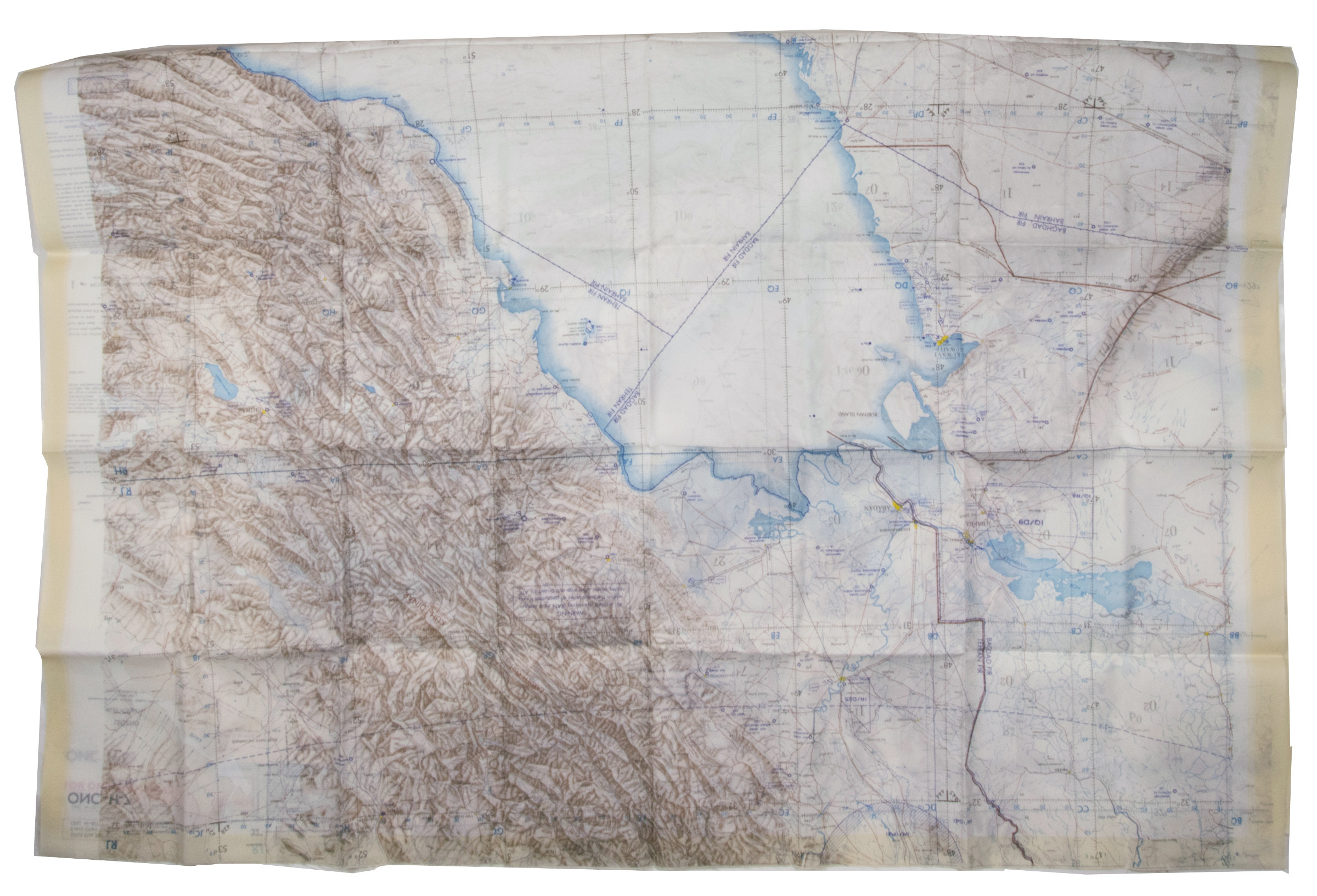
USAF pilot's map of the Arabian Gulf
Persian Gulf. ONC-H-6/7. Operational navigation chart.
Two copies of two folding maps colour printed on both sides of a sheet of silk (1030 x 785 cm) on a scale of ca. 1:1,000,000. The two maps (ONC-H-6 & ONC-H-7) show one continuous area.
€ 2.800,00
Rayon pilot's map of the Arabian Gulf region focusing on the Trucial States (modern United Arab Emirates), Qatar, Bahrain, Oman, Iran and Saudi Arabia, including the main oil installations. Items of specific interest to aircraft, such as airfields and even seaplane bases, are particularly listed. Warnings to stay within the specific flying routes while in Iran are placed on multiple locations. While the map depicts a continuous area on both sides of one sheet, it actually consists of two maps, originally published separately. We here include two copies so the whole area can be displayed at once. The maps are reproduced after the third and fourth edition.
In very good condition.
Ähnlich
-
![Die Ritterlich und lobwürdig reiß [...] Sagend von den landen, Egypto, Syria, von beiden Arabia Persia, India und Ethiopia, von den gestalten, sitten, und dero menschen leben und glauben.](https://inlibris.com/wp-content/uploads/2020/05/img-bn44556-324x324.jpg)
Die Ritterlich und lobwürdig reiß [...] Sagend von den landen, Egypto, …Straßburg, 1516.
€ 250.000,00 -

Carte de l’Empire Ottoman comprenant les possessions de la Porte en Europe, …Paris, 1825.
€ 3.000,00 -
Travels to the City of the Caliphs, along the Shores of the Persian Gulf …London, 1840.
€ 6.000,00 -
![Hodaeporicon Indiae Orientalis; Das ist: Warhafftige Beschreibung der ansehnlich lobwürdigen Reyß, welche der edel, gestreng und weiterfahrne Ritter, H. Ludwig di Barthema von Bononien aus Italia bürtig, in die Orientalische und Morgenländer, Syrien, beide Arabien, Persien und Indien, auch in Egypten und Ethyopien, zu Land und Wasser persönlich verrichtet [...].](https://inlibris.com/wp-content/uploads/2020/05/img-bn45427-324x324.jpg)
Hodaeporicon Indiae Orientalis; Das ist: Warhafftige Beschreibung der ansehnlich …Leipzig, 1608.
€ 28.000,00