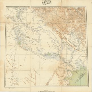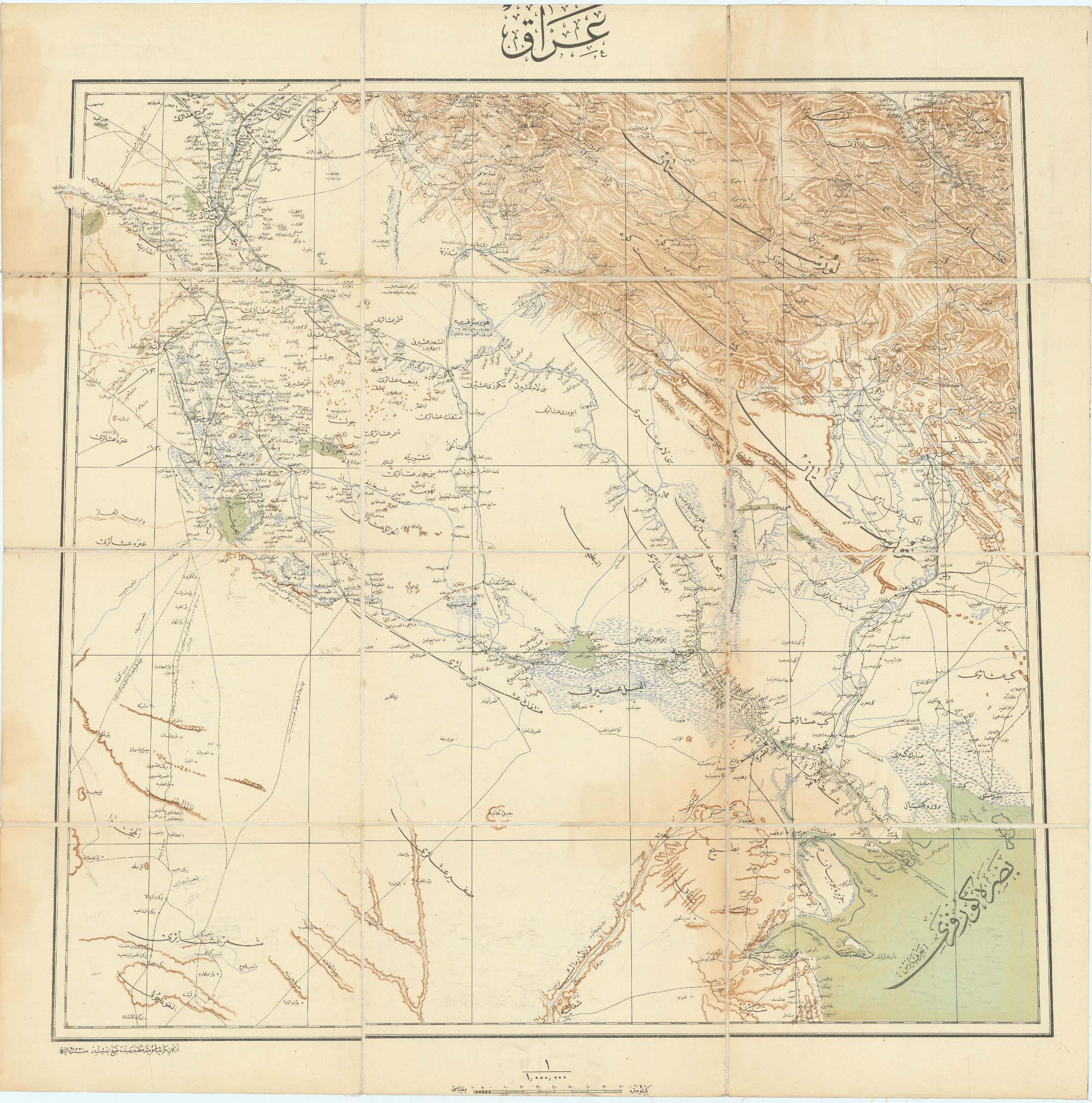
Iraq.
655 x 660 mm. Lithograph in colours, dissected into 12 sections and mounted on original cloth.
€ 3.500,00
First edition of the first accurate Ottoman general map of Central and Southern Iraq, Kuwait, and Khuzestan (Iran); the authoritative map used by the Ottoman Army for strategic planning during the "Mesopotamia Campaign", during which Ottoman-German forces mounted a unexpectedly strong resistance to Britain's invasion of Iraq in World War I. Examples of the present map were used by Ottoman commanders who oversaw the successful Ottoman-German defence of Baghdad at the Battle of Battle of Ctesiphon (22-25 Nov. 1915), as well as the capture of the main British army at the Siege of Kut-al-Amara (7 Dec. 1915-29 April 1916).
With text entirely in Ottoman Turkish, the map is based on the British War Office's "Lower Mesopotamia Between Baghdad and the Persian Gulf" (1911), which was itself in part based on Ottoman sources. Both maps were dramatically superior in all respects to previous efforts, forming the culmination of over three generations of reconaissance, capped by critical late-breaking discoveries.
Some light staining in margins and in lower-right quadrant, but generally in good condition. Very rare.
Ähnlich
-
![(The Travels of Peter Teixeira from India to Italy by Land.) A View of the Universe: or, a New Collection of Voyages and Travels Into All Parts of the World. With the Geography and History of Every Country [ed. by John Stevens].](https://inlibris.com/wp-content/uploads/2020/05/img-bn49332-324x324.jpg)
(The Travels of Peter Teixeira from India to Italy by Land.) A View of …London, 1710.
€ 4.500,00 -

Voyage en Arabie & en d'autres Pays circonvoisins. Tome premier (-second). …Amsterdam & Utrecht, 1775-1780.
€ 6.000,00 -

Iran (Persia) and Iraq.London, 1930s.
€ 650,00 -

Persian Gulf. ONC-H-6/7. Operational navigation chart.St. Louis, 1967.
€ 1.500,00