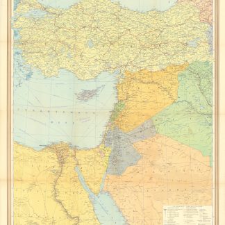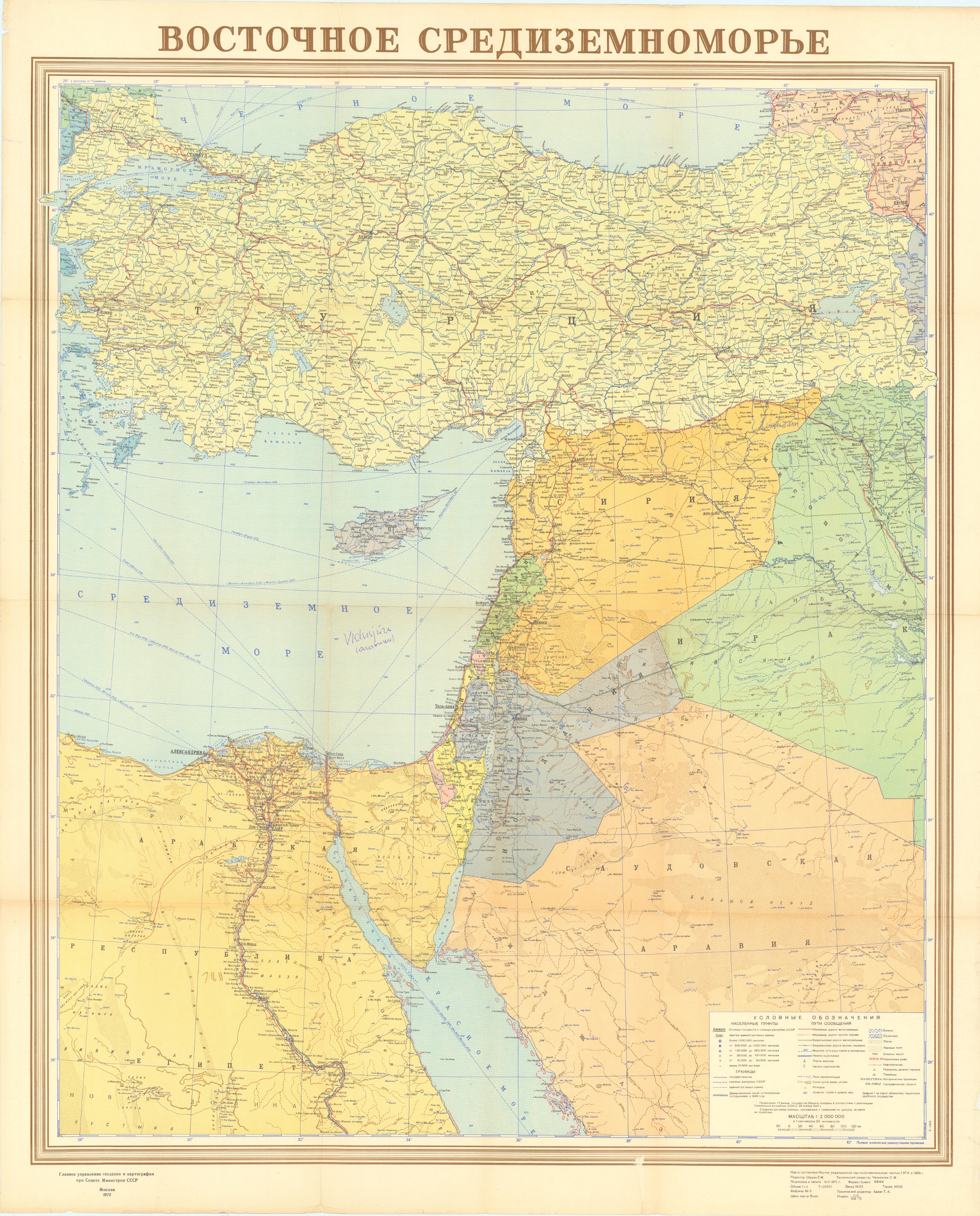
Vostochnoe sredizemnomor'e.
Moscow, [Main Directorate of Geodesy and Cartography under the Council of Ministers of the USSR], 1972.
91 x 111 cm. Original colour-printed map. Scale: 1:2,000,000.
€ 200,00
Rare political map of the Eastern Mediterranean from the Cold War era, showing Turkey, Syria, Lebanon, Israel, Jordan, and large parts of Egypt, Iraq, and northern Saudi Arabia. With Cyrillic titles and captions.
Small marginal flaws. A few annotations in blue ballpoint.
Ähnlich
-

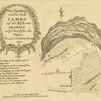
Reisen oder Anmerkungen verschiedene Theile der Barbarey und der Levante …Leipzig, 1765.
€ 2.000,00 -

Reize naar Arabië en andere omliggende landen.Amsterdam & Utrecht, 1776-1780.
€ 6.000,00 -
Begebenheiten einer Reise auf dem rothen Meer, auf der arabischen und ägyptischen …Leipzig, 1781.
€ 1.800,00 -
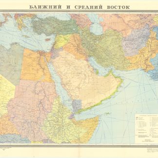
Blizhnij i srednij vostok.Moscow, 1972.
€ 400,00