![[Atlas of the world].](https://inlibris.com/wp-content/uploads/2023/08/img-bn62095.jpg)
![[Atlas of the world]. – Bild 2](https://inlibris.com/wp-content/uploads/2023/08/img-bn62095-a.jpg)
![[Atlas of the world]. – Bild 3](https://inlibris.com/wp-content/uploads/2023/08/img-bn62095-b.jpg)
![[Atlas of the world]. – Bild 4](https://inlibris.com/wp-content/uploads/2023/08/img-bn62095-c.jpg)
![[Atlas of the world]. – Bild 5](https://inlibris.com/wp-content/uploads/2023/08/img-bn62095-d.jpg)
![[Atlas of the world]. – Bild 6](https://inlibris.com/wp-content/uploads/2023/08/img-bn62095-e.jpg)
![[Atlas of the world]. – Bild 7](https://inlibris.com/wp-content/uploads/2023/08/img-bn62095-f.jpg)
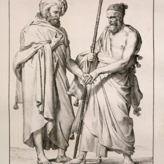
Turkish atlas following the dissolution of the Ottoman Empire
[Atlas of the world].
Folio (230 x 284 mm). 32 pp. Original red boards, titled in black.
€ 800,00
An atlas of the world in Ottoman Turkish from the first decade after the dissolution of the Ottoman Empire. Published at the close of the 1920s, its geographical content reflects the changing landscape across the globe from the perspective of the newly founded Turkish state. Likely intended for schoolchildren, the atlas particularly focuses on geology and climate in addition to geography, and begins with a colourful geological map of Egypt, the Arabian Peninsula, and West Asia. It also includes information on the Solar System to explain seasonality, and an explanation of how to read colour-coded elevation in maps, prevailing winds, and climates. The first few pages are dedicated to Turkey: its geography, its political boundaries, and its cities. An interesting example of the educational material of a newly born nation-state.
Exterior wear, binding professionally restored.
Ähnlich
-
![[Atlas of the world].](https://inlibris.com/wp-content/uploads/2023/07/img-bn61700-324x324.jpg)
[Atlas of the world].Ottoman Empire, 1909/10 CE = 1325 Rumi.
€ 4.500,00 -

Reize naar Arabië en andere omliggende landen.Amsterdam & Utrecht, 1776-1780.
€ 6.000,00 -

Voyage en Arabie & en d'autres Pays circonvoisins. Tome premier (-second). …Amsterdam & Utrecht, 1775-1780.
€ 6.000,00 -
Voyage dans le Levant en 1817 et 1818.Paris, 1819.
€ 35.000,00
![[Atlas of the world].](https://inlibris.com/wp-content/uploads/2023/08/img-bn62095-324x324.jpg)