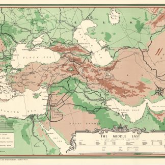
Troop information program map of the Middle East
The Middle East. A Troop Information Program Map.
[Washington, D.C.], Army Information Branch, [1946].
Colour-printed map, 895 x 1185 mm. Scale 1:4,000,000. Relief shown by hachures.
€ 1.500,00
Large "Troop information program map" of the Middle East prepared from various information sources, bearing the facsimile signature of the cartographer Liam Dunne. Shows Turkey, Iran, Iraq, Syria, Lebanon, Palestine, Transjordan, Egypt, Saudi Arabia, the Trucial States, Kuwait, Afghanistan, portions of Oman, Russia and Eastern Europe. Indicates physical features, boundaries, population and land measurement data, capitals, oilfields and oil pipelines, railways, and roads.
Zustand
Several small tears repaired with Japan paper on the reverse by a former collector. Ms. note "Salvage" on the reverse.
Literatur
OCLC 63041402.
Ähnlich
-
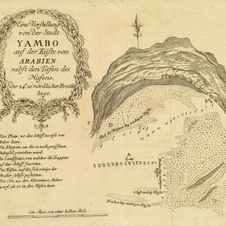
Begebenheiten einer Reise auf dem rothen Meer, auf der arabischen und ägyptischen …Leipzig, 1781.
€ 1.800,00 -
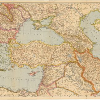
Der Nahe Osten. Tornisterschrift des NS.-Führungsstabes der Wehrmacht. …Berlin, 1944.
€ 350,00 -
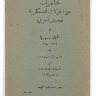
Muhadirat `an al-harakat al-`askariyyah lil-jaysh al-`Arabi fi al-Hijaz …Baghdad, 1947.
€ 4.500,00 -

A Series of Adventures in the Course of a Voyage up the Red-Sea, on the …London, 1780.
€ 12.500,00