


Joint Operations Graphic. Series 1501 Air.
3 colour-printed maps, 570 x 735 mm. Scale 1:250,000. Series 1501 Air, editions 8-GSGS and 11-GSGS. Comprises: NH-39-9, 39-13 and 38-12.
€ 3.500,00
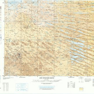
Three consecutive NATO military operations maps of Kuwait indicating international borders with Saudi Arabia and Iraq. The maps show the state of Kuwait almost in its entirety, only omitting the portion south of the Ahmadi and Burgan oilfields, but including Kuwait Bay and a significant portion of the Gulf to the east, including offshore oilfields such as Ardeshir and Nowrouz.
From 1965 onwards NATO adapted maps compiled by the United States and Great Britain into the Joint Operations Graphic series, designed for the use of NATO allies during military operations. Two versions were made: the 1501 series for ground operations, and the 1501A series for air operations, present here. Though these three maps originate from different editions, they are adjoining sheets, forming a large map exhibiting a wealth of information specifically relevant to air operations near Kuwait City, including carefully marked landing fields and runways, with the directionality of the runway shown if the information was available, along with the positions of Kuwait and Ali Al Salam air bases and flight warnings. Notes are also presented on the presence of power lines in given areas, a very important risk for pilots landing in unknown and unofficial areas during wartime.
Two maps stamped: "Limited distribution. UK officials are not to release the map outside UK government service without authority from the Director of Military Survey".
Very well preserved.
Ähnlich
-
Joint Operations Graphic. Series 1501.London, ca. 1984-1991.
€ 4.500,00 -

Kuwait. Series K961. Edition 5-NIMA, Al-Ahmadi.U.S. Government, 1998.
€ 3.000,00 -

Kuwait. Series K6614. Edition 1-DMA (6), 2-NIMA (2), 3-NIMA (1).U.S. Government, 1994, 2002 and 2003.
€ 4.500,00 -

Saudi Arabia City Graphic. Ra's Tannurah. Series K9611. Edition 1-DMA.U.S. Government, 1994.
€ 1.500,00
