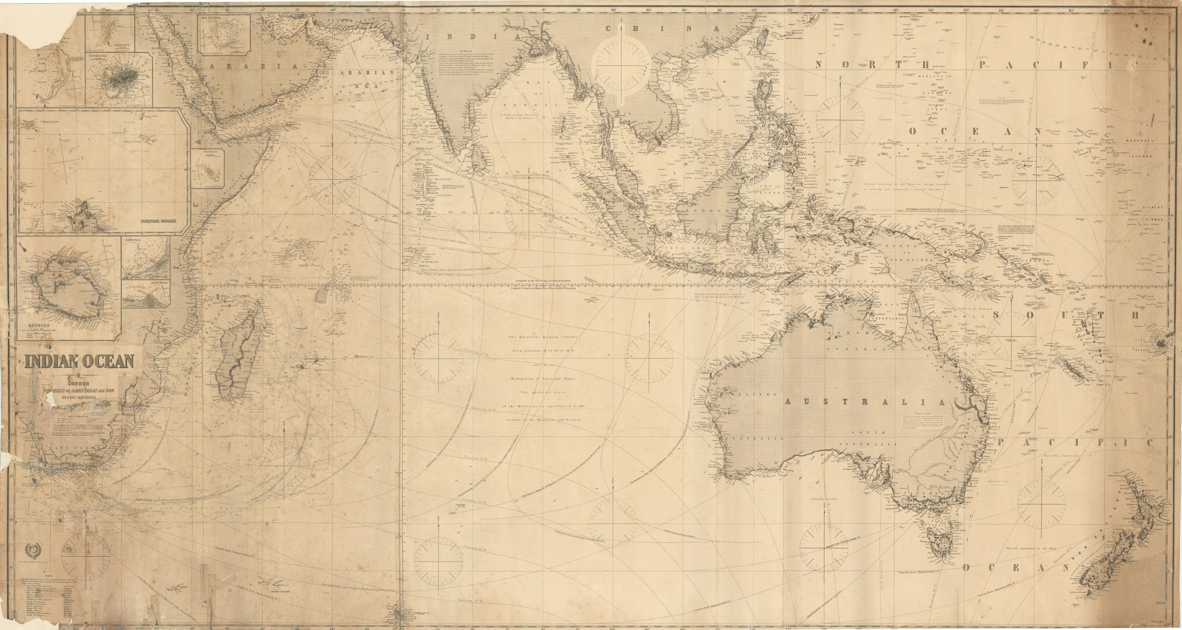
"Abu Thabi" the major settlement on the Trucial Coast
Indian Ocean.
Engraved map, ca. 103 x 192 cm. Constant ratio linear horizontal scale, approx. 1:10,000,000. Relief shown by hachures and spot heights. Depth shown by isolines and soundings.
€ 3.000,00
Large blue-backed hydrographic chart of the Indian Ocean, showing an area between the Cape of Good Hope and New Zealand. Extends north to include the Arabian and Indian peninsulas, Philippines, and much of China. Shows the Gulf coast as far north as Al-Latif, identifying "Abu Thabi" as the major settlement on the Trucial Coast. Includes courses of currents and standard tracks for shipping through the ocean, with nine inset maps of islands and coastal features (Cargados Carajos; Coetivy; Rodrigues; Des Roches; Farquhar Passage; Tromelin; Réunion; Saint Paul; Saint Denis).
Stamped "Imray & Son, London, 1886". Noticeable browning and staining; several edge and corner defects as well as paper flaws in the map professionally repaired (some corner loss and slight loss near Capetown). Signs of contemporary use with several pencil markings.
Cf. OCLC 884378574 (1879 edition). Tooley II, 407.
Ähnlich
-

Anciennes relations des Indes et de la Chine, de deux voyageurs mahométans, …Paris, 1718.
€ 9.500,00 -
![[Silsilat al-tawarik - English]. Ancient Accounts of India and China, by Two Mohammedan Travellers, Who Went to Those Parts in the 9th Century.](https://inlibris.com/wp-content/uploads/2023/05/img-bn61650-324x324.jpg)
[Silsilat al-tawarik - English]. Ancient Accounts of India and China, by …London, 1733.
€ 28.000,00 -
![The First Booke of the Historie of the Discoverie and Conquest of the East Indias, Enterprised by the Portingales, in their Daungerous Navigations [...].](https://inlibris.com/wp-content/uploads/2021/08/img-bn56683-324x324.jpg)
The First Booke of the Historie of the Discoverie and Conquest of the East …London, 1582.
€ 85.000,00 -
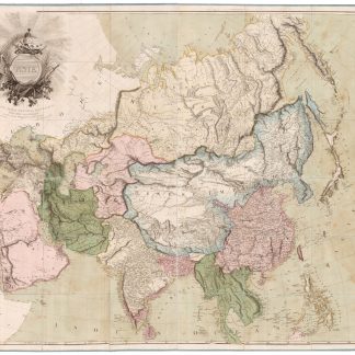
Asia. To Major James Rennell, Esqr. F.R.S. &c. &c. This Map is …London, 1801.
€ 12.500,00