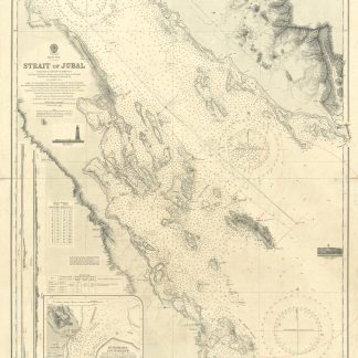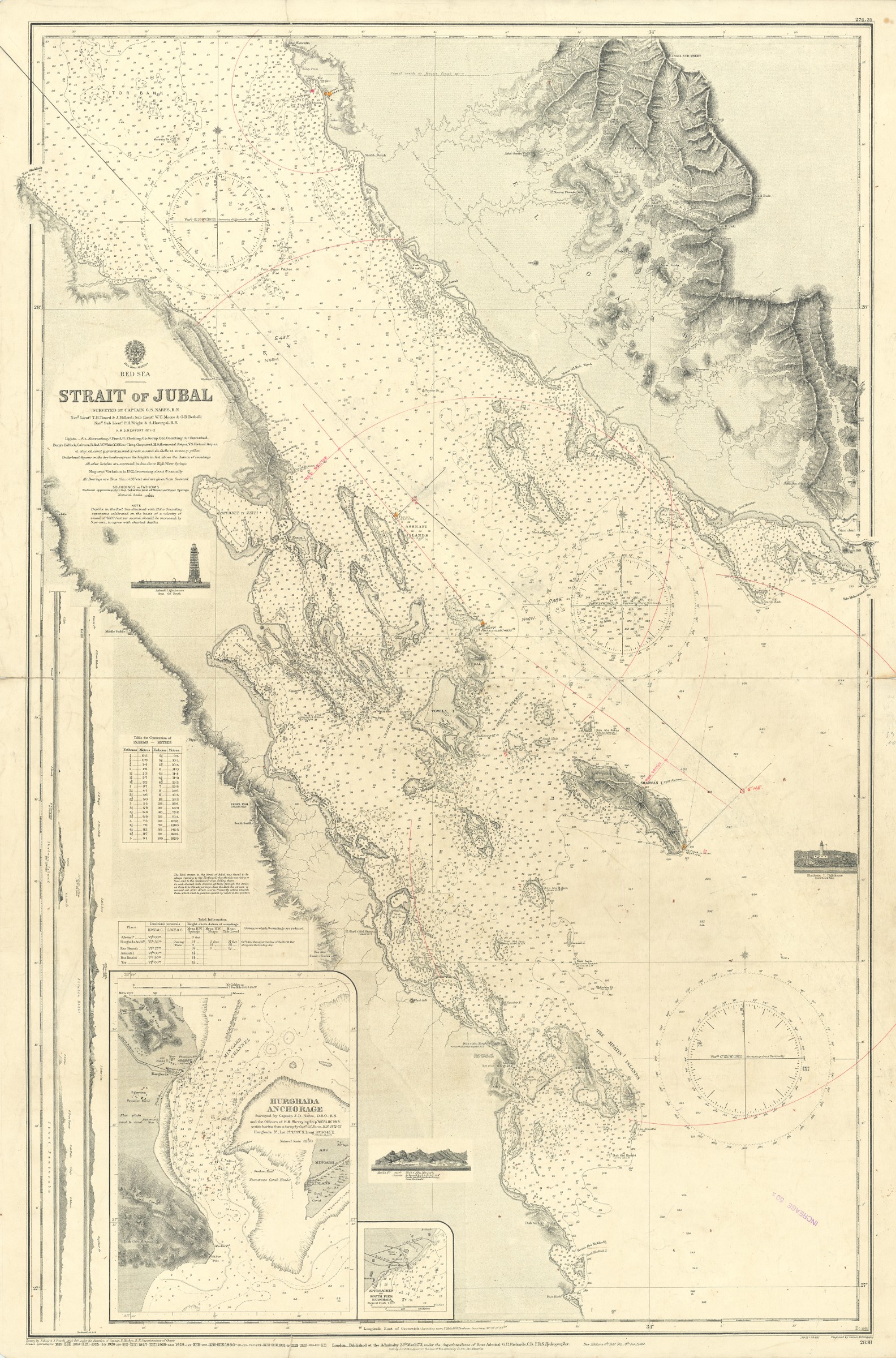
Strait of Jubal. No. 2838.
Standard issue, 710 x 1050 mm. Scale 1:144,820.
€ 450,00
Nautical chart of the southern portion of the Gulf of Suez, prepared by the British Admiralty. With two inset maps of the Hurghada anchorage and the approaches to the Hurghada south pier, as well as small views of the Ashrafi and Shadwán lighthouse, and three mountain views.
The chart details the Tor Bank, the Strait of Jubal, the Ashrafi Islands, and the Jifátin Islands. Among the most prominent places are Tor, Jebal, Ras Muhammed, and Hurghada. The inset map of Hurghada labels the Egyptian frontier force, oil and water tanks, as well as fishermen's huts.
The British Admiralty has produced nautical charts since 1795 under the auspices of the United Kingdom Hydrographic Office (HO). Its main task was to provide the Royal Navy with navigational products and service, but since 1821 it has also sold charts to the public. The present chart was composed after Admiralty surveys of 1871-72; it was first published in 1873 and saw several corrections up to 1931.
With a single fold. A few manuscript notes. With a stamp "Increase 50%" near lower right margin. Captioned in print and in a former collector's hand on verso. Some small marginal tears, hardly affecting image.