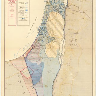
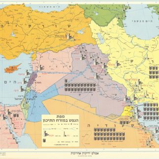
Mapat Medinat Yis´ra'el bama'arakha [Map of the State of Israel in the Campaign].
Tel Aviv, Joseph Shapiro, 1949.
385x 635 mm. Original colour-printed map. Scale 1:750,000.
$1,676.00
Hebrew map of Israel after the Armstice Agreement with Egypt of 24 February 1949. A group of agreements with Egypt, Lebanon, Jordan, and Syria, all signed between February and July 1949, formally ended the hostilities of the 1948 Arab-Israeli War and also demarcated the Green Line, which separated Arab-controlled territory (i.e. the Jordanian-annexed West Bank and the Egyptian-occupied Gaza Strip) from Israel until the latter's victory in the 1967 Arab-Israeli War. The present map indicates large cities including Tel Aviv, Haifa and Jerusalem, and clearly distinguishes Arab and Jewish settlements.
Slightly creased. Otherwise very well preserved.
Literatur
OCLC 782170206.
Ähnlich
-
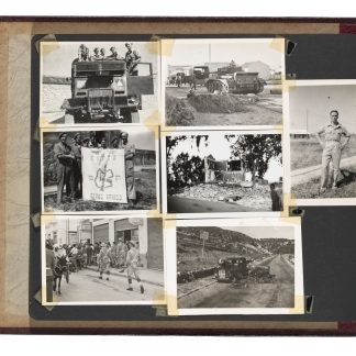
Photograph album.Palestine, ca. 1945-1947.
$7,820.00 -
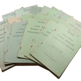
Weekly Military Intelligence Review.Jerusalem, General Headquarters Palestine, 17 May 1946 - 28 Feb. 1947.
$21,784.00 -
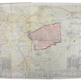
Guide-Map of Jerusalem.Jerusalem, ca. 1935.
$559.00 -
Mapah ha-neft ba-mizrah ha-tikhon (Map of the Oil Industry in the Middle …Jerusalem, 1963.
$2,793.00