![Mapat Medinat Yis´ra'el bama'arakha [Map of the State of Israel in the Campaign].](https://inlibris.com/wp-content/uploads/2023/03/img-bn61144.jpg)
Mapat Medinat Yis´ra'el bama'arakha [Map of the State of Israel in the Campaign].
Tel Aviv, Joseph Shapiro, 1949.
385x 635 mm. Original colour-printed map. Scale 1:750,000.
€ 1,500.00
Hebrew map of Israel after the Armstice Agreement with Egypt of 24 February 1949. A group of agreements with Egypt, Lebanon, Jordan, and Syria, all signed between February and July 1949, formally ended the hostilities of the 1948 Arab-Israeli War and also demarcated the Green Line, which separated Arab-controlled territory (i.e. the Jordanian-annexed West Bank and the Egyptian-occupied Gaza Strip) from Israel until the latter's victory in the 1967 Arab-Israeli War. The present map indicates large cities including Tel Aviv, Haifa and Jerusalem, and clearly distinguishes Arab and Jewish settlements.
Slightly creased. Otherwise very well preserved.
References
OCLC 782170206.
Related
-
![[Shanah be-Yisrael 708-709. Parashat ha-shanah bi-temunot]. A Year in Israel 5708-5709. A Pictorial Record.](https://inlibris.com/wp-content/uploads/2023/02/img-bn61132-324x324.jpg)
[Shanah be-Yisrael 708-709. Parashat ha-shanah bi-temunot]. A Year in Israel …Tel-Aviv, 1949 CE = 5709.
€ 450.00 -
![Hasahar Hapore [The Fertile Crescent].](https://inlibris.com/wp-content/uploads/2024/01/img-bn61399-324x324.jpg)
Hasahar Hapore [The Fertile Crescent].Tel Aviv, 1958.
€ 650.00 -
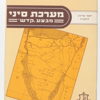
Ma’Rechet Sinai “Mivza Kadesh” (The Sinai War "Operation Kadesh").Tel Aviv, 1957.
€ 950.00 -
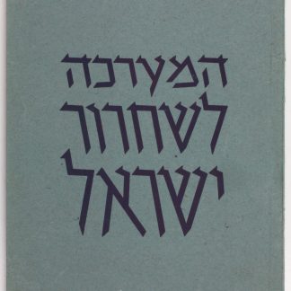
Ha-Ma'arakhah le-shihrur Yisra'el.Jerusalem, 1949.
€ 600.00
![Mapat Medinat Yis´ra'el bama'arakha [Map of the State of Israel in the Campaign].](https://inlibris.com/wp-content/uploads/2023/03/img-bn61144-324x324.jpg)