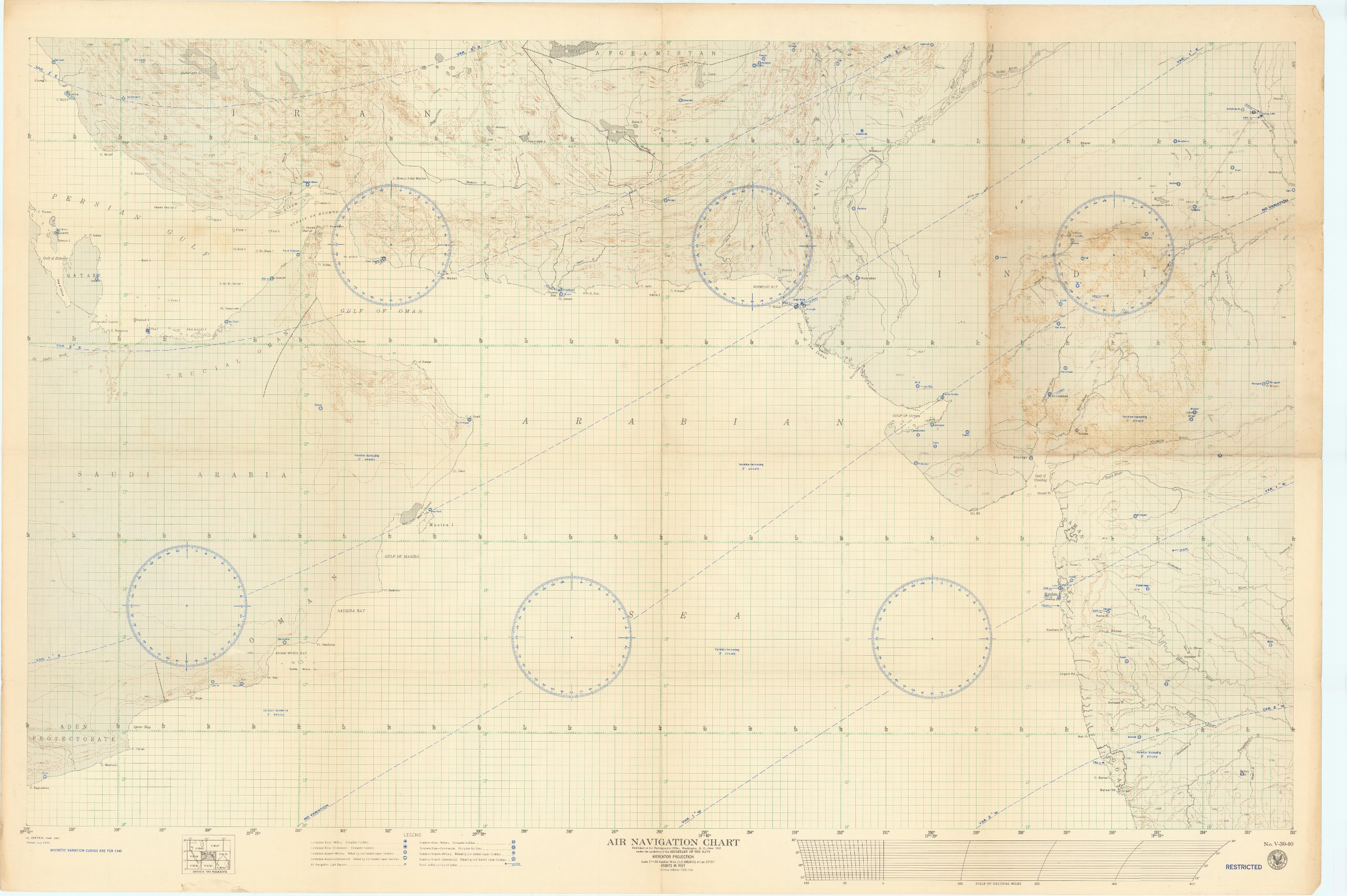
1940s navigation map for pilots above the Arabian Gulf, Gulf of Oman, and Arabian Sea
Air Navigation Chart. Mercator Projection. No. V-30-40. Restricted.
Colour-printed map, 910 x 1370 mm. Scale 1:2,188,800. Reprinted July 1943.
€ 4.500,00
Large WWII U.S. Navy map used for air navigation above the Arabian Gulf, the Gulf of Oman, and the Arabian Sea. Before the widespread use of more sophisticated navigation tools, Navy pilots were reliant on air navigation light beacons (carefully noted on the map), the occasional radio facility, and visual flight rules, compasses, and navigation maps. This particularly detailed example carefully depicts coastlines and river systems from Bahrain to Bombay, and notes "landplane" bases and airports both military and civilian, including facilities in Manama, Doha, Abu Dhabi, Sharjah, and Ras Al Khaimah, as well as numerous others. Many of these early military bases would later become the major commercial airports of the Arabian Peninsula and Indian subcontinent in the postwar years.
Light wear, minor discoloration, otherwise in good condition.
Ähnlich
-
![Les voyages advantureux de Fernand Mendez Pinto. Fidellement traduits de Portugais en François par le Sieur Bernard Figuier Gentil-homme Portugais [...].](https://inlibris.com/wp-content/uploads/2021/10/img-bn56349-324x324.jpg)
Les voyages advantureux de Fernand Mendez Pinto. Fidellement traduits de …Paris, 1645.
€ 3.500,00 -

Karte von Asien.Wien, 1786.
€ 2.500,00 -
Asia tabulis aeneis secundum rationes geographicas delineata.Oberursel, 1600.
€ 15.000,00 -

A New Account of the East Indies. Giving an exact and copious description …London, 1744.
€ 9.500,00