Irrigation in 19th century Egypt
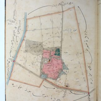
Manuscript maps of Khamarah.
Large folio (345 x 426 mm). Arabic manuscript on laid paper. 50 pp., misbound (1-22, 31-34, 27-30, 23-26, 35-50 pp.), hand-numbered, complete in 25 ff. With 12 hand-drawn, coloured maps and plans (scale 1:4,000) and a hand-painted headpiece. Bound in blue half morocco. A facsimile 1909 French manuscript map is loosely inserted.
€ 18.000,00
Twelve manuscript maps of agricultural basins (havd) at Khamarah, al-Beheira, Egypt, most likely from late 19th century. Each agricultural area is divided into small plots of land, also showing rivers or wetland areas and occasionally a few residential areas. Borders with towns such as Daqduqah, Jabaris, al-Uyun or with other basins are clearly indicated in the outlines of the maps. Each map is accompanied by a table on the facing page which gives the size of each parcel of land and additional notes on necessary parcels. The first leaf offers a detailed explanation of colours and designs used in the maps, followed by a table of all areas. Today, the village of Khamarah is part of of the city of Itay El Barud (though in the manuscript it is described as a district of al-Delengat). Beheira, the governorate that includes Khamarah, is considered one of the most important agricultural regions in Egypt.
Cover label with dedication to Suleiman Pasha (probably the Ottoman commander).
Some staining and browning throughout. Binding professionally repaired.
Ähnlich
-
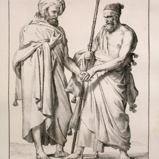
Voyage dans le Levant en 1817 et 1818.Paris, 1819.
€ 35.000,00 -
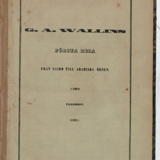
Första Resa fran Cairo till Arabiska Öknen i April 1845. Fragment.Helsingfors Helsinki, 1853.
€ 9.500,00 -

Carte de l’Empire Ottoman comprenant les possessions de la Porte en Europe, …Paris, 1825.
€ 3.000,00 -
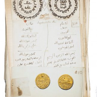
Islamic coins and medals.Paris?, ca. 1791-1817?.
€ 28.000,00