


Important pilot's manual
Pilot's Handbook of the Cairo-Baghdad Route.
8vo (145 x 220 mm). (2), 94 pp. With 12 double-page maps; an appendix (pp. 82-99) and a folded blueprint map inserted in rear pocket (titled "IPC - Pipeline Air Route - Amman - Rutbah"). Original full blue cloth with flap; black cover title.
€ 4.500,00
Rare third edition of this important pilot's manual for the challenging desert route from Cairo to Baghdad. Particularly remarkable for including an extraordinary blueprint map unique to our copy, which indicates, at a scale of 1:1,000,000, the Haifa-Mosul pipeline next to notable towns, landing grounds, and distinguishable desert features. Dated 24 January 1933, the chart was compiled by the Cairo Engineering Department from information supplied by the Royal Air Force and International Petroleum, undoubtedly assisting the owner of the pilot's handbook in his flying.
The handbook itself meticulously describes the route and its origins, ground characteristics, required desert equipment, meteorology, wireless, forced landings, pilotage in poor weather when the track has been lost, refuelling bases with illustrated instructions for the tanks, signals, notes and precautions, including interactions with the native population, pointing out that Arabs "generally display a friendly attitude, especially to British personnel". The book includes a sample Log, useful Arab phrases, route report, distance and speed tables. The maps cover twelve sections on a scale of 1 inch to 8 miles, showing air routes from Cairo to Kantara, Kantara to Moseifig, Moseifig to Rafa, Rafa to Jericho, Jericho to landing site C in the open desert, C to H, H to O, O to 8, 8 to V, V to II, II to Fallujah, and Ramadi to Baghdad. Appendices list equipment for the DH9a light bomber used for policing and reconnaissance flights, as well as for the Vickers Victoria used as a troop and freight carrier.
Plans for an air route between Cairo and Baghdad were originally drawn up in 1919 by Winston Churchill as Secretary of State for Air in collaboration with Hugh Trenchard, marshal of the Royal Air Force. As the stretch between Amman and Baghdad was largely featureless, a furrow was etched out to provide a visible navigational aid for pilots; emergency landing strips were established every 20 miles, as were secret fuel departments hidden under the sands.
Signed "JR.9762" to pastedown - perhaps the RAF identifier of the owner of the handbook.
Binding worn and spotty; hinges starting. Some pencil annotations to maps.
This edition not in OCLC.
Ähnlich
-
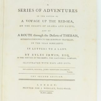
A Series of Adventures in the Course of a Voyage up the Red-Sea, on the …London, 1780.
€ 12.500,00 -
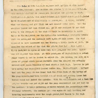
Report on flight from Baghdad to Egypt.RAF 31st Wing Headquarters, Baghdad, 22.03.1919.
€ 1.500,00 -

Red Sea and Arabian Sea. ONC J-6/8. Operational navigation chart.St. Louis, Missouri, 1967 / 1975.
€ 3.000,00 -
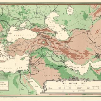
The Middle East. A Troop Information Program Map.Washington, D.C., 1946.
€ 1.500,00
