From the library of Francis Drake
The Periplus of the Erythrean Sea [...] Containing an Account of the Navigation of the Ancients [...] With Dissertations.
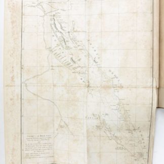
Large 4to. 2 vols. XII, 227, (1), 87, (3) pp. XII, (229)-559, (1), 83, (1). With engraved frontispiece in vol. 1, 8 engr. maps (6 folding), and 1 folding table.
(Bound with): The Voyage of Nearchus, and the Periplus of the Erythrean Sea. Oxford, Cadell & Davies, 1809. XV, (1), 119, (1) pp. With 1 plate. Contemporary giltstamped English full calf; spines rebacked with original gilt labels.
€ 5.000,00
First edition of this rare Middle Eastern geography, published in two parts: 1. From the Sea of Suez to the Coast of Zanguebar; 2. From the Gulph of Elana, in the Red Sea, to the Island of Ceylon. Includes an extensive discussion of the Arabian Peninsula, including sections on Myos Hormus, the Wealth of Arabia, the Coast of Yemen, Aden, Mokha and Oman, Oriental Commerce by the Gulph, etc. Among the plates are a map of the western Arabian coastline, a chart of the Red Sea, and al-Idrisi's famous world map, "a pinnacle of medieval cartography as well as of the history of geographical research" (cf. Lex. z. Gesch. d. Kartographie, p. 325; Tooley II, 405). William Vincent (1739-1815) served as headmaster and later Dean of Westminster, and "ancient geography was the subject which Vincent made his chief study" (DNB). Also includes Vincent's edition of the Greek text of the voyage of Nearchus.
Covers rubbed; corners bumped. Traces of old stamps, removed from title pages and half titles. Somewhat browned and brownstained. From the library of the antiquary and bookseller Francis Drake (1828-85), a descendant of the like-named English navigator and privateer, with his engr. bookplate to pastedowns. A good, wide-margined copy.
Ibrahim-Hilmy II, 311. DNB LVIII, 364. Graesse VI/2, 325. OCLC 6388867. Not in Atabey, Blackmer, Aboussouan, Weber, Henze, etc.
Ähnlich
-
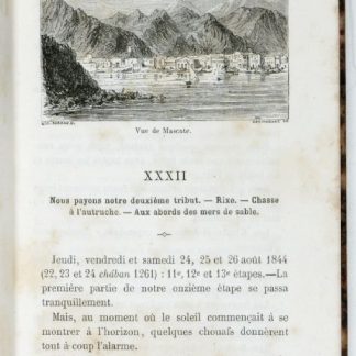
Les mystères du désert. Souvenirs de voyages en Asie et en Afrique.Paris, 1859.
€ 950,00 -
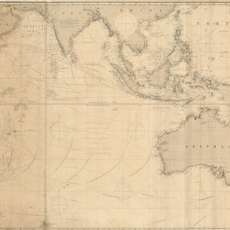
Indian Ocean.London, 1885.
€ 3.000,00 -
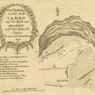
Begebenheiten einer Reise auf dem rothen Meer, auf der arabischen und ägyptischen …Leipzig, 1781.
€ 1.800,00 -

Persian Gulf. ONC-H-6/7. Operational navigation chart.St. Louis, 1967.
€ 1.500,00