"Not to be Published"
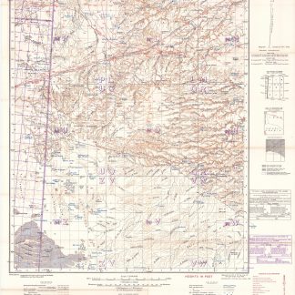
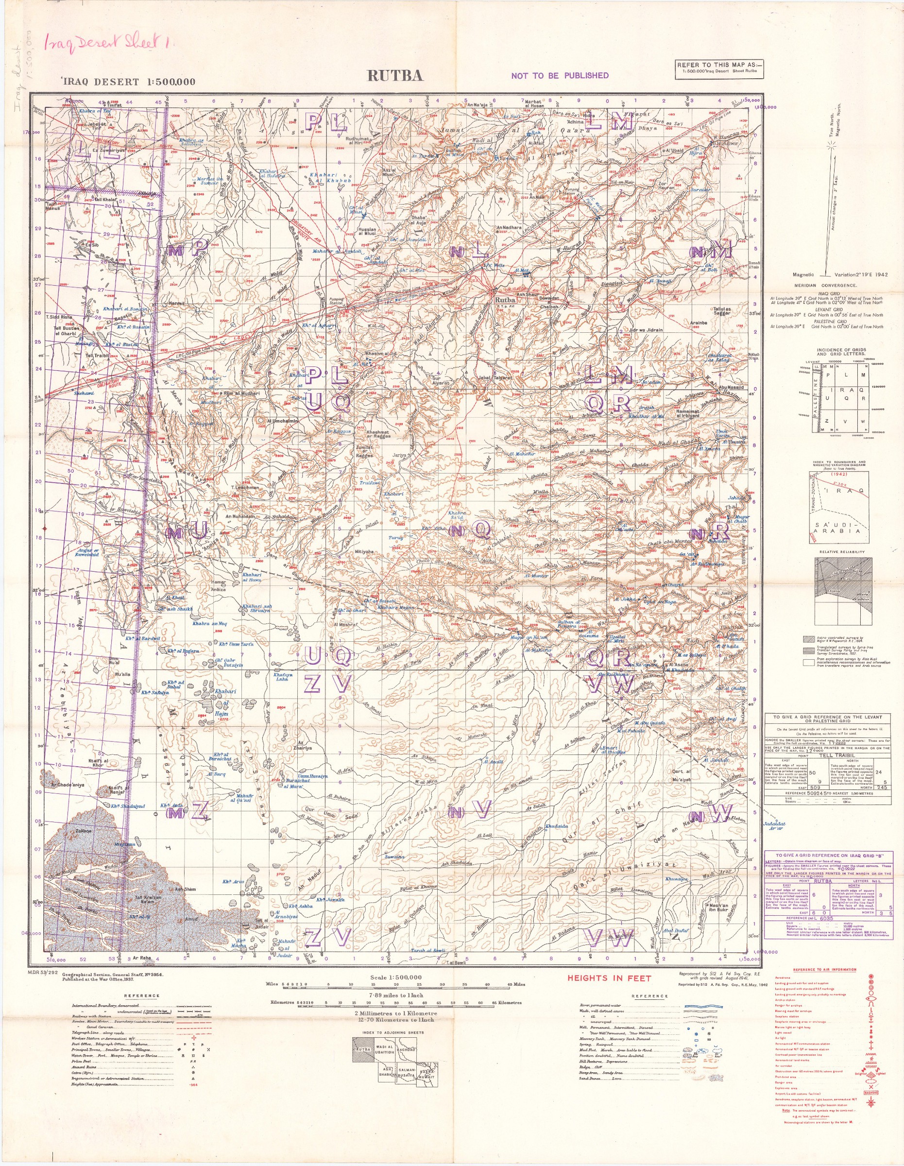
2 lithographic WWII maps: Rutba and Wadi Al Ubaiyidh.
[UK Government], Geographical Section, General Staff, War Office, 1940-1942.
2 topographic maps, colour-printed. Scale 1:500,000. 820 x 640 mm and 770 x 648 mm.
€ 1.250,00
Compiled from 1930s surveys and produced by the British 512 (Army Field Survey) Company, Royal Engineers, for use in the Persian war theatre, these consecutive maps cover the south-western area of Iraq, including Rutba and Fallujah, with parts of Saudi Arabia, Jordan, and Syria (approximately the area between 31° and 33°30' N and 39° and 44° E).
Previously folded. Marked "Iraq Desert Sheet 1" and "Sheet 2". Generally well preserved.
Ähnlich
-
![Northern Arabia according to the original investigations of Alois Musil [...].](https://inlibris.com/wp-content/uploads/2020/05/img-bn50160-324x324.jpg)
Northern Arabia according to the original investigations of Alois Musil …New York, 1926.
€ 3.500,00 -

Iran (Persia) and Iraq.London, 1930s.
€ 650,00 -
Neue Reise in Arabien, die europäische und asiatische Türkey. Nach dem …Leipzig, 1814.
€ 2.500,00 -
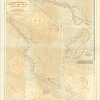
Mouth of the Euphrates. Shatt Al Arab and Bahmanshir River from surveys …London, 1931.
€ 800,00