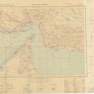
International Map of the World 1:1,000,000. 'Bandar Abbas. Sheet N. G-40.
[London, War Office], 1942.
Original colour heliozincographed map. 474 x 632 mm on 630 x 845 mm (sheet). Scale 1:1,000,000. Folded.
€ 1.500,00
Excellent official aeronautical chart of the Strait of Hormuz, covering part of Oman, a large section of the coastline of today's United Arab Emirates (including Abu Dhabi, Dubai, Sharjah, and Ras al Khaimah), and Hormuz Island. Indicates airfields, mooring stations, submarine cables and marine lights. Prepared for the British army "for official use only".
Main roads marked with a thick red pencil. Somewhat toned and dusty; small tear to lower edge, just touching text.
Literatur
Not in OCLC.
Ähnlich
-
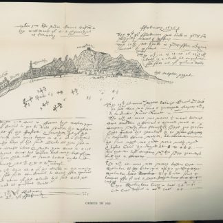
The Geographical Journal. Vol. IV, No. 2.London, 1894.
€ 500,00 -

Carte de l’Empire Ottoman comprenant les possessions de la Porte en Europe, …Paris, 1825.
€ 3.000,00 -
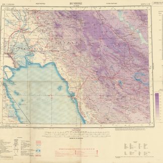
Asia 1:1,000,000.. Bushire. Sheet North H-39.London, 1944.
€ 850,00 -

Reize naar Arabië en andere omliggende landen.Amsterdam & Utrecht, 1776-1780.
€ 6.000,00