Landkarten, Pläne
Zeige Artikel 49–96 von 559 (Landkarten, Pläne)
-
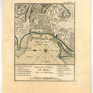
Plan de la ville de Moka située sur la Mer Rouge.Paris, 1764.
€ 450,00 -
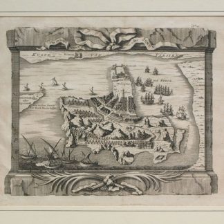
Das Eyland Ormus oder Jerun.No place or date, mid-18th c.
€ 400,00 -
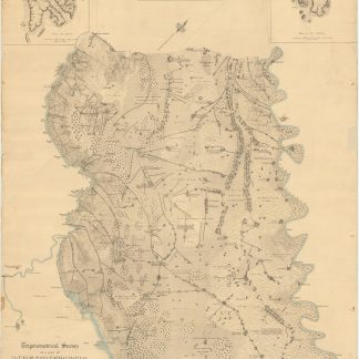
Guerre d'Orient. Campagnes d'Egypte et de Syrie 1798-1799. Mémoires pour …Paris, 1847.
€ 7.500,00 -
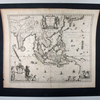
India quae orientalis dicitur, et insulae adiacentes.Amsterdam, 1640.
€ 1.500,00 -
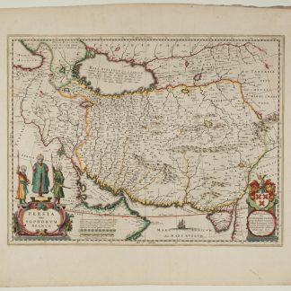
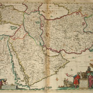
Persia Sive Sophorum Regnum.Amsterdam, 1642.
€ 1.500,00 -
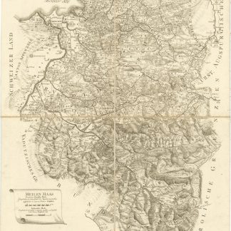
Provincia Arlbergica.Wien, 1783.
€ 4.000,00 -
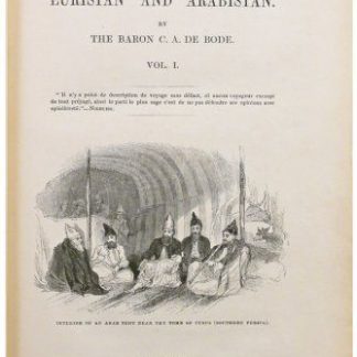
Travels in Luristan and Arabistan.London, 1845.
€ 8.500,00 -
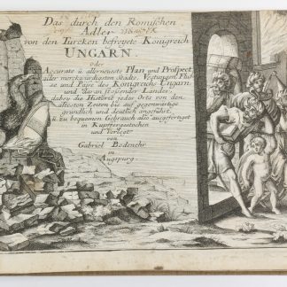
Das durch den Römischen Adler von den Türcken befreyete Königreich Ungarn …Augsburg, ca 1740.
€ 7.000,00 -
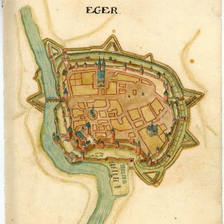
"Eger".Wohl Böhmen, ca. 1660 / 2. Hälfte des 17. Jahrhunderts.
€ 800,00 -
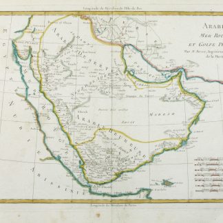
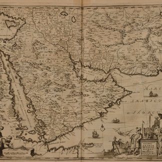
Arabie. Mer Rouge, et Golfe Persique.Paris, ca. 1780.
€ 850,00 -
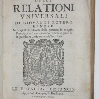
La seconda [terza, quarta] parte delle relationi universali.Brescia, 1599.
€ 3.000,00 -
Relationi universali. Arricchite di molte cosse rare, e memorabili. E con …Venice, 1640.
€ 4.500,00 -
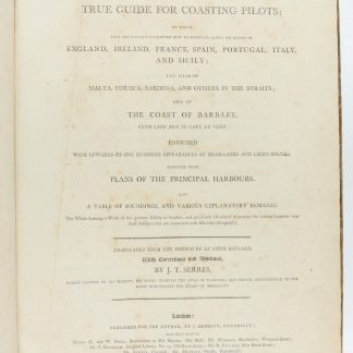
The little sea torch: or, true guide for coasting pilots: by which they …London, 1801.
€ 15.000,00 -

A New and Accurate Map of Anatolia or Asia Minor with Syria and such other …London, 1747.
€ 400,00 -
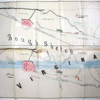
3 manuscript documents and 2 watercolour plans.Sabará and n. p., 1868.
€ 5.000,00 -

Syria and Palestine. Confidential. Handbooks prepared under the direction …London, April 1919.
€ 9.500,00 -
Geological Maps, Columns, and Sections of the High Zagros of South-West …Delhi, 1964.
€ 8.500,00 -
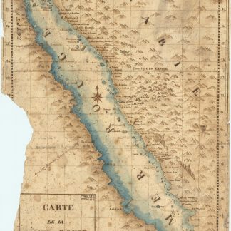
Carte de la mer Rouge, relevée sur celle de James Bruce.Egypt, probably Cairo, 1827.
€ 15.000,00 -

Carte Generale de la Turquie d'Asie, de la Perse, de l'Arabie, du Caboul …Paris, 1826.
€ 750,00 -
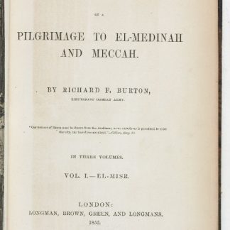
Personal Narrative of a Pilgrimage to El-Medinah and Meccah.London, 1855-1856.
€ 15.000,00 -
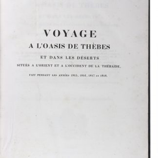
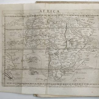
Voyage à L’Oasis de Syouah. Rédigé et publié par M. Jomard [...] …Paris, 1823.
€ 19.500,00 -
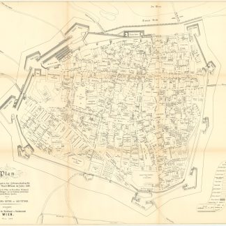
Plan der Befestigungen und der Höhenverhältnisse der Häuser der Stadt …Wien, 1880.
€ 350,00 -
Syria, the Holy Land, Asia Minor, &c. illustrated.London u. a. O., 1836-1838.
€ 850,00 -
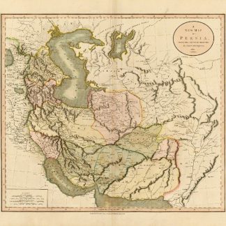
A New Map of Persia, from the Latest Authorities.London, 1811.
€ 950,00 -
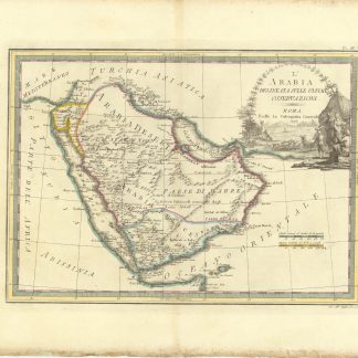
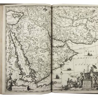
L'Arabia delineata sulle Ultime Osservazioni.Rome, 1797.
€ 3.000,00 -
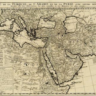
Carte de la Turquie, de L'Arabie et de la Perse avec leurs dependances …Amsterdam, ca. 1720.
€ 1.500,00 -
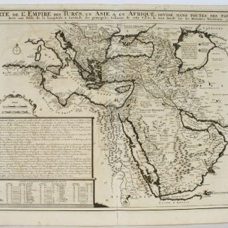
Carte de l'Empire des Turcs en Asie & en Afrique.Paris, 1720.
€ 1.500,00 -
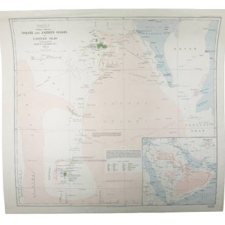
Arabia. Routes between ‘Oqair and Jabrin Oasis in Eastern Nejd.London, 1925.
€ 1.800,00 -
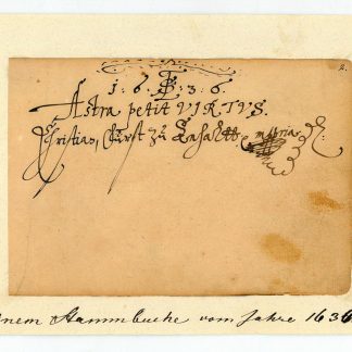
Eigenh. Albumblatt mit U. ("Christian Fürst zu Anhaltt mppria").O. O., 1636.
€ 950,00 -
Atlas, ay majmu’ kharitat rasm al-ard [Atlas, or a collection of maps, …Malta, 1835 CE.
€ 55.000,00 -
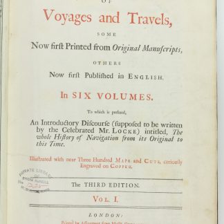
A Collection of Voyages and Travels, Some Now First Printed from Original …London, 1744-1746.
€ 35.000,00 -
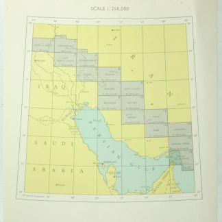
Trigonometrical Survey of a part of Mesopotamia. From Hillah to the Ruins …London, 1862.
€ 2.500,00 -
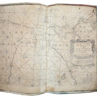
[Description de la mer méditerranée].Amsterdam, ca. 1670.
€ 25.000,00 -
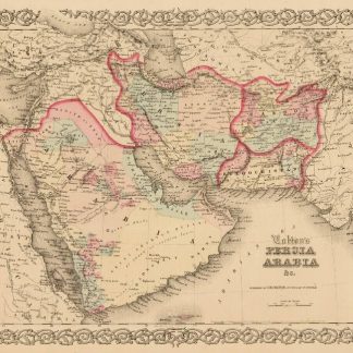
Persia Arabia &c.New York, 1858.
€ 500,00 -
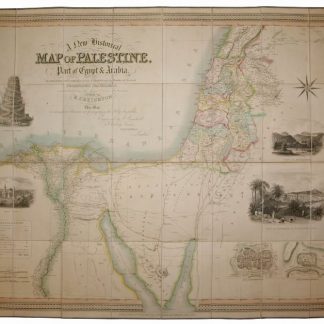
A New Historical Map of Palestine, With Part of Egypt & Arabia. Ancient …London, 1833.
€ 1.500,00 -
Cyanea. Oder die am Bosphoro Thracico, ligende hohe Stein-Klippen. Von …Augsburg, 1687.
€ 8.500,00 -
Wilayat yawlalaa kharituh sydur [Road Maps of the Vilayets].Istanbul, 1913 CE = 1329 Rumi.
€ 35.000,00 -
Nova Persiae Armeniae Antoliae et Arabiae.Amsterdam, 1690.
€ 2.300,00 -
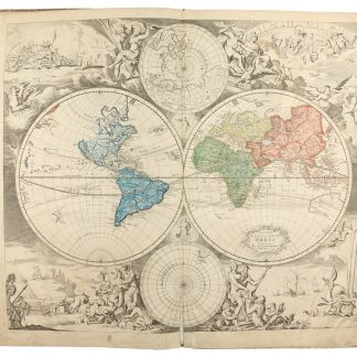
Nova totius terrarum orbis.Amsterdam, ca. 1685.
€ 8.500,00 -
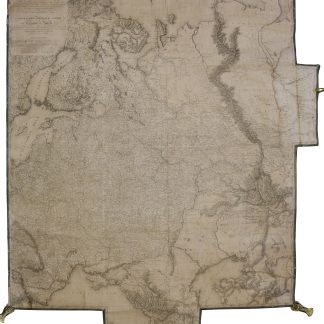
Carte des europäisch- und eines Theils des asiatisch-russischen Reichs …Wien, 1812.
€ 5.000,00 -
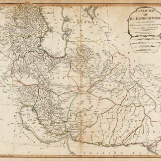
A New Map of The Empire of Persia from Mon. D. Anville, Geographer to the …London, 1794.
€ 2.000,00 -
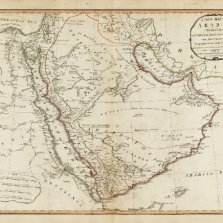
A New Map of Arabia, Divided Into Its Several Regions and Districts from …London, 1794.
€ 2.800,00 -
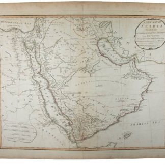
A New Map of Arabia, Divided Into Its Several Regions and Districts.London, 1794.
€ 2.500,00 -
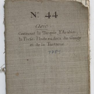
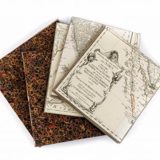
Prémière partie de la carte d'Asie contenant la Turquie, l'Arabie, la …Paris, 1751.
€ 6.500,00 -
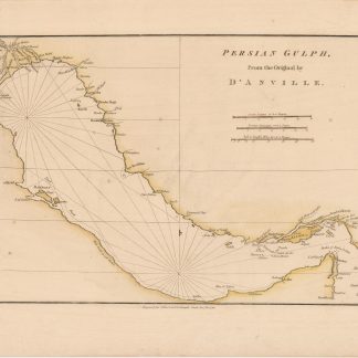
Persian Gulf. From the original by D'Anville.London, 1788.
€ 400,00 -
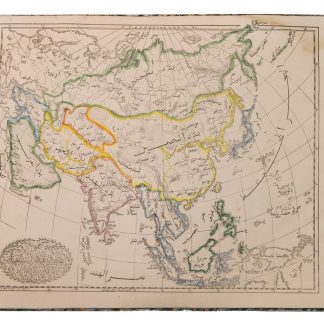
Karte von Asien.Wien, 1786.
€ 2.500,00 -
Umbständliche und eigentliche Beschreibung von Asia: In sich haltend die …Nürnberg, 1681.
€ 6.000,00 -
Naukeurige beschryving van Asie: behelsende de gewesten van Mesopotamie, …Amsterdam, 1680.
€ 8.500,00
Zeige Artikel 49–96 von 559 (Landkarten, Pläne)
Nichts Passendes gefunden? Durchsuchen Sie unsere 30.000 Bücher und Autographen nach Sachgebieten oder benutzen Sie die erweiterte Suche.