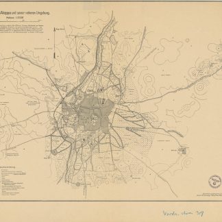
Kartenbild von Aleppo und seiner näheren Umgebung.
Lithographed map, ca. 55 x 71 cm. Scale 1:25,000.
€ 450.00
German military map of Aleppo, printed in the field by German troops during the last months of the First World War. Shows railway lines, roads, caravan trails, pastures and arable land, irrigated gardens, Muslim and Christian cemeteries, etc. The cartography, performed during April and May 1918, is credited to a Lieutenant Erdmann. A note (in German) instructs the user that "the city topography is based on the 'Plan général de la Ville d'Halep'; the environs were mapped by the compass-time-route method. The contour lines, about 8 by 8 metres, are intended merely to convey a rough notion of the terrain. The names are written so as to sound most pleasing to those not versed in the language".
Folded. Formerly in the collections of the Geographical Institute of the University of Berlin with 1940s stamp and shelfmark. Well preserved.
OCLC 179713973.
Related
-
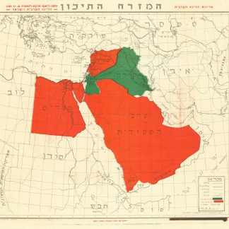
Ha’Mizrach Ha-Tichon (The Middle East) Ha’Liga Ha’Aravit (The Arab …Kfar Monash, 1949.
€ 2,800.00 -
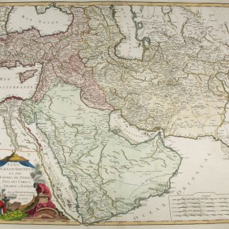
Etats du Grand-Seigneur en Asie, Empire de Perse, Pays des Usbecs, Arabie …Paris, 1753.
€ 1,950.00 -
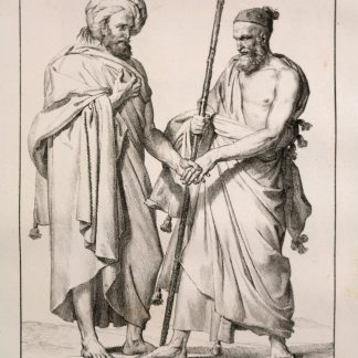
Voyage dans le Levant en 1817 et 1818.Paris, 1819.
€ 35,000.00 -
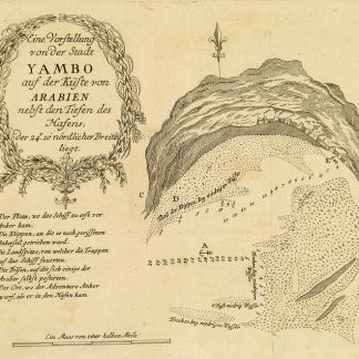
Begebenheiten einer Reise auf dem rothen Meer, auf der arabischen und ägyptischen …Leipzig, 1781.
€ 1,800.00