Bower's secret reconnaissance mission into Tibet: an outstanding copy of a fabled rarity
Diary of a Journey Across Tibet.
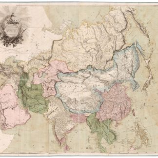
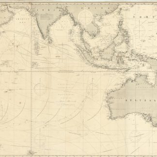
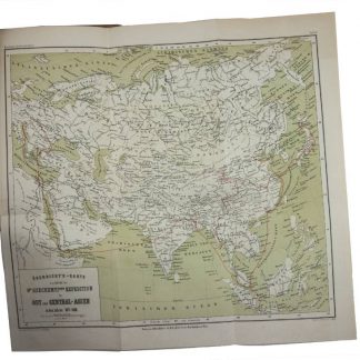
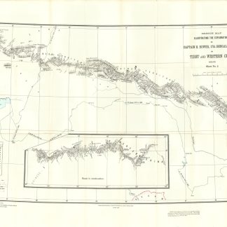
Large 8vo (153 x 244 mm). (6), 116, X pp. (1 integral blank). With frontispiece and 12 plates, as well as two very large (1070 x 725 mm, 1010 x 685 mm) photozincographic folding maps in front and rear pockets, as issued. Bound in original printed blue boards with black cloth spine, “Not for Sale” imprinted on front board.
€ 25,000.00
An outstanding rarity of Tibetan exploration: the first edition - limited to 150 copies for official government use, “not for sale” - of Bower’s expedition across the Tibetan plateau in 1891, in fact a secret reconnaissance mission for the possible British invasion of the country. A revised edition for public consumption was released in the following year in London, but the present first edition printed in Calcutta is of fabled rarity: just seven copies are recorded in institutions worldwide, according to OCLC (1 US, 4 UK, 1 Germany, and the National Library of China).
Bower (1858-1940) and his companion Dr. Thorold, along with a small retinue of handlers, set out from Ladakh in the summer of 1891, crossing illegally into neighbouring Tibet. They became the first known Europeans to traverse the high-altitude plateaus of the region, travelling in disguise as Muslim traders to evade detection by the native Tibetans, who refused to grant passage or provisions to any Europeans. Nevertheless, by the time Bower's caravan reached Lake Tenrgi Nor, suspicions had been raised and the Tibetan authorities forbade him to continue along the road to Lhasa. Bower was eventually granted permission to exit the country into China rather than retracing his steps back to Ladakh. "But, as we know, there was considerably more to this journey than met the reader's eye. Bower had spent those seven hazardous months crossing Tibet for the satisfaction of neither the Royal Geographical Society nor the British public. He was there, as the Foreign Office archives show, to gather as much intelligence as he could about India's shadowy northern neighbour on behalf of Colonel Elles, his chief in the Intelligence Branch at Simla" (Hopkirk, Trespassers on the Roof of the World, pp. 83-91). In 1903, just ten years after Bower’s report, the British under Sir Francis Younghusband launched an ultimately successful invasion of Tibet, capturing Lhasa while the Dalai Lama fled into exile.
"A full account of the expedition was published by the Indian government in 1893 in an edition limited to 150 copies […] This account contained two maps, each more detailed than the single map provided with the book published one year later in London. Additional information, including an introduction by Colonel Elles, Assistant Quarter Master General Intelligence Branch, is also found in the Calcutta printing, but not in the London publication" (Waller, The Pundits: British Exploration of Tibet and Central Asia, p. 303).
The enormous maps found in the present edition were clearly designed for official use, and both bear the caption “plotted from the field books of Atma Ram, Sub-Surveyor, and checked by Captain Bower". Ram’s technique of measuring distances by paces proved invaluable in constructing the maps, but he did not share in the Royal Geographical Society’s gold medal awarded to Bower for the results of his expedition.
A few page edges slightly frayed, otherwise a wonderfully fresh and clean copy, with maps in excellent condition. “Copy No. 43” inscribed on front board and on each folding map.
Yakushi, Catalogue of the Himalayan Literature (1994), B252. Marshall & Lamb, Britain and Tibet 1765-1947: A Select Annotated Bibliography (2005), #1283 (London edition only).