![Indian Ocean - Northern Portion [Admiralty Chart No 748b].](https://inlibris.com/wp-content/uploads/2023/10/img-bn33603.jpg)
![Indian Ocean - Northern Portion [Admiralty Chart No 748b]. - Image 2](https://inlibris.com/wp-content/uploads/2023/10/img-bn33603-a.jpg)
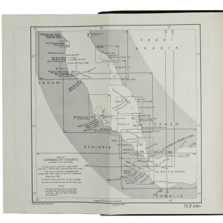
Indian Ocean - Northern Portion [Admiralty Chart No 748b].
[London], Hydrographic Office, [ca. 1881].
Engraved hydrographic chart, 1325 x 550 mm. Scale ca. 1:8,500,000.
€ 1,000.00
Nautical chart including the Arabian Peninsula and the Gulf, with tidal information, compass roses, soundings, seabed notations, currents and sandbanks. Lighthouses and beacons picked out in red and yellow.
Condition
Signs of contemporary use, with several pencil markings. Lower margin with caption neatly trimmed away.
References
Not in the Al Ankary or Al-Qasimi collections.
Related
-

Carte de l’Empire Ottoman comprenant les possessions de la Porte en Europe, …Paris, 1825.
€ 3,000.00 -

Golfe Persique & Golfe d'Oman.France, 1975-1984.
€ 9,500.00 -
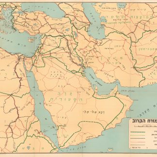
Ha-mizrah ha-karov (The Near East).Tel Aviv, 1958.
€ 3,500.00 -
Red Sea and Gulf of Aden Pilot Comprising the Suez Canal, the Gulfs of …London, 1967.
€ 1,250.00
![Indian Ocean - Northern Portion [Admiralty Chart No 748b].](https://inlibris.com/wp-content/uploads/2023/10/img-bn33603-324x324.jpg)