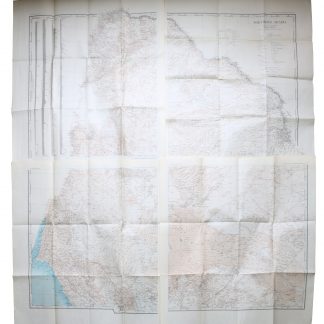
Map of Europe.
[Italy, ca. 1900].
Colour-lithographed map, 425 x 635 mm. Orthographic azimuthal projection.
€ 650.00
Topographical map of Europe including Asia Minor and the northwestern coast of Africa. The orthographic projection shows Europe distorted but realistically as the upper part of a sphere in space. Place names are identified in Italian, and the volcanoes Vesuvius and Etna are marked with red dots.
Traces of folds; some old tears. Some browning and foxing throughout.