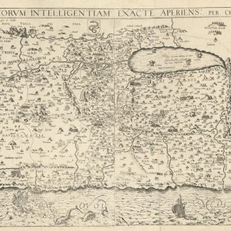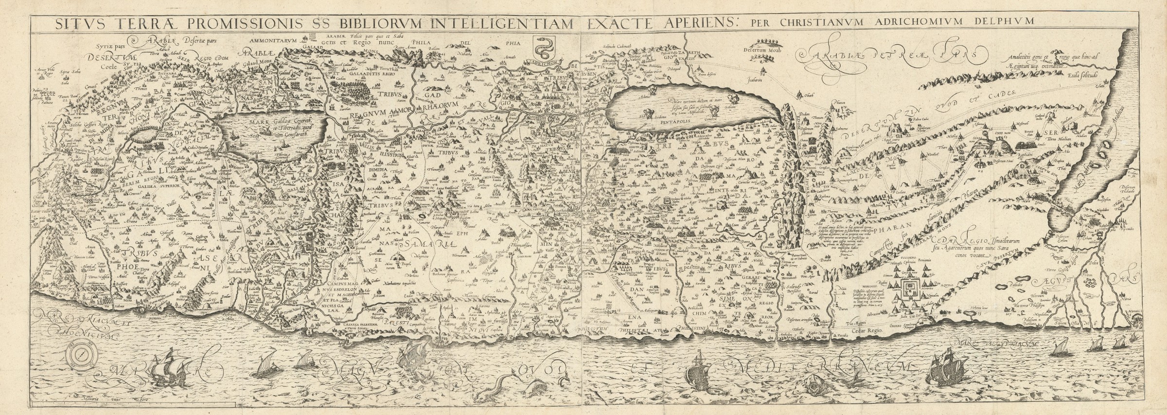
Situs Terrae Promissionis SS Bibliorum Intelligentiam Exacte Aperiens: Per Christianum Adrichomium Delphum".
Cologne, Kramer, 1682.
Engraved map, printed from two plates and assembled. Ca. 1065 x 390 mm (printed area ca. 1005 x 350 mm).
€ 2,000.00
Large and decorative map of the Holy Land, printed from two plate, from Christian van Adrichem's "Theatrum terrae sanctae et biblicarum historiarum". Van Adrichem's map is oriented toward the east and shows the twelve tribes of Israel on both sides of the River Jordan. The coastline runs from Sidon in Lebanon to Alexandria in Egypt, also showing part of the Red Sea. In the Mediterranean, off the coast, several ships and sea monsters are visible. On the Dead Sea are four burning cities: Sodom, Gomorrah, Zeboim, and Adama.
Folds smoothed and reinforced in places. A good, strong impression.
Related
-
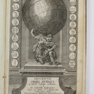
Descriptio orbis antiqui in XLIV tabulis exhibita.Nuremberg, ca. 1720.
€ 3,800.00 -
Voyage dans le Levant en 1817 et 1818.Paris, 1819.
€ 35,000.00 -
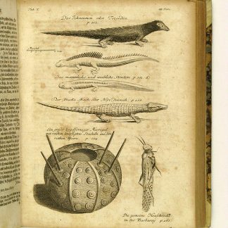
Reisen oder Anmerkungen verschiedene Theile der Barbarey und der Levante …Leipzig, 1765.
€ 2,000.00 -
Commentaire géographique sur l'exode et les nombres.Paris und Leipzig, 1841.
€ 950.00