
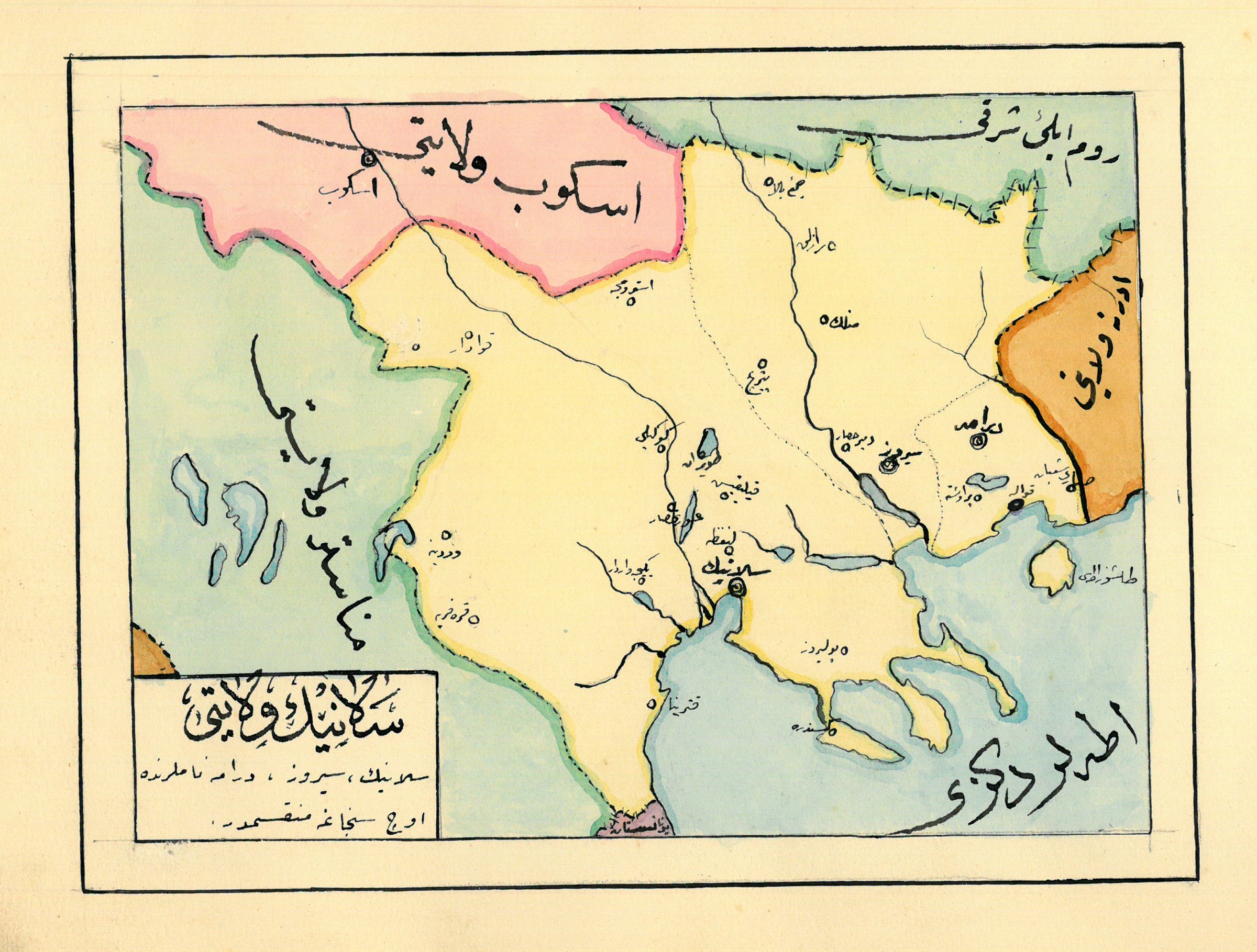
Manuscript map album of the Ottoman Empire.
Ottoman Empire, ca. 1910.
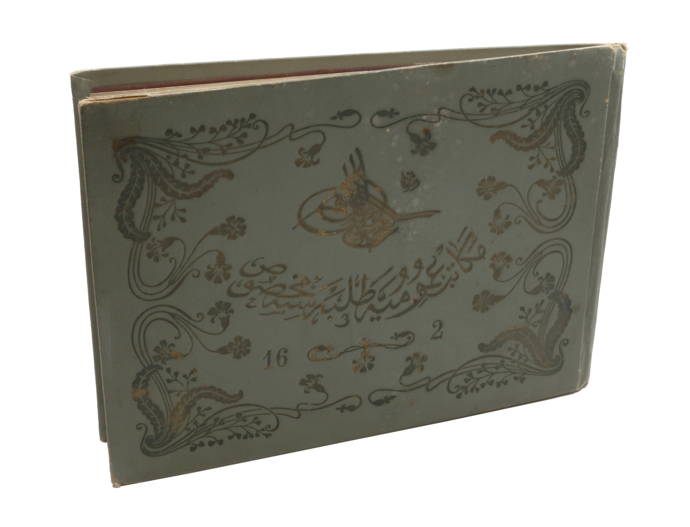
Oblong 4to (264 x 195 mm). 14 leaves with 10 pen-and-ink maps, hand coloured with watercolours. Tissue guards. Full giltstamped cloth binding with tughra of Mehmed V (ruled 1908-18), titled "Mekatib-i Umumiye Talebesine Mahsustur" ("Reserved for students of Mekatib-i Umumiye") on the upper and "Album" on the lower cover.
€ 8,500.00
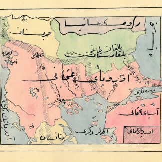
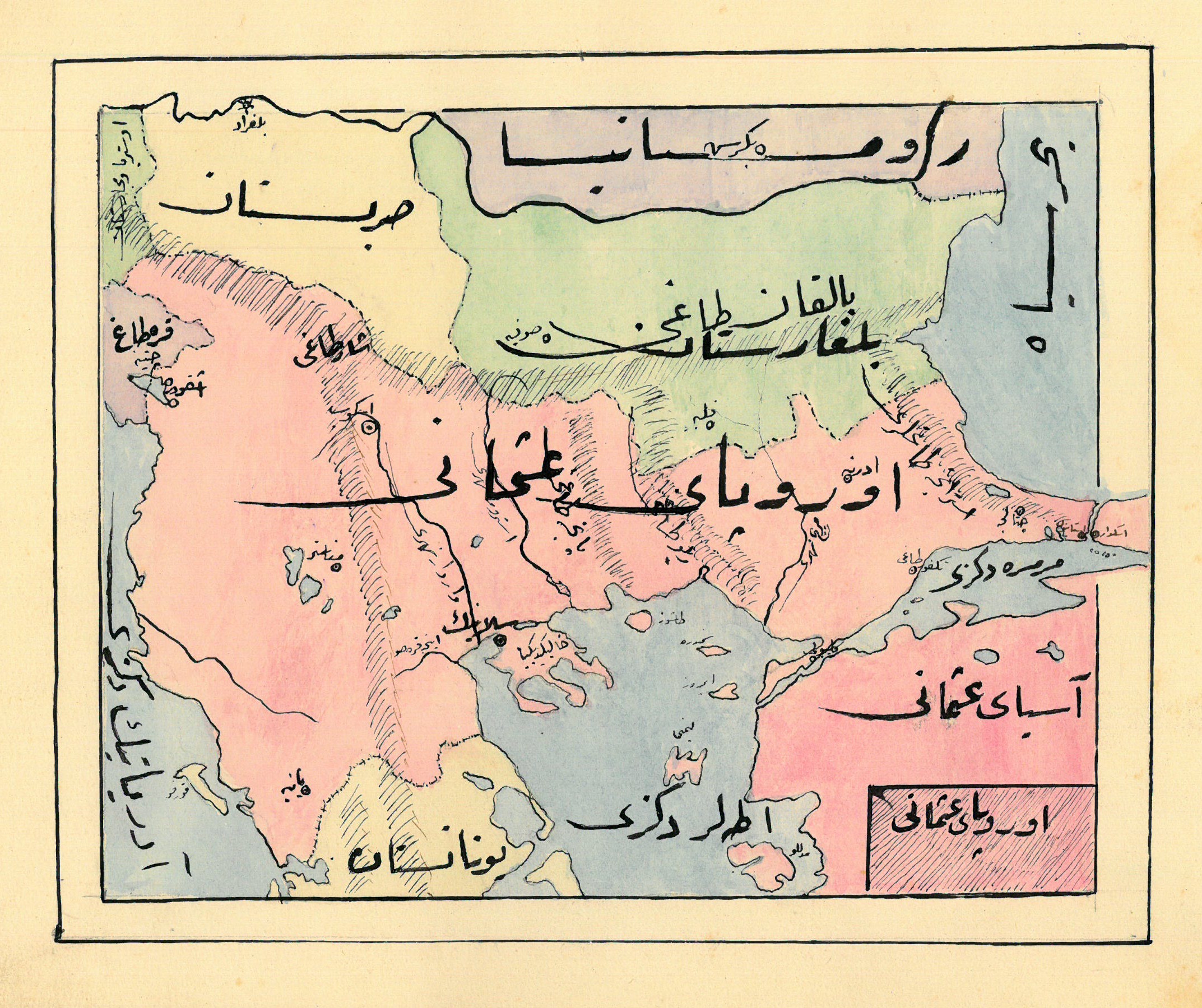
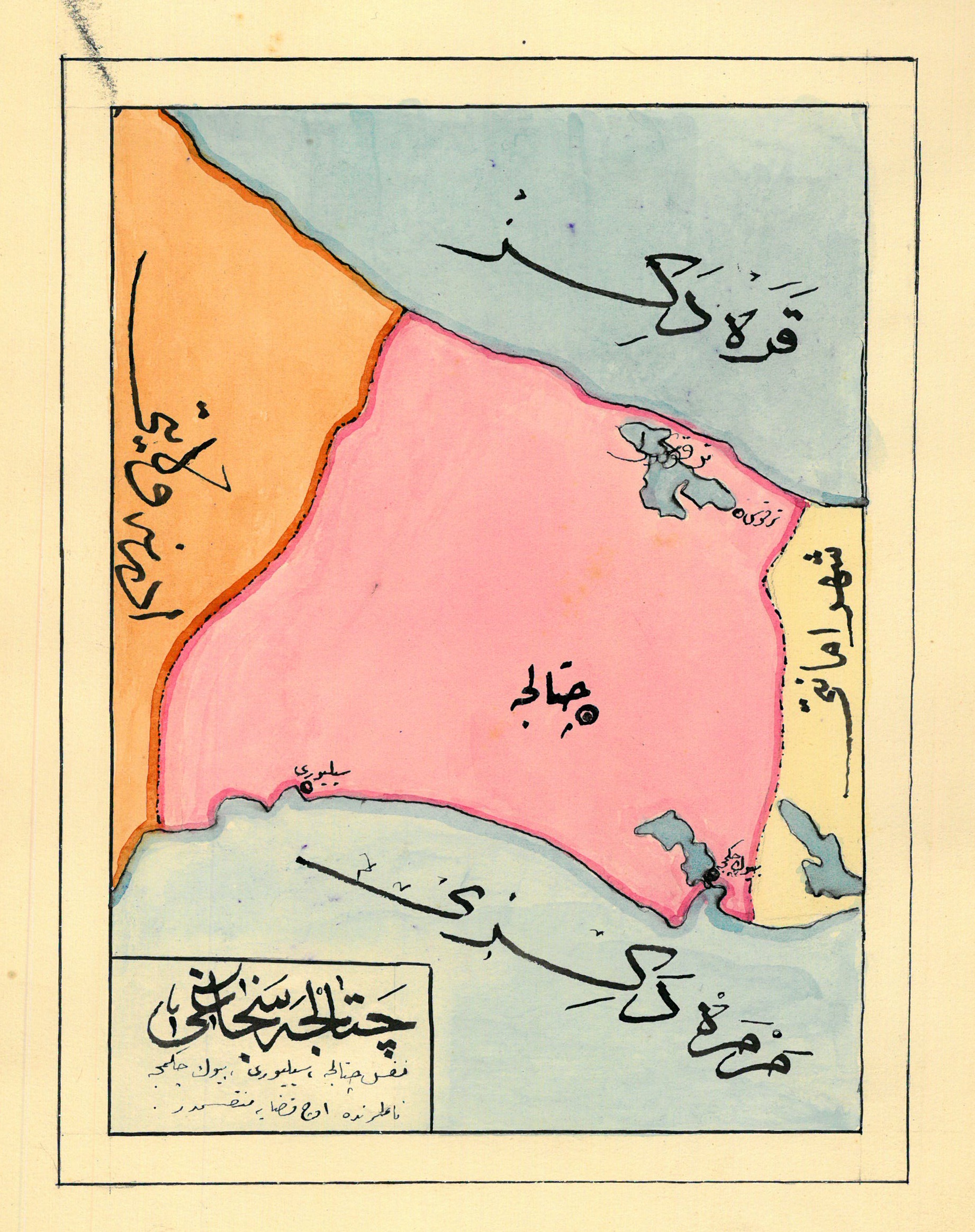
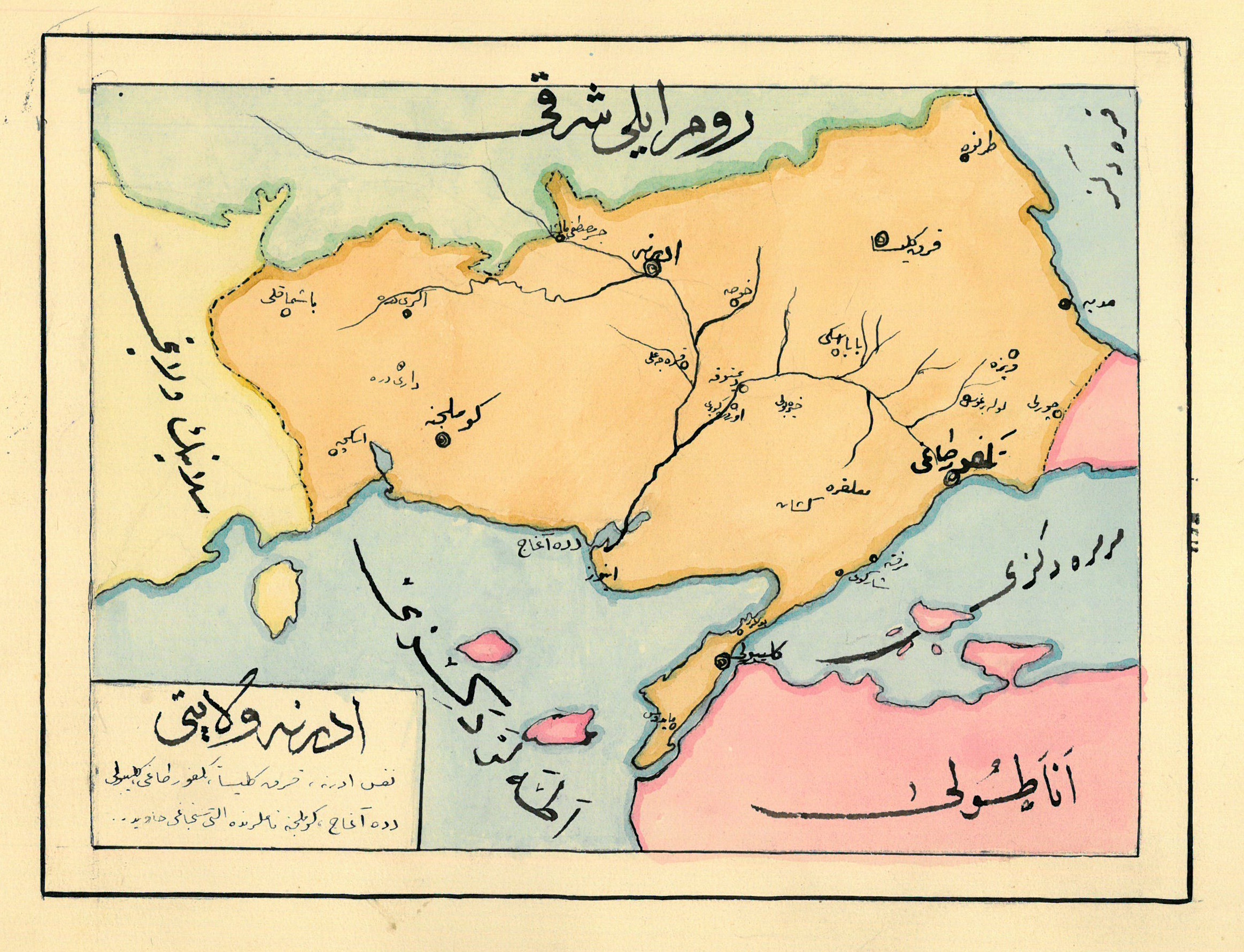
A hand-drawn album of maps showing the western parts of the Ottoman Empire, with legends in Ottoman Turkish. Maps include northern Greece (from Macedonia to Constantinople), the Bosporus, the Dardanelles, Halkidiki, Albania, Crete, etc.
Finely preserved.
Related
-

Vierzig-Jährige Reise-Beschreibung. Worinnen dessen durch Türkey, Persien, …Nuremberg, 1681.
€ 8,500.00 -

Första Resa fran Cairo till Arabiska Öknen i April 1845. Fragment.Helsingfors Helsinki, 1853.
€ 9,500.00 -

Reize naar Arabië en andere omliggende landen.Amsterdam & Utrecht, 1776-1780.
€ 6,000.00 -
Reisen oder Anmerkungen verschiedene Theile der Barbarey und der Levante …Leipzig, 1765.
€ 2,000.00