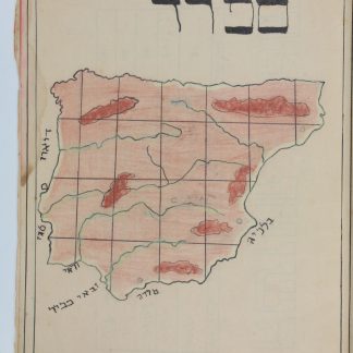
Jewish schoolgirl's hand-drawn atlas
Machberet kitâ a'. [School notebook with hand-coloured maps].
4to (165 x 205 mm). (18), (11 blank) ff. Decorated with hand-drawn maps in ink and crayon, labelled in handwritten Hebrew. Original black wrappers. All edges red.
€ 250.00
Unique private copybook of folk art hand-coloured maps from an unknown Jewish girl named Sarah Klein. Klein was likely a schoolgirl; most of the maps she has drawn and labelled in neat Hebrew are of European countries, including Spain, Italy, Greece, Yugoslavia, Bulgaria, Turkey, Great Britain and Ireland, Iceland, France, Portugal, and Scandinavia, as well as one map of the entirety of Africa. The northern coast of France is shown twice and in greater detail than many others. Most of the maps are carefully hand-coloured in crayon or perhaps oil pastels, often indicating rivers and mountain ranges.
A unique preservation of a Jewish schoolgirl's vision of her world.
Light wear, one leaf detached but present, altogether well-preserved.
Related
-
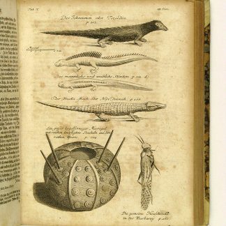
Reisen oder Anmerkungen verschiedene Theile der Barbarey und der Levante …Leipzig, 1765.
€ 2,000.00 -
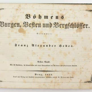
Böhmens Burgen, Vesten und Bergschlösser.Prag, 1844-1849.
€ 4,500.00 -
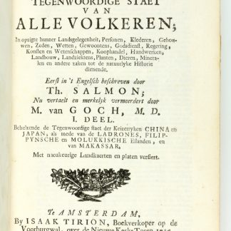
Hedendaegsche historie, of tegenwoordige staet van alle volkeren [...] …Amsterdam, 1729.
€ 3,500.00 -
Castella & praetoria nobilium Brabantiae, coenobiaque celebriora, ad …Leiden, 1699.
€ 9,500.00