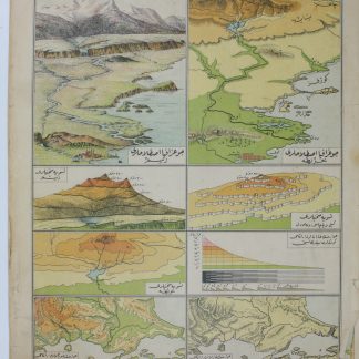
Ottoman atlas of nation states and railways
[Atlas of the world].
4to (115 x 158 mm). 32 pp. (lacking all but title-page and pp. 31-32) + 118 colour-printed plates, loose as issued. Original yellow cloth titled in black.
€ 4,500.00
An Ottoman Turkish atlas of the world from the final decades of the Ottoman Empire. Published just a few years prior to the events of the First World War, its geographical content reflects the changing 20th century landscape across the globe from an Ottoman perspective. Comprising over one hundred plates of maps, most plates are dedicated to a single country or region: a snapshot of Mandate Palestine and the Levant, Greece, South Africa, or Japan. The secondary focus after national geographies is evidently economic and transport connections on land and sea. Railway lines and shipping lanes are shown in almost every map, for areas as far flung as Korea, Japan, Egypt, and Great Britain, as well as those closer to home, such as a map of the Arabian Peninsula showing the Gulf and the newly constructed Hejaz Railway.
Light wear to binding, lacking part of the preliminary text.
Related
-
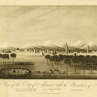
An Account of the Empire of Marocco, and the District of Suse.London, 1809.
€ 1,500.00 -

Reize naar Arabië en andere omliggende landen.Amsterdam & Utrecht, 1776-1780.
€ 6,000.00 -

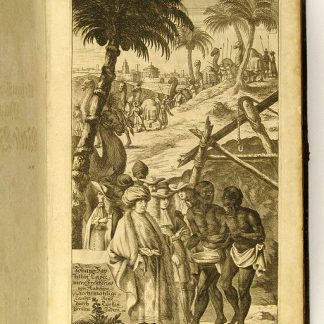
Indiae Orientalis pars septima [...]. Including: Icones, hoc est verae …Frankfurt, 1606.
€ 28,000.00 -
Vierzig-Jährige Reise-Beschreibung. Worinnen dessen durch Türkey, Persien, …Nuremberg, 1681.
€ 8,500.00